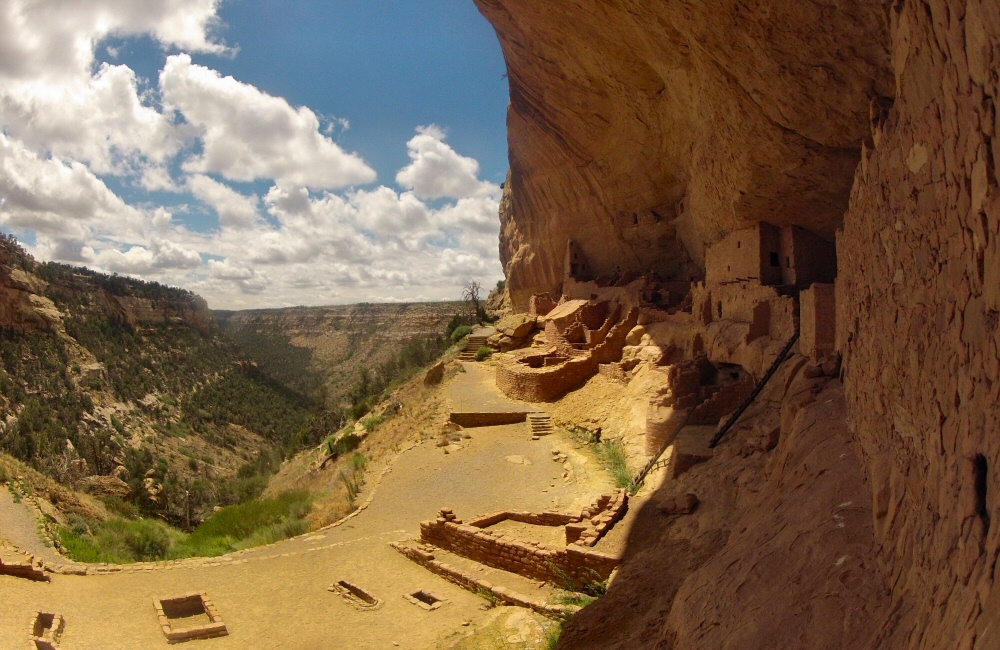
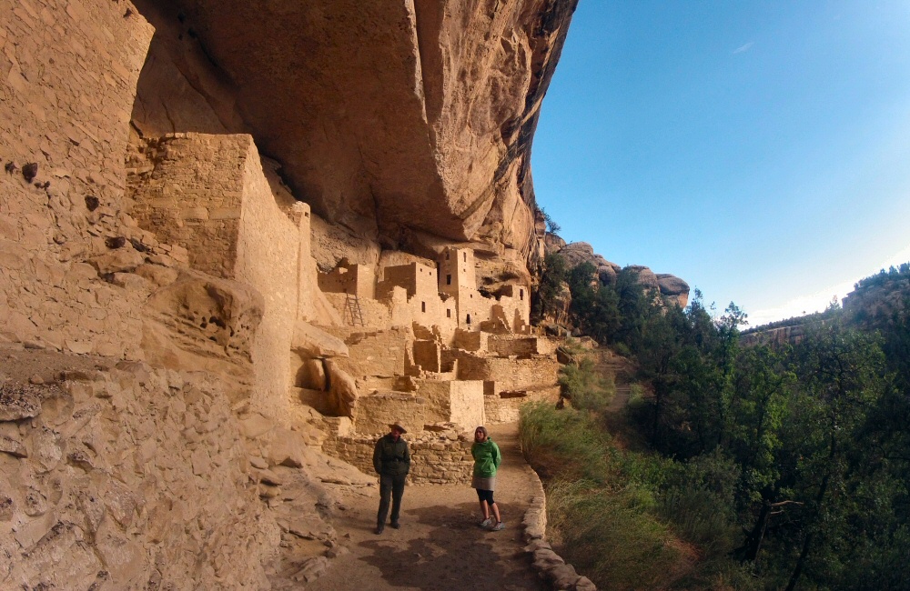
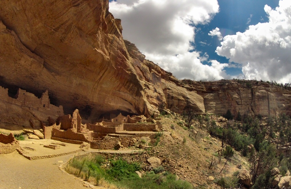
Helen wasn’t feeling so good, so we left her and Jon at camp while Rose and I explored the cliff dwellings of the park – Long House in the morning, Balcony House in the pouring rain, then in the evening, as we were the only two people, with our very own guide we explored Cliff Palace. Wandering around these ruins was much like the experience in the Mexican ruins a few years back. Clearly there has been a lot of “restoration”, since early photos show many of the sites as piles of rubble – which makes it feel a bit like you’re walking around a prepared, packaged exhibition rather than an original, ancient site. But without restoration, you wouldn’t get the same idea of what the villages used to be like, and tourism probably wouldn’t even be possible. Impressive, nonetheless. Yet another unique experience!
We picked up Jon & Helen and trucked on towards Utah. We’d not had an American diner meal together, so we stopped off for dinner at Denny’s in Cortez where we met a friendly local called Steve, who lives on a small ranch nearby with his wife – having moved from Boston seeking the simple life. Another late night drive – we’ve hardly done any driving after dark in months – took us over the border into Utah. It’s very, very dark at night out here. No street lights, and pretty poor van lights means that we only get to see a small patch of yellow tarmac for a few hours – with a huge flash of lightning every now and then in the distance. We’ve been able to see thunderstorms somewhere on the horizon pretty much every day. So we turned up at a campsite a 6 miles down a small side road, in the dark. With my powerful bike light we could just make out the huge, red rocks looming over us. What’s it going to look like in the morning?
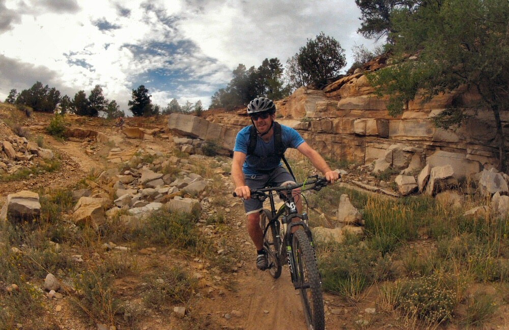
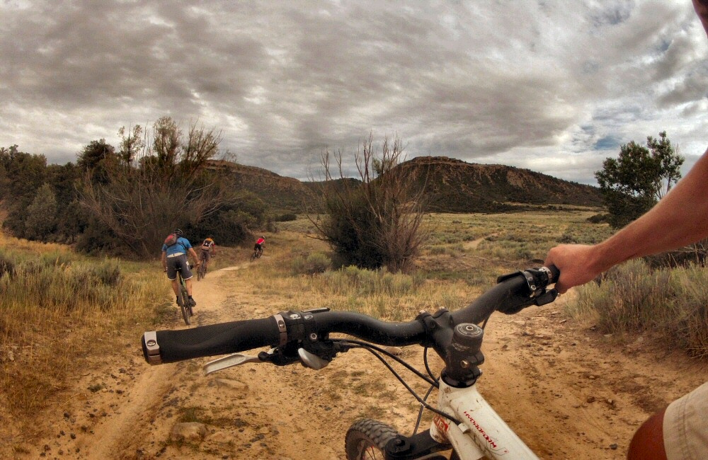
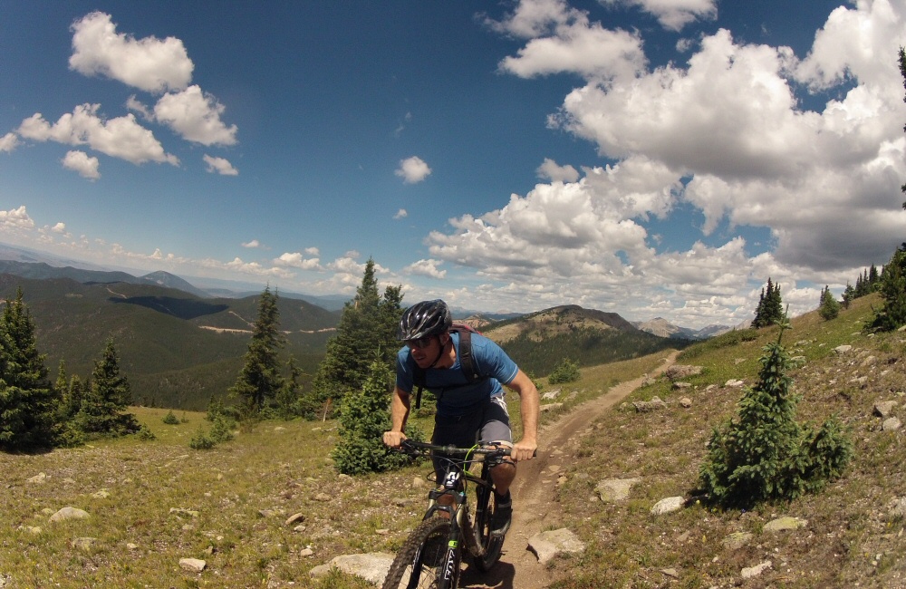
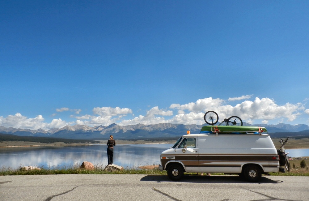
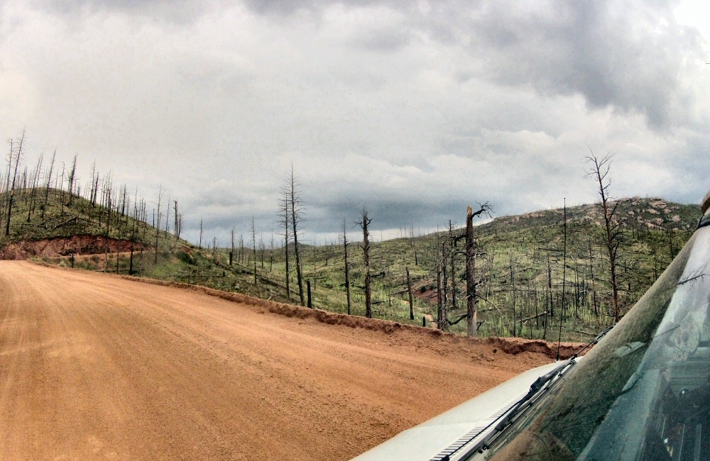
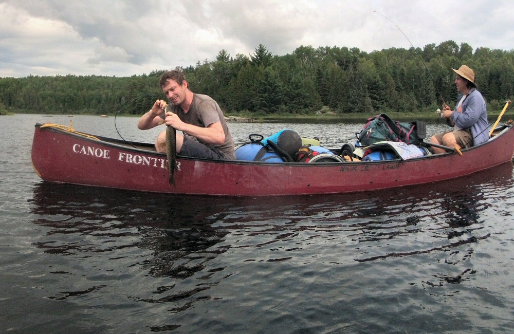
I got up early and wandered down to the lake overlook. Not much of a lake really. The water had clearly been much, much higher when the local maps were made, but now there was not much more than a pond sitting in the bottom of the valley. Back into Colorado, where we stopped at Durango, another mountain bike hub. First port of call was a place called Steaming Beans for coffee and internet catch-up, and to make plans for the next few days with the maps and guide books out. Jon and I tackled another of Colorado’s Top Ten Rides – a double black diamond rated route up onto a ridge and down a super rocky, technical descent – more like trials riding than mountain biking, with a huge vertical drop into the valley below if you get it wrong. So not many pics.
At the top we met a couple of locals, Andy and Ivan, who showed us some more awesome riding over the back of Horse Gulch and Telegraph Hill, including an epic swooping twisting downhill called Sidewinder. We met the girls for dinner at Steamboat brewery, then piled back into the van for a late night drive to Mesa Verde National Park, where we camped.
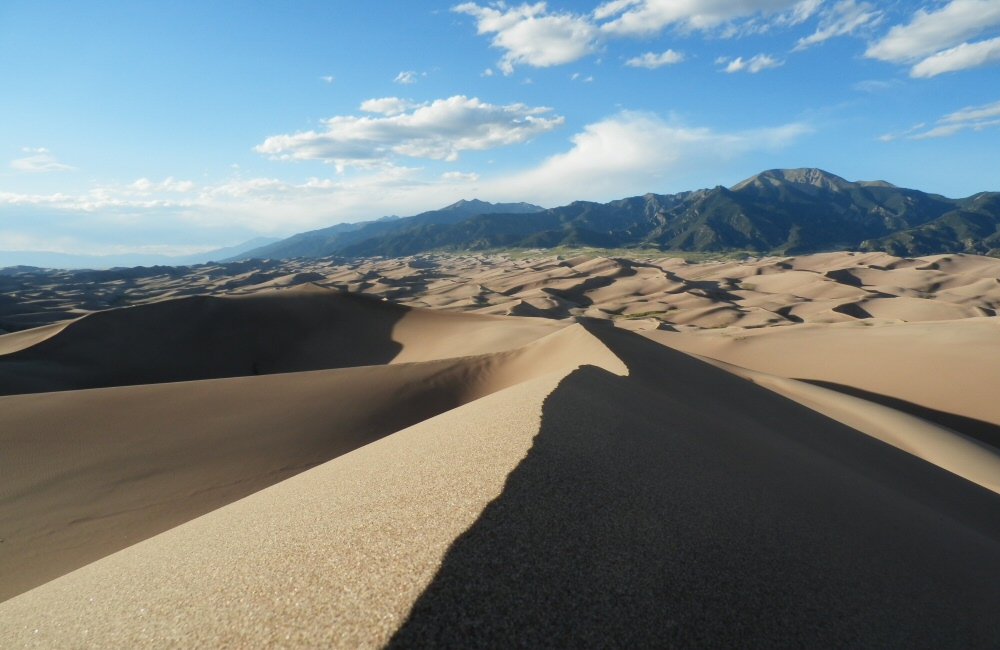
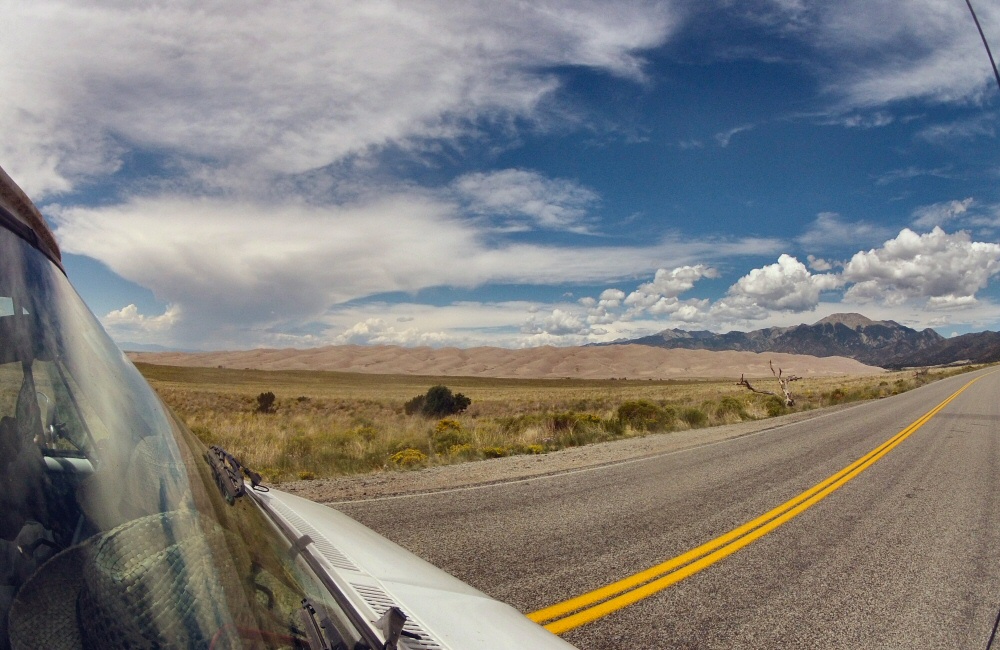
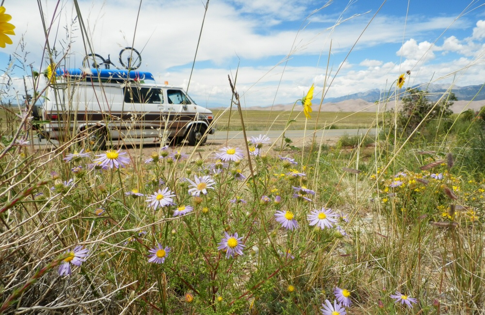
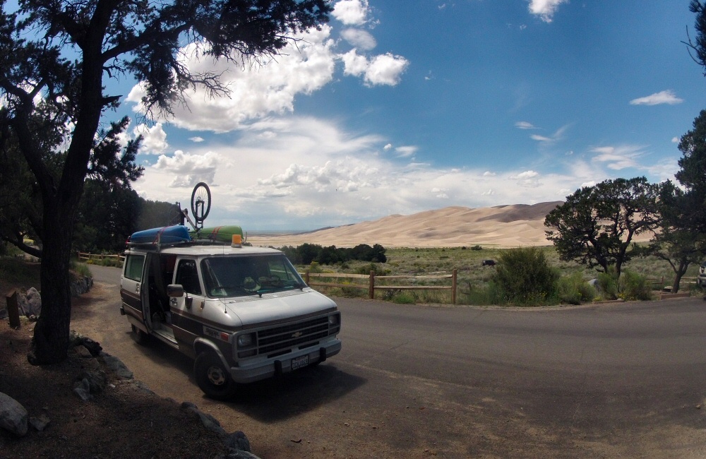
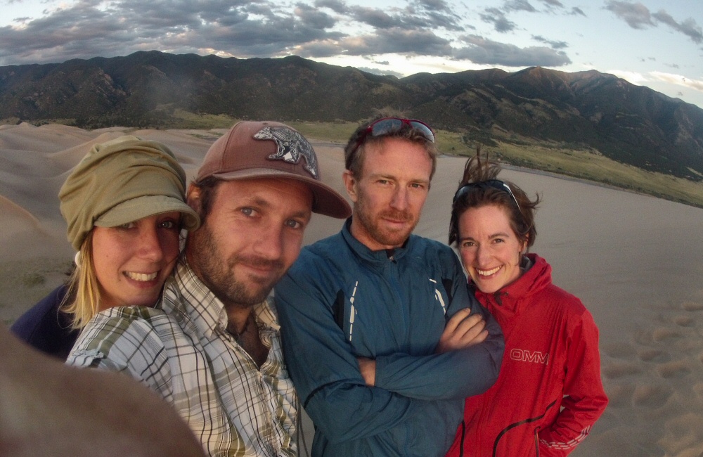
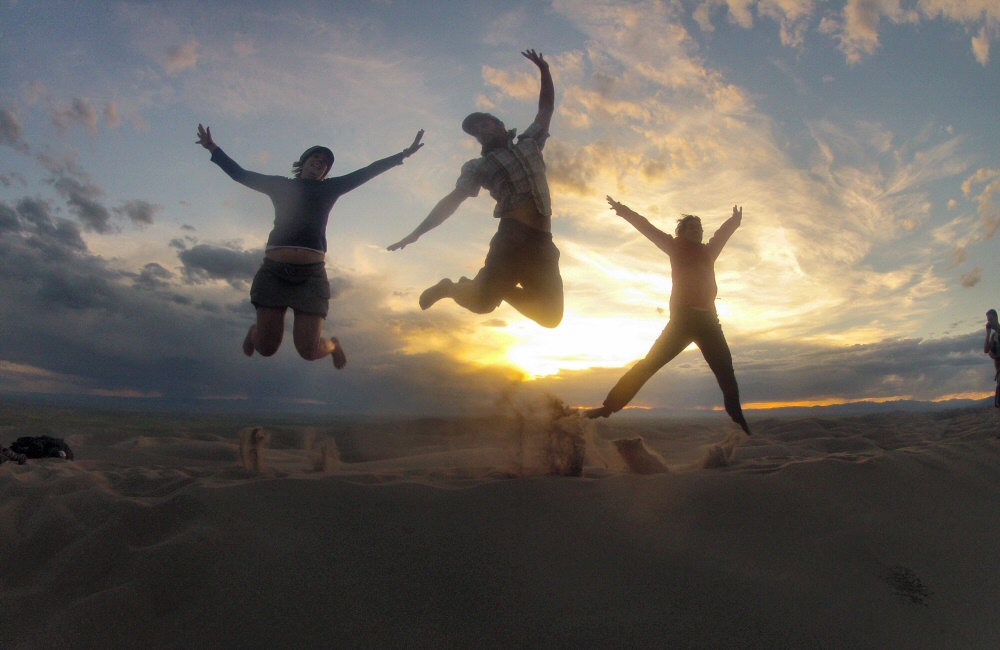
South again, to Sand Dunes National Park. A dramatic drive across huge, open plains with the Sangre de Cristo Mountains rising gradually from the valley floor on the left. In the distance, nestled at the foot of the hills, we could see the sand dunes as we approached. All the sand from the surrounding mountains gets washed into the valley, then the regular strong wind blows it all down to the corner where the huge dunes form. We set up camp, waited for the sun to chill out a bit, then hiked up the dunes to watch the sunset. Way across on the other side of the valley, a couple of thunderstorms were rolling southwards, making for a pretty atmospheric evening. We decided that we liked this camp so much that we’d stay another night, so we spent a day relaxing, reading, and had a wander up the river that runs along the foot of the dunes.
Wednesday 20th
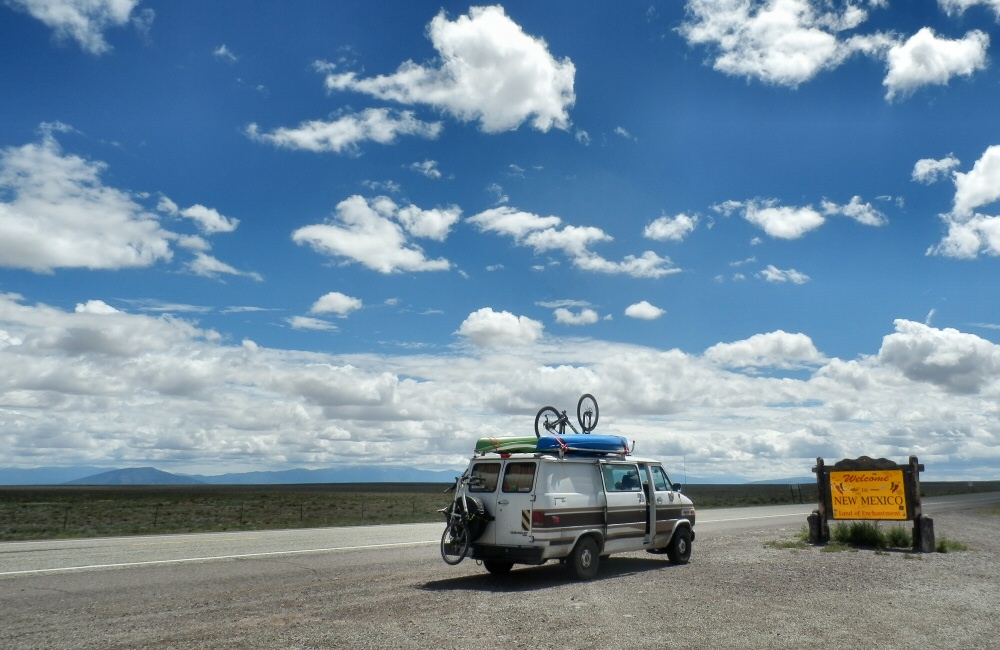
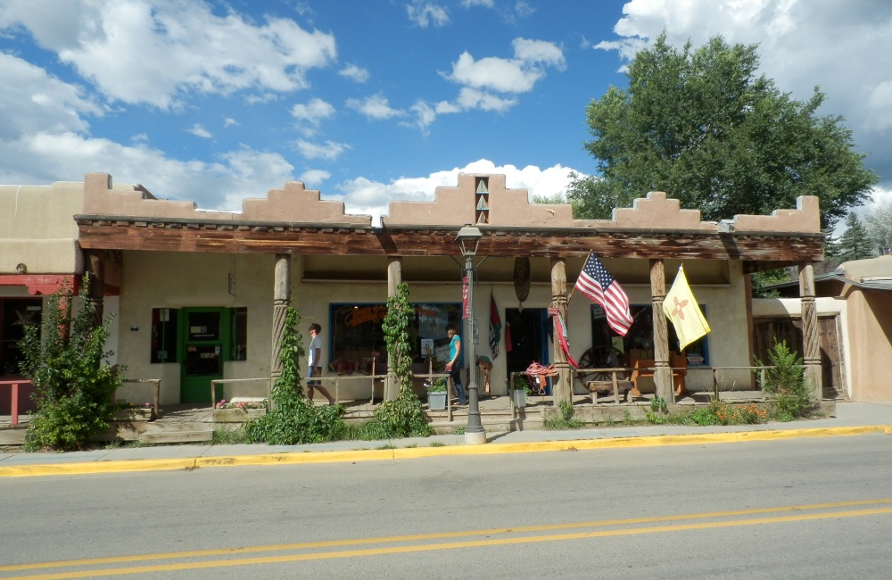
Into New Mexico! We weren’t originally planning to come this far south, but on recommendation from Ben and Rosie, and with a pinch of wanting to bag an extra state, we thought we’d pop over the border to Taos. The drive to Taos took us past a load of random homesteads – families set up for remote, desert living. Some really run down, and some clearly belonging to old hippies that have been here for a long time; from school buses converted into houses to smart solar panelled eco-dwellings made from adobe and glass. We stopped in Taos for lunch, had a look around at the numerous galleries and bought a couple of souvenirs. We decided that there wasn’t much extra to be gained from staying for a night, so we turned back on ourselves, over the impressive Rio Grande Canyon, and on towards Durango. With hindsight, and reading the guides, we should have stopped in at Taos Pueblo just north of Taos – the longest continuously inhabited settlement in America – but we just drove by without knowing about it. Should try to read up a bit further ahead.
A long drive through Carson National Forest brought us to a campsite at Heron Lake State Park – a pretty much empty gravel site on the edge of a lake.
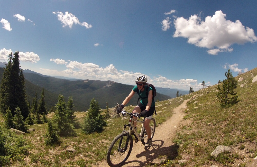
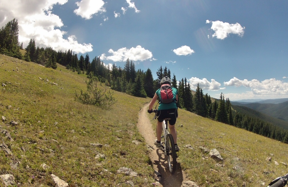
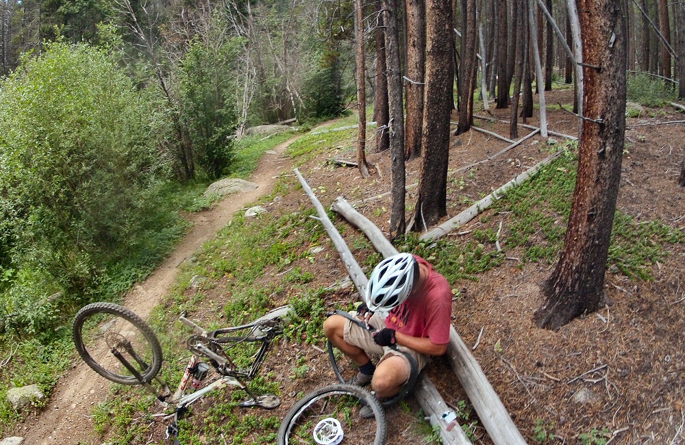
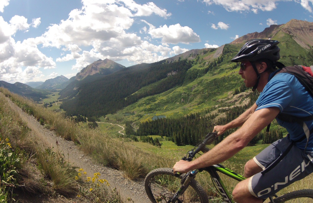
Rode another of Colorado’s top ten trails this morning – the start of the Monarch Crest trail, and then breaking off left down Fosse Creek. Rose wasn’t riding, so she took the van round to pick us up at the bottom, which meant a short bit of climbing for us – with stunning views – and then 9 miles of downhill. Probably the best ride I have ever had in my life. Real mountains, dry, dusty trail, incredible scenery, fast technical downhill that just went on and on and on. Two more pinch punctures – I’m getting good at quick tube changes!
Colorado definitely deserves its title as the mountain bike centre of the world. There are so many amazing trails – we’re only managing to scratch the surface. It feels awesome to have been able to get a taster – I wonder if I’ll ever be back?
Time for a shower, which meant heading east into a small town called Salida to find a motel. In the afternoon, we wandered round the place, did a round of laundry, and then had a meal out. Salida is yet another Colorado mountain bike town – filled with a mix of hippies, cyclists and old timers. Met a couple in a cafe who are cycling down from Montana to Mexico and had a quick chat.
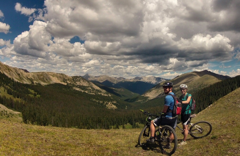
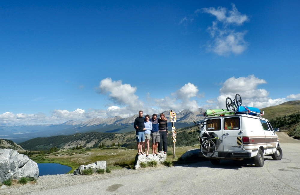
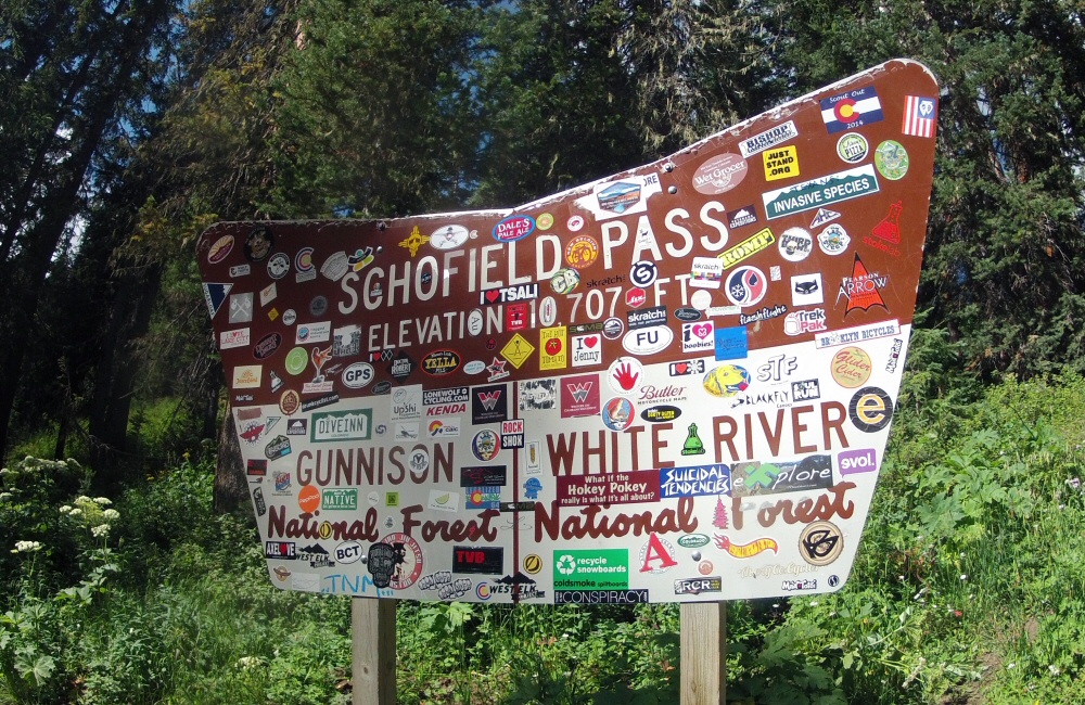
Drove up over Cottonwood Pass – the highest the van has been so far on this trip, an altitude of over 12000 feet. And then all the way down the other side to Crested Butte, one of Colorado’s many mountain bike towns.
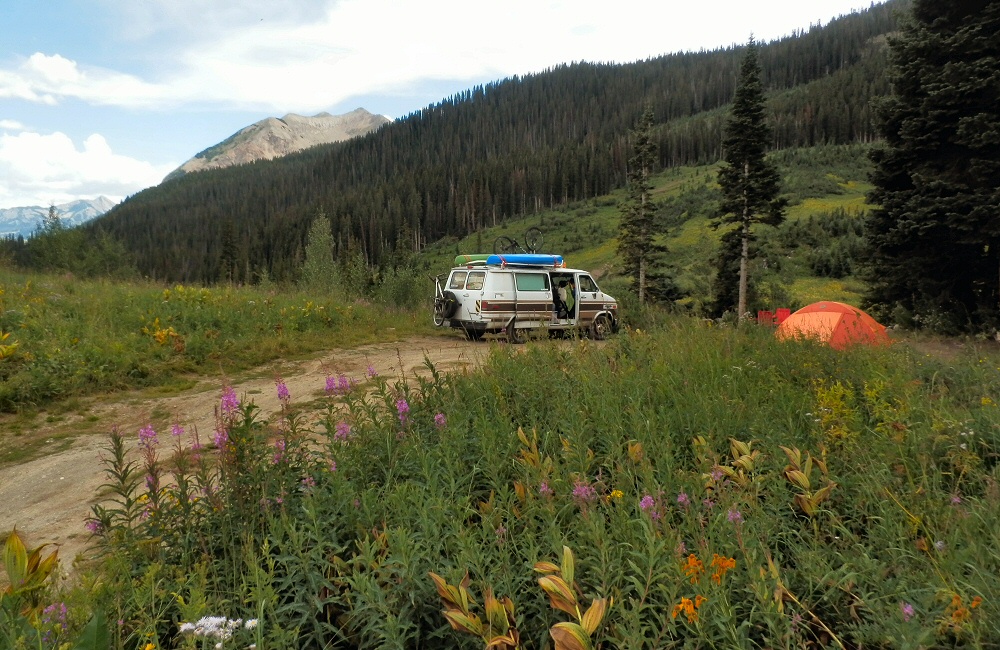
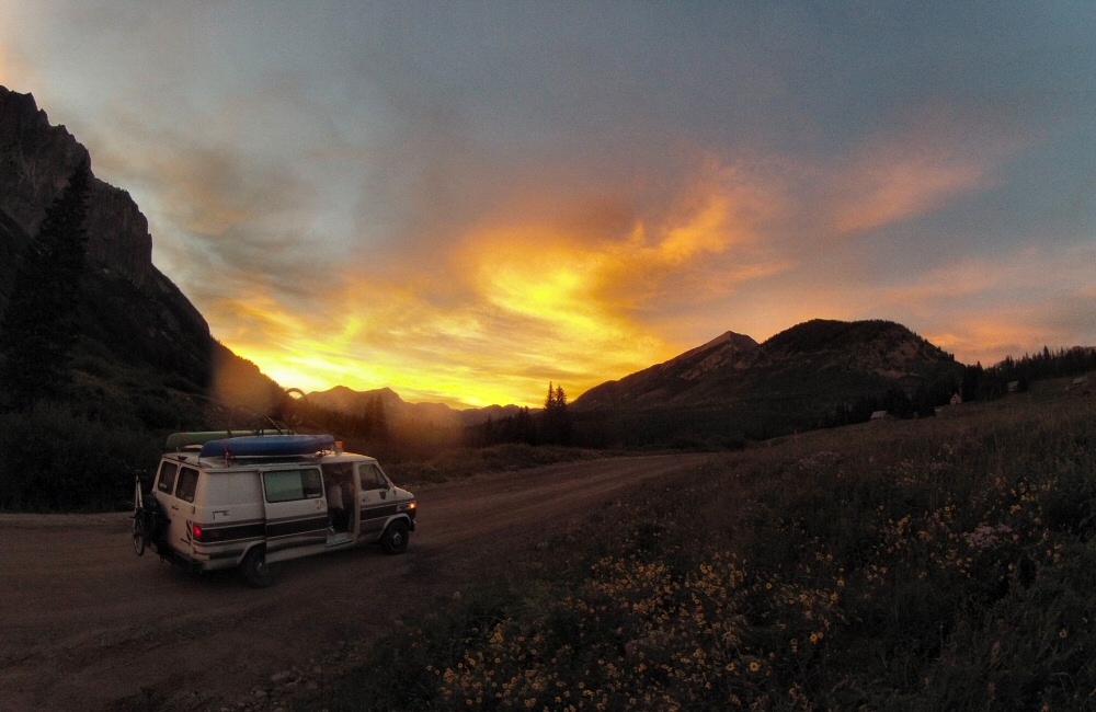
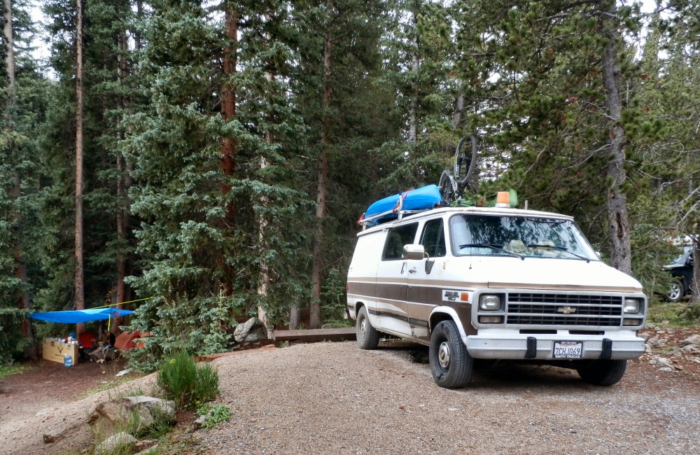
Introduced J&H to The Great American Breakfast at Paradise Café, then headed on up into the hills through Mount Crested Butte, to find somewhere to spend the night. Found a wild National Forest site, perched on the side of Gothic Mountain, along a bumpy dirt track. I’d spotted that the local ski centre was doing free chairlift rides in the evening, so we all had a few hours riding the downhill trails of the bike park. Thunderstorms around the local hills meant that the usual free-Friday night crowds weren’t around, and it wasn’t too hot. My bike is still just about holding together, it’s pretty old and tired now. No idea what I’m going to do with it when we go through the next phase of selling / giving things away in September, to thin possessions down for our trip south. I managed to get two pinch punctures during the evening, broke a tube valve, and a pump. Awesome riding though – typical bike park trails – a range of smooth swoopy berms and rougher technical bumpy stuff through aspen groves.
Saturday 16th
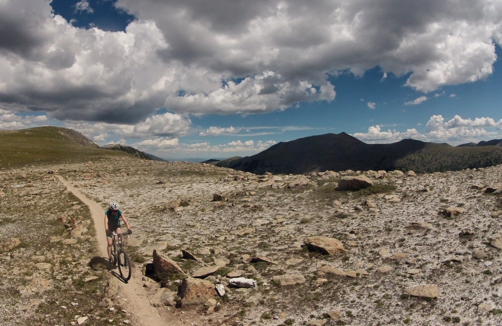
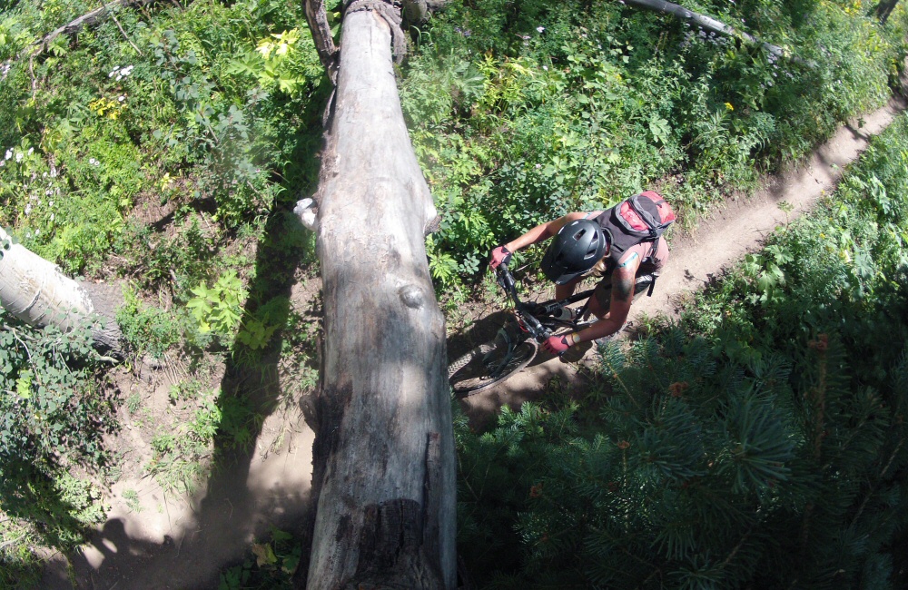
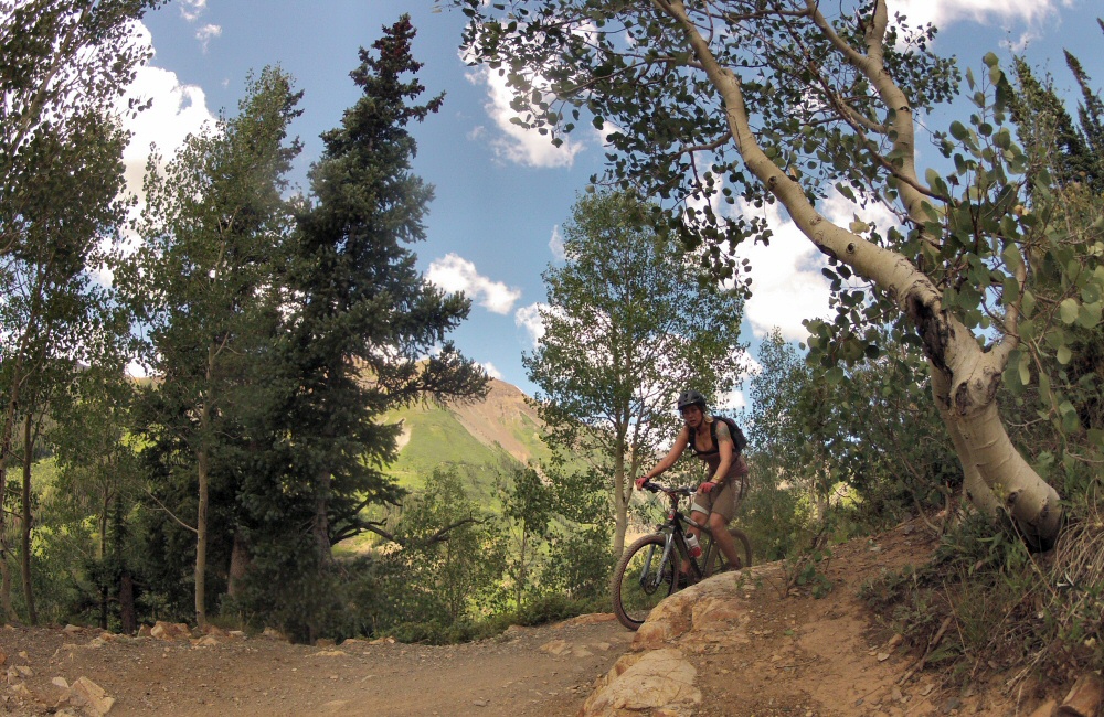
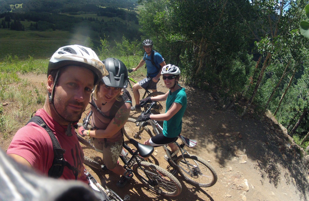
We’d come up this valley to be near a trail called the “401” – one of Colorado’s ten best mountain bike rides. We took the van a short way further up the road and parked up. The ride starts with a couple of miles of tough climbing – a bit of dirt road and then singletrack to the high point at about 11000 feet. Pretty hard work riding at this altitude, but incredible scenery. Then perhaps 6 miles of downhill, skimming along the side of the valley, looking out over amazing views, swooping and twisting through chest-high wild flowers. They say that the height of the wild flowers is a prediction for the depth of snow that’s going to settle in the coming winter. Left Rose and Helen at the bottom of the trail while we rode back up the road to get the van.
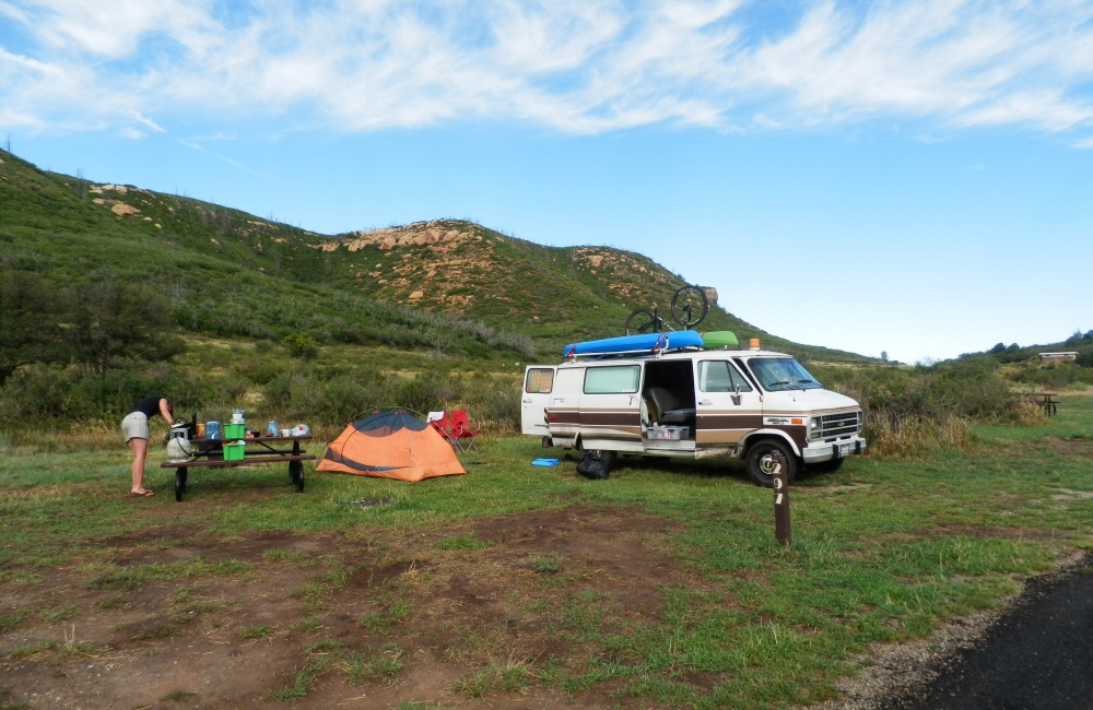
There’s a load more riding here, but we need to keep moving. It’s the same story with everywhere we’ve been – it would be easy to spend days, even weeks, getting to know a place and meeting people, but with limited time, we’re choosing to just get a taster of each spot. So we headed on south through Gunnison towards Salida – over the top of Monarch pass then found a campsite nearby. I was just starting my shower out of the back of van when the rain clouds opened – Jon and Rose put the awning up. The rain didn’t last long, and by the end of the evening we were sat around the camp fire, burning the cardboard bike boxes that we’d been lugging around ever since J&H arrived.
Wowzers. So it’s been over ten days since I managed to sit down and get some writing done. So this post and the next few are being uploaded from Zion in Utah … split into a number of separate posts since we have, again, gazillions of photos. Our buddies Jon and Helen have been with us since the 12th, and we’ve been busy.
Tuesday 12th
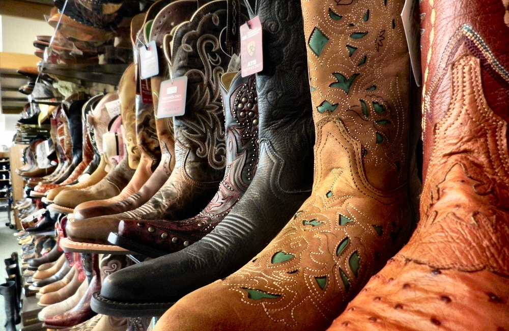
We descended from the hills into Denver to shop for cowboy boots and sun hats, and to get some internet time. As part of the sun hat hunt, we visited a huge outdoor store filled with not only all the hunting, fishing and camping gear that’s ever existed, but also every North American animal stuffed and put up somewhere on the walls. Four wolves chased an elk across the wall as we came in. Across the back of the store, trout, salmon and walleye eyed us up from huge tanks. In the evening we picked up Jon and Helen from the airport – I drive loops around the arrivals area while Rose waits inside. Helen has a cousin who lives in Boulder, so we are staying with them for a couple of nights – Rosie and Ben.
Wednesday 13th
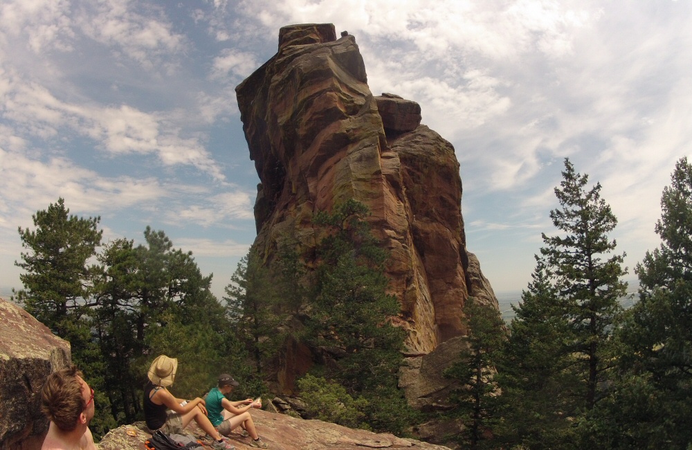
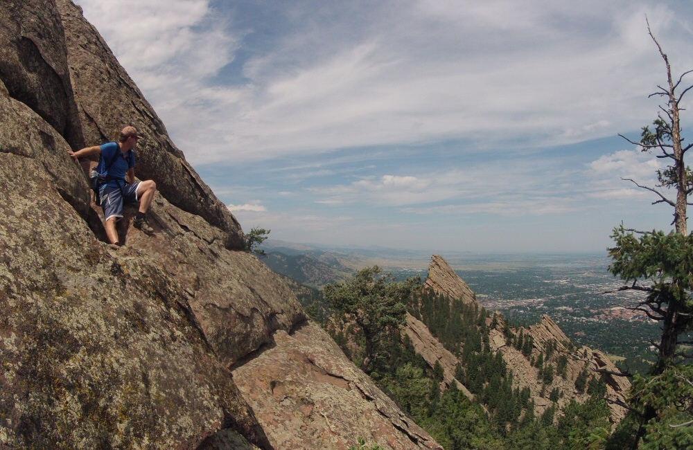
Hiked up Boulder Flatirons – great big slabs of rock guarding over the town of Boulder. The Rocky Mountains here rise straight out of the prairies, so the view from the top was pretty impressive. In the evening we explored Boulder’s Pearl Street, browsed around a bookstore and had dinner out in town at a local brewery.
Thursday 14th
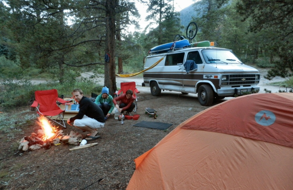
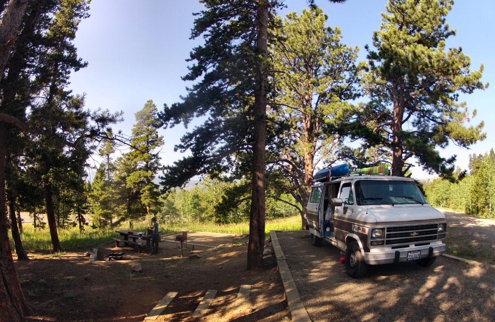
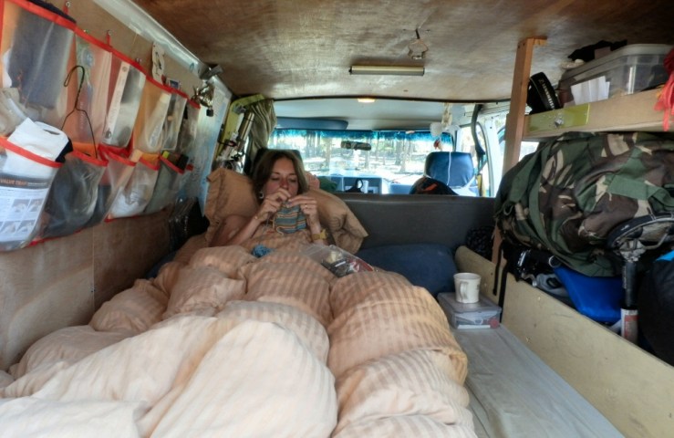
Jon and Helen brought their bikes over with them – Colorado has some of the best mountain biking in the world – and Ben had suggested we ride a local trail called Betasso, so we drove a few minutes out of town to do that. 8 hot and dusty miles later we were back at the van – a good ride – the altitude really makes a difference! Denver calls itself the “mile high city”, and here in the hills it’s riding at over 8000 feet. We stopped to wash off in Boulder Creek, then filled up with fuel for the drive west – over plains not far from where we were a few days ago at Eleven Mile Lake – an area called South Park. Through Buena Vista and up into Cottonwood Pass, where we found a nice camp in the National Forest by a stream. In Colorado you can just camp anywhere in a National Forest which is handy. J&H are sleeping in the tent they brought with them, so we need to find sites that work with a tent as well as the van.
Frustrating day today. It’s been too long since I spent a load of energy. Sitting in the van, and sitting around camp for too many days. It’s relaxing, but after a while I get all antsy and need to get the blood pumping. I’d read that there was some good riding in the State Park, so I headed out on a random track – Mule Deer trail – which turned out to be an awesome 9 mile loop of singletrack through beautiful alpine forest and meadows. I certainly felt the 9,000 foot altitude, but it didn’t take too long to readjust. Back at the van feeling much revitalised, I freshened up under the camp shower and made dinner as the sun set over the aspen trees.
Sunday 10th August
Another day of surprises! One of the great things about being on the road with no particular agenda is that unexpected things always creep up on you. Today we planned to get some more time at the library, and then scoot south over the Interstate 70 to another campground where we could get a shower, but that’s not quite what happened.
We did spend some time at the library, where, it being closed on a Sunday, we had to sit outside to use the WiFi. I had a long chat with a guy in the car park about the settling of The West while Rose did some research. I feel like I’ve not absorbed as much local history and culture as I would have liked on this trip – I’m going to have to stock up on books and catch up retrospectively when we have lots more reading time on the boat. We headed south and somewhere around Black Hawk, a crazy town that seems to be purely casinos and hotels, we missed the turning to the i70 and ended up in Clear Creek Canyon. Which turned out to be an awesome drive through a twisty gorge of red and golden rocks, next to the tumbling creek. Lots of people were out – fly fishing, running, climbing and enjoying their day off. It’s funny how I look forward to weekdays now since everywhere is less busy.
The canyon road funneled us all the way back to Denver, which was way off route and there were no campgrounds anywhere nearby, so we decided to head further south west to a state park and a likely looking site. After an hour or driving, along a twisty, narrow dirt track by the site of the Platte River, we ended up at Platte River Campground … not much more than a dusty parking space and a few tent pitches. Checking my phone again, I realise that the Platte River Campground I was looking at was in Michigan. Oops. Was a nice drive, anyway.
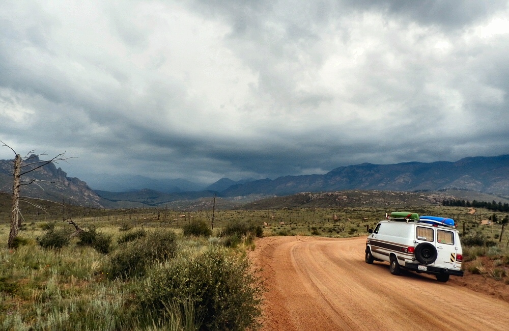
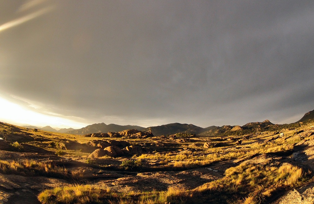
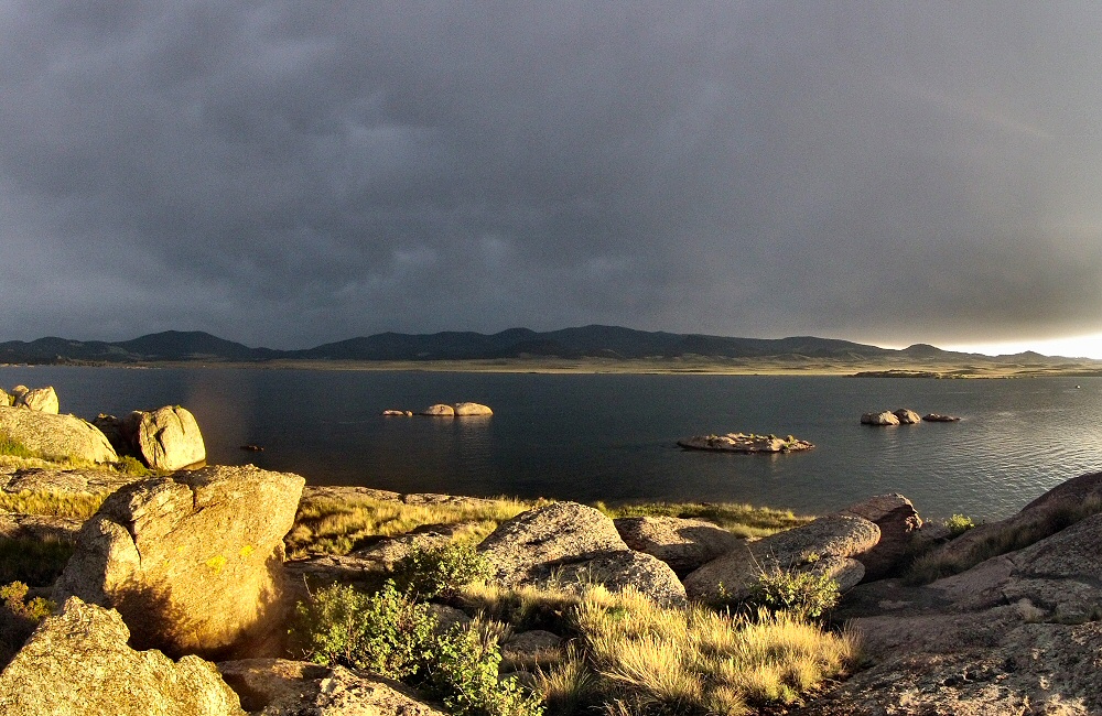
So we came up with a new plan. Across the mountains to another State Park. We took an unpaved road up onto the hill which wound its way through empty wilderness and dead fire-destroyed trees for miles and miles. Every now and then we passed a parked truck, where a couple of guys were shooting guns – I assume at targets. We also passed a number of mountain bikers loaded with gear. Stopping to chat briefly to a chap at a junction, we learnt that they were part of a 500 mile race from Denver to Durango. Hardcore. Pretty miserable for them this afternoon though – the skies opened and poured with rain, turning the dirt road into a river and making for some slippery driving. Pretty dramatic though. We even passed an area where it looked like it had snowed, or maybe hail. Eventually we ended up at Eleven Mile State Park, surrounding a reservoir. The setting sun dropped below the dark cloud cover and gave us an awesome light show.
Oh yeah, and last night we had the police disturb us around midnight. We were parked up in a quiet layby, fast asleep, when a car pulled up with all its lights ablaze. I’m a good sleeper, but something woke me up before the car pulled to a stop. I poked my head through the back door to a cop asking what we were up to. I gave him our story, he took my licence and came back a couple of minutes later – all ok – wishing us a good night.
Monday 11th August
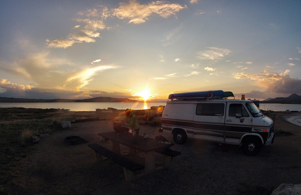
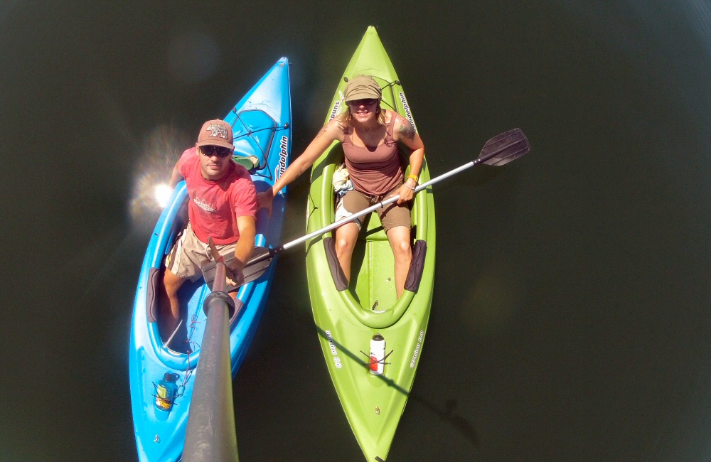
So nice to be back out in open country. The majority of our campgrounds on this trip have been tucked away in the trees, without much view of the sky or surrounding mountains, which means it gets dark early, and we don’t see the sun until quite late in the morning. This place is a huge flat valley, nestled in between the foothills of the Rocky Mountains, about 60 miles southwest of Denver. There are no trees, just lumps of granite amongst the grassland, which reminds me a bit of Joshua Tree NP. We had a relaxing day, out on the water in the kayaks and relaxing in camp.
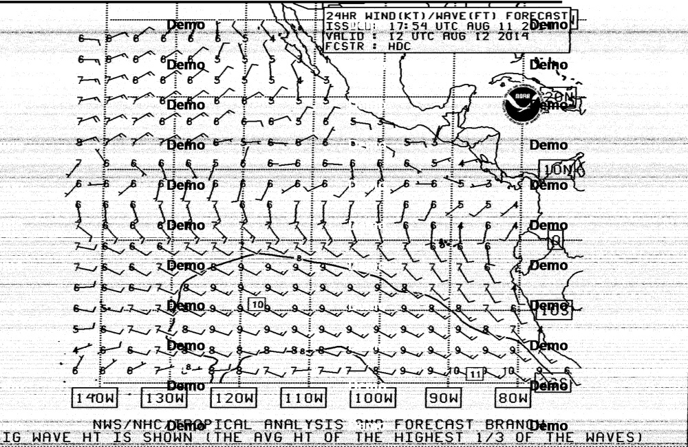
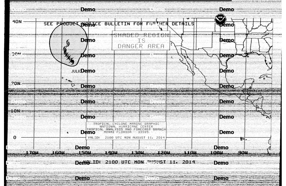
I fiddled a bit more with the shortwave radio and laptop, receiving weather faxes. When we’re out at sea, away from phone and VHF radio reception, the shortwave radio is the only way we’re going to be able to get weather forecasts, so I’m testing out the gear and getting practice to make sure everything works OK. I’ve been trying at a number of remote places, but have generally had reception problems – but here I finally managed to receive clear, complete faxes. Looks like Hurricane Julio is sat just above Hawaii, tracking north. The rest of the eastern Pacific looks pretty chilled out though.
I’m still deliberating whether to get a satellite phone for when we head south, which would let us download weather files by email, as well as stay in touch with family. Not cheap though. Also trying to decide what to do about a life raft. We already have an inflatable dinghy to use as a tender, but it’s not a survival craft by any stretch of the imagination. Usually people also have a dedicated inflatable life raft, either stowed below in a tough bag, or up on deck in a canister. Life rafts need to be serviced every year, and cost a bomb … and from what I’ve been reading, are not anywhere near 100% reliable, especially after a few months in the sun. They sometimes don’t inflate, and sometimes leak badly once inflated. If we’re going to be spending a bunch of money, I’m thinking it might be better to get a hard dinghy that converts into a lifeboat – something like the Portland Pudgy. Nothing to inflate, nothing to leak, a more robust tender than an inflatable would be, and would also hold its value.
Tuesday 12th August
We’re on the way to pick up Jon and Helen from Denver! They are going to be with us for three weeks, as we journey down through Colorado, Utah, Nevada and maybe a bit of Arizona. We’ve been looking forward to them joining us, it’s going to be rad. Hopefully lots of hiking, biking and adventure, as well as seeing some of the most dramatic scenery in the USA.
Got up early this morning – before the dawn – and watched the sun come up over the mountains, burning off the wisps of mist on the lake. I keep saying it, but I love early morings. As Henry David Thoreau says in his classic “Walden”, which I’m gradually working through,
“The morning, which is the most memorable season of the day, is the awakening hour. Then there is least somnolence in us; and for an hour, at least, some park of us awakes which slumbers all the rest of the day and night.”
The mind is fresh, with none of the half-finished threads of thought that collect during the day to distract from peacefully absorbing the surroundings. The fizz of mental activity has not yet begun and the body is (usually) well rested. I make a coffee, have a stretch, listen to other creatures waking up, and just watch the world.
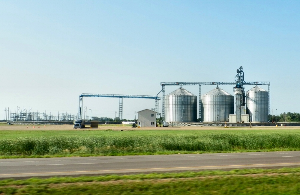
After a long day of driving we pulled into North Platte to find somewhere to stay and something to eat. Ended up at a great little motel where we cleaned up, and then popped down the road to a Taco John’s for a quesadilla. The past few days we’ve not been cooking much, we’ve been eating breakfast in camp then snacking during the day, and eating out in the evenings. It’s not easy to find decent, healthy food on the road out here, so we’re going to do a shop tomorrow and start cooking again.
Motel at North PlatteAn abandoned grain elevator
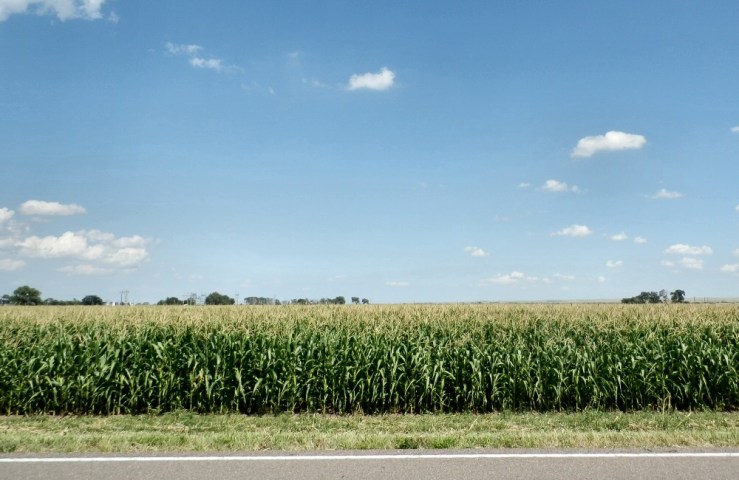
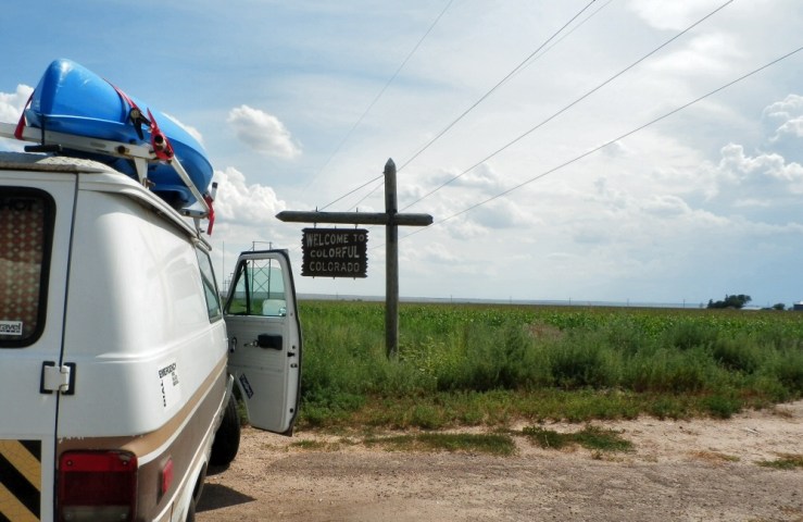
Thursday was another long day on the road – closing off our Nebraska experience and heading into Colorado. I was expecting to be driving through the same kind of open grassland landscapes that we saw when going east through South Dakota, the state just north of here, but the cornfields and agriculture in Nebraska extend a lot further west.
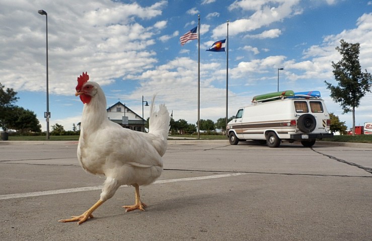
Someone left a chicken at the rest areaCorn, corn, cornHello Colorado!
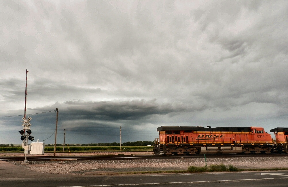
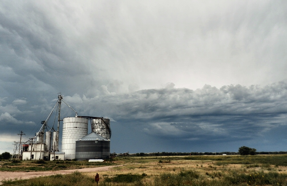
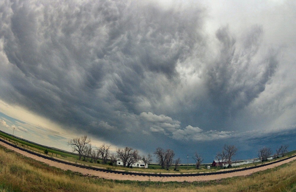
The skies were awesome. Driving into Colorado we saw a huge thunderstorm ahead – from about 20 miles away, the beast covered over a quarter of the horizon. The clouds were changing every minute as the storm developed. It looked pretty menacing. Not sure if we were heading into the belly of a full-on mid-west summer tornado, we flipped the radio on to get a weather update. Sure enough, the music was interrupted regularly by storm warning broadcasts. The storm was due to pass south of us by a few miles, with winds of up to 65 mph forecast, and golf ball sized hailstones being reported.
We cut through the trailing corner of the storm, and got our fair share of wind and rain before we popped out the other side for the final run into Denver. Driving straight through the city, we headed up into the Golden Gate Canyon State Park to look for a campsite. The site in the State Park was fully booked, but the ranger directed us down the road a short way to a National Forest site which still had a few places free. I’m sensing the outdoorsy and adventure vibe here – much like Montana and Wyoming – lots of cars and pickups with high-end mountain bikes on the back. Not so many kayaks or boats though. I think it’s going to be a bit harder to find free camp sites, so we may have to plan a bit more and book ahead.
Friday was a nice leisurely day, hanging around camp, tidying up the van, and making an excursion to a local library just down the road for Rose to do some stuff online. It feels a little strange to be right in the middle of beautiful mountain country and not walking, biking or getting out at all but it’s just nice to be stopped still for a while, recovering from a few long days of driving.
Back on the road! Over the last week we’ve been based in Thunder Bay, staying with Gerry and Julie (and kids) friends of Oli and Kate, who came over from Ottawa with their two young ‘uns. Being in company with lots of people and 4 kids under 5 has been a big change from just the two of us, but it’s been a great time.
We drove up through Duluth in Minnesota, where we spent a night at a campground in town, and then caught up with the rest of the world for a short time at the library the next day. A few hours’ drive north east of Duluth brings us to the border with Canada, where (again!) we get searched, and have to abandon some firewood. I declared the mini pepper spray we got free with the big bear spray we bought a few weeks ago, which was confiscated as it could be a “concealed weapon” – the larger canister supposedly couldn’t be concealed so it’s OK…
In the ten days or so we’ve been in Canada (I’m writing from the road on our way back down to Duluth in the US), Oli and I managed to get an evening of kitesurfing, Kate gave me a long overdue hair cut, we did lots of playing with the kids, the lads went on a canoeing trip, and we all spent a couple of nights camping on the north shore of Lake Superior at Neys Provincial Park.
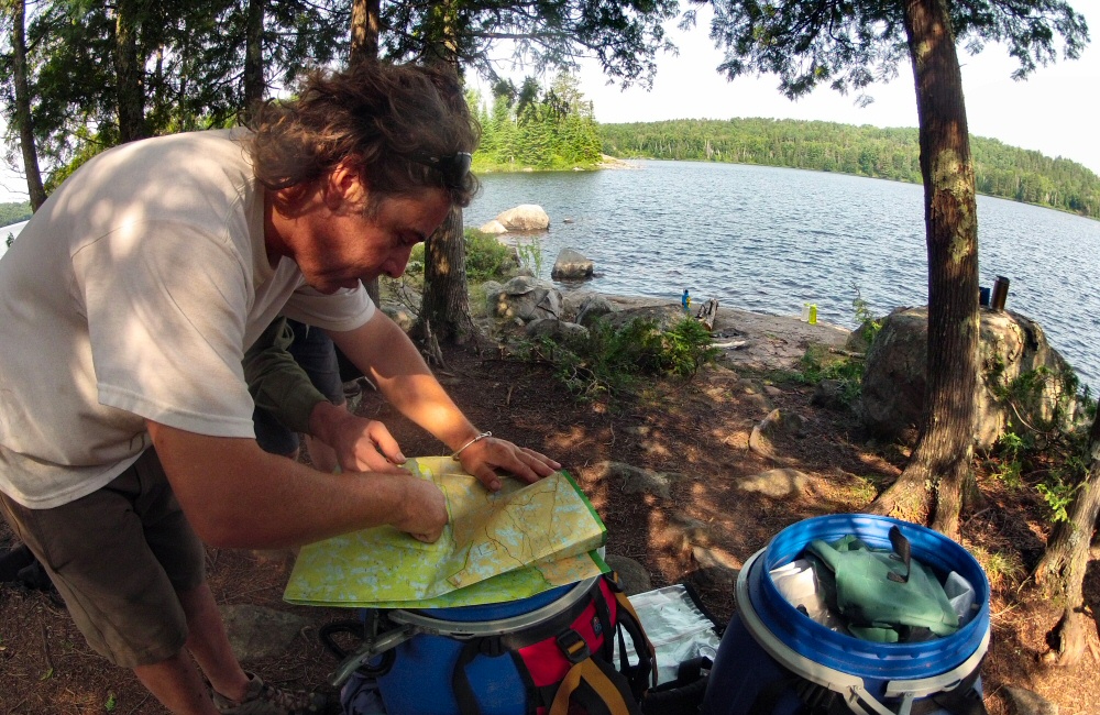
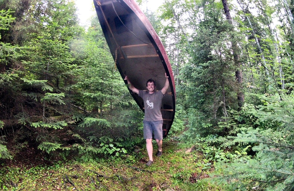
Our 3-day canoeing trip into Quetico park was a good bit of exercise, and a wilderness trip of a different sort from what I’m used to. Gerry and Oli took a regular canoe, which carried most of our kit, and I took one of the kayaks we bought last year. The 30 mile loop involved plenty of paddling and 9 portages – where we carry all the gear and boats overland between lakes, or around sections that are too shallow to float. The portages ranged from just lifting the boats past a small waterfall, to 1km+ hikes through the mud, forest and hordes of mosquitoes. Three days felt too short to really get into the lake country wilderness – we only just skimmed the north end of the park – someday I’d like to do a much longer trip. Gerry used to be a guide further north in Canada, taking groups into the middle of nowhere by float plane, and then spending a week or more paddling, camping, fishing and ending up on the coast at Hudson Bay.
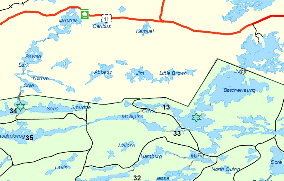
Lerome to Nym Lake
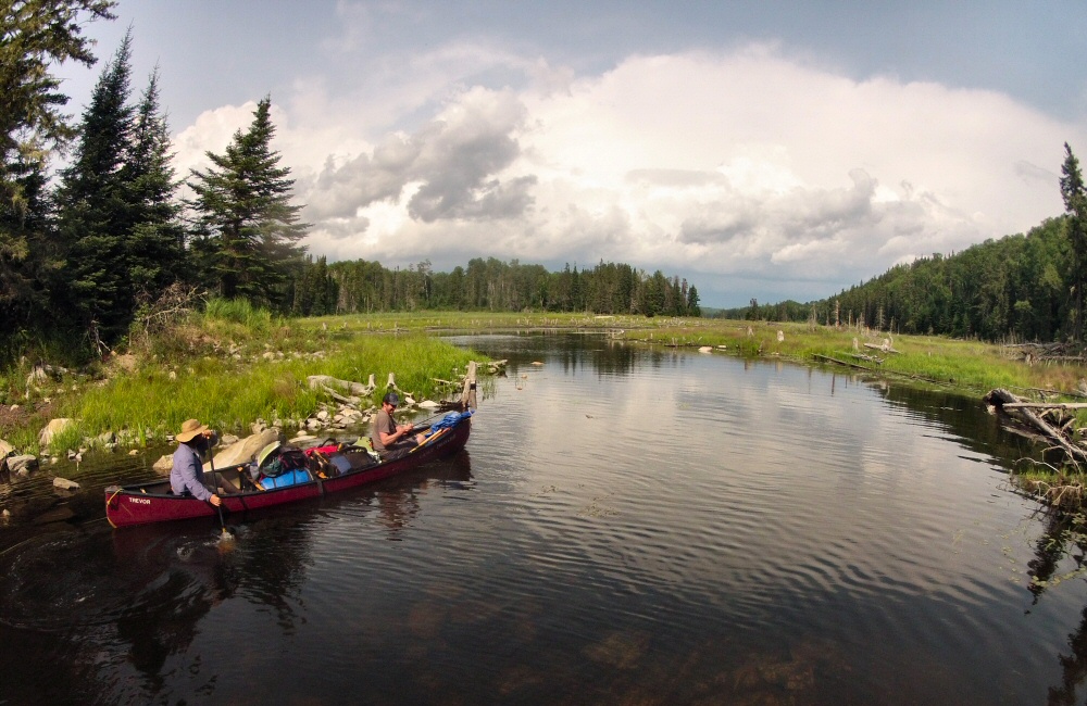
We put in at Lerome lake, just off the Trans Canada Highway, early afternoon on Monday, having picked up fishing and park licences from Atikokan. Then paddled through Bewag, Lark and Cole, with a few small portages, to reach the longer Sue Falls portage. From the bottom of Sue Falls we paddled a short way across Cirrus Lake (not labelled on the map above), to a sweet camp spot – marked with the green star. The breeze kept the bugs away as we cooked up steaks and corn in the setting sun.
On day two we continued south over Cirrus Lake to the longest portage of the trip, over the hill to Kaskokwog Lake. Carrying boats and kit through the wet foliage sets the swarms of biting bugs in flight, and if you’ve got both hands full you just have to grit your teeth and watch them suck your blood out as you charge on as fast as possible to the other side. Once in Kaskokwog Lake, we drifted slowly downwind for a couple of hours, fishing and watching the world go by. We all caught pike, which went straight back in the water – not nice to eat.
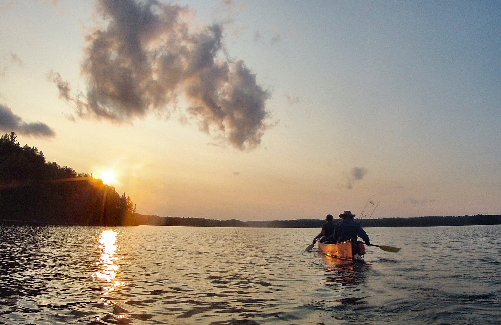
Thunder clouds marched over the sky in the afternoon, and as they approached the wind strengthened and changed to dead ahead, so we pulled into the side of the lake while the storms passed over. Heavy rain fell in front and behind us, but we got away with just a light shower, while Oli read the history of the park to us from the back of a map we’d found on the side of the trail. I hope the previous owners of that map had a spare … this is not a place to get lost! We carried on down McAlpine Lake and squeezed in a couple more portages before the end of the day (marked as “33” on the map). Emerging onto the water at the other end, we could see that all the obvious camp spots were taken, so we paddled around in the dusk, and then decided on a small island with what looked like a clear spot on the summit. Turned out to be a great site, with lots of wild blueberries to enjoy with breakfast.
The third morning involved a paddle, a short portage onto Batchewaung Lake, and then a longer, but very well trodden, portage onto Nym Lake, and then a paddle into the wind across to the take-out (marked on the map above by the short black road at the very north east of the map). Gerry hitched to get the truck, we packed up and drove the 2 1/2 hours back to Thunder Bay to arrive in time to put the kids to bed.
Camping at Neys gave us a further couple of days all together, though it was chilly and overcast, and last night we had some rain which set off the biting bugs in full force. Fun times with kids and friends, but we gotta get moving again. Should be about five or six days to Denver, back across the prairies.
The alarm I’d set to wake me up to see the sun rise over the Tetons did its job, but the mountains were still asleep under a thick blanket of cloud, so I tucked back in for a few more minutes shut-eye. That was almost a week ago! Since leaving the Tetons we’ve crossed half of America, and still have a couple of days to go before Thunder Bay. The Grand Teton Range is on the far western side of Wyoming – the last we see of the Rockies as we head east. The rest of Wyoming, at least the centre section that we drove across, is just empty grassland and ranches.
[Friday 18th] We spent the night in Casper, one of the larger towns in the state, so that Rose could go to “the west’s leading ranch outfitters” to buy some cowboy boots. Even though they had the biggest selection we’ve ever seen, nothing had that special feel so we left empty handed.
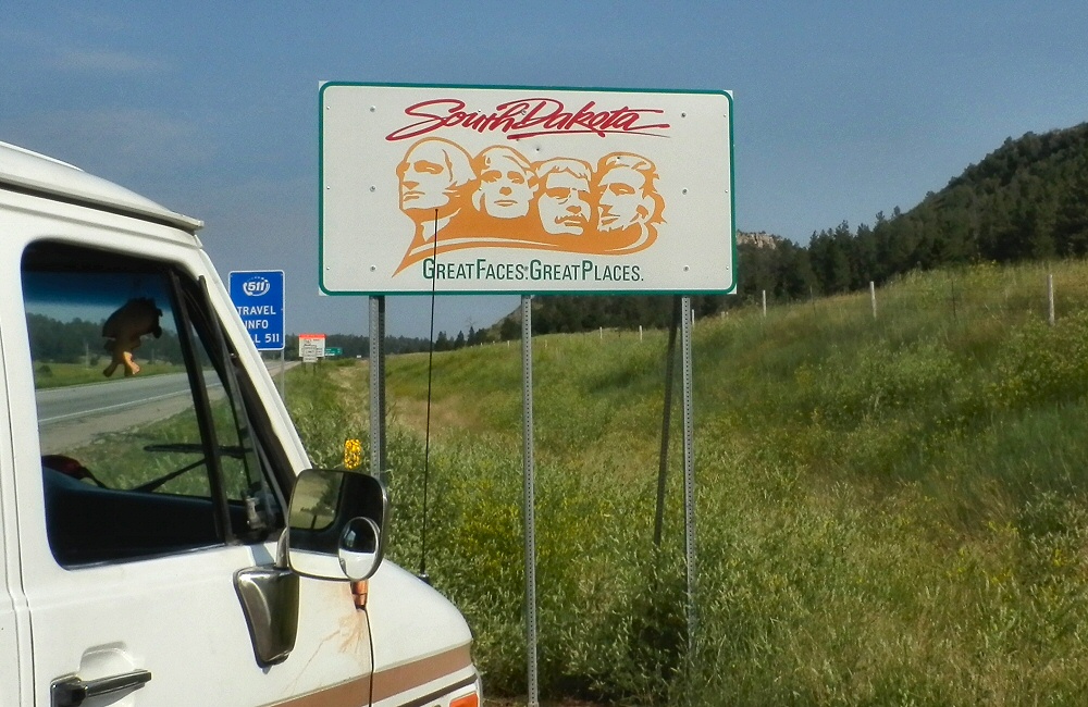
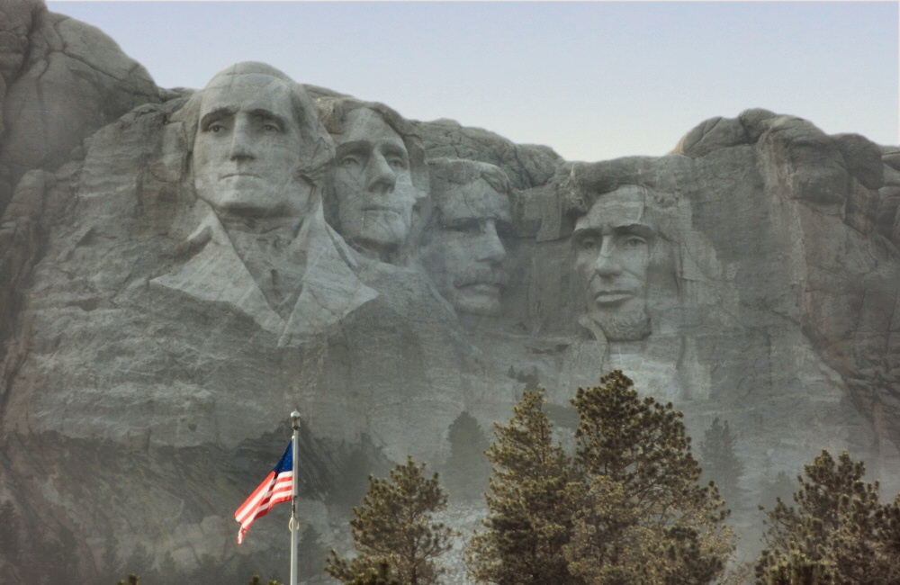
The next day took us to the edge of Wyoming – open, empty land covered in sweet yellow clover grass, as though the hills had been dusted with yellow powder. It’s a lot hotter out here than in the mountains. As soon as we crossed over the state border into South Dakota, we climbed into the Black Hills, where it cooled down quickly. The Black Hills are full of history – Indian sacred grounds and hunting lands, and of course the subsequent clashes with the settlers once gold was found here in the 19th century. We drove through the town of Custer (of Custer’s Last Stand) and past Mt. Rushmore, into Custer State Park where we planned to stay the night. Driving through the park we ended up on a tight, winding mountain road with tunnels and “pig tail” bridges – it turns out that this road was built in the early 20th century purely as an engineering challenge.
Not planning ahead, being naïve travellers, means that when we come across interesting things it’s much more of a surprise. So far we’ve not really been planning anything, other than a general trend towards the north and east. Yeah, we may have missed things along the way, but we don’t want to be just jumping from one tourist spot to the next.
As the sun disappeared we found the last available camp site in the park, and cooked up some chilli and rice. At about midnight we were woken by an amazing storm – huge lighting flashes and booming thunder. And then hail hammering down on the roof of the van, so hard I was expecting to find dents all over it in the morning.
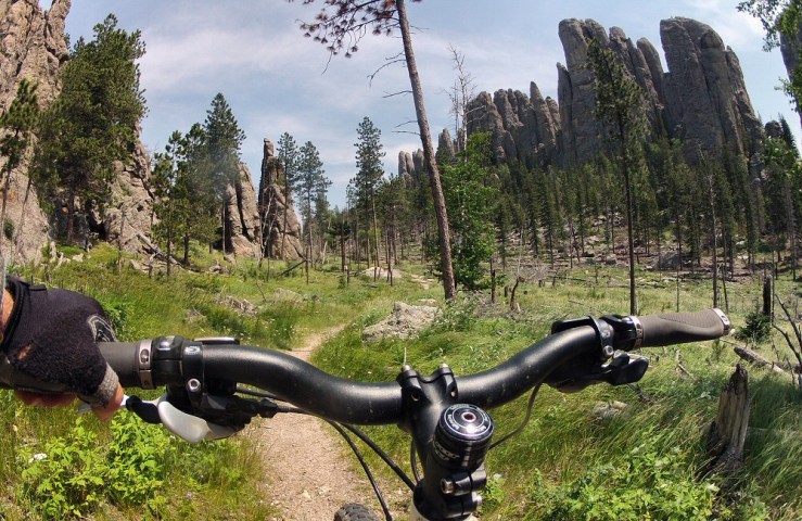
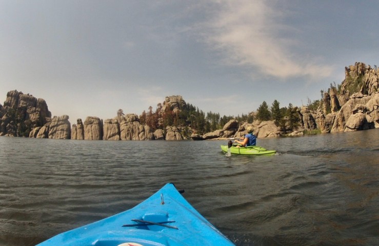
[Saturday 19th] On Saturday we bimbled around the wildlife loop in the state park, seeing more buffalo, plenty of deer and a prairie dog town. I’d seen that there were some mountain bike trails in the Black Hills, and I was desperate to get out on the bike again. But without any internet connection and pretty poor information from the visitor centre, I had to take my chances and head off on a hiking trail – up to Cathedral Spires. Turned out to be a fun hour. Hot! Heading back towards the Crazy Horse memorial we passed Sylvan Lake which looked too tempting to pass by without a quick paddle, so we popped the kayaks in, powered across the lake, and had a swim.
Cathedral Spires, Black Hills, SDSylvan Lake, Black Hills, SD
Late afternoon we wandered around the Crazy Horse visitor centre. The memorial is of one of the Lakota Indian chiefs – as a response to the building of the Mt. Rushmore memorial which commemorates the first four American presidents, “so that the white man knows that the Red man had great leaders too”. It’s a huge undertaking, started in the forties, to sculpt a whole mountain into a statue of the chief riding a horse – the biggest sculpture in the world.
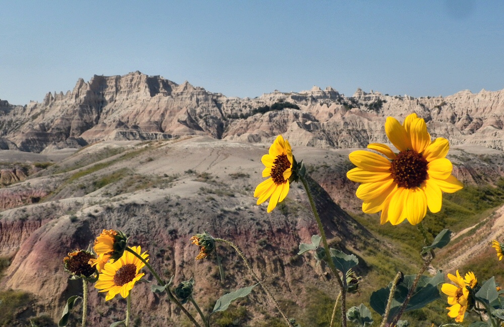
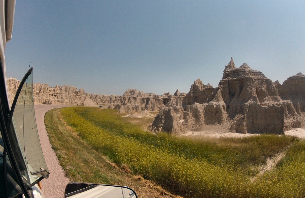
As the evening set in, we grabbed a bite to eat in Custer and then carried on east out to the Badlands National Park. The park campground as described in our National Parks book is “primitive” – it’s just a ring of grass in the middle of the grassland, with a couple of long drop toilets and a bunch of picnic tables under sun shades. Not a single tree, which makes it completely different from every other campground we’ve been to. Still mosquitoes though … how do they survive out here?!
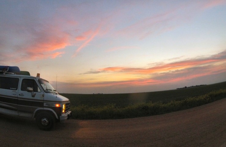
Sunset as we approach Badlands NP
Chatted late into the night with a bunch of other young travellers – one guy from San Francisco heading to Harvard in Boston to spend a few years studying architecture, a young couple driving around the US for a couple of months, almost the same route as us but in reverse – again from the bay area in California, two brothers from Florida headed for college in Missoula, Montana, and a girl from Iowa who was taking a weekend break from her job as a National Park environmental worker in Minnesota. Normally the US and Canadian campgrounds are quite anti-social; everyone has their own pitch with table and fire ring, a good distance apart to give some privacy. It means you don’t really get to meet people, which is a shame. Here you could pitch up anywhere you wanted, no fire rings, and shared tables. Everyone had been travelling for days and was keen for conversation with a new bunch of people.
[Sunday 20th] Explored the Badlands in the morning, in the searing heat. Not a breath of wind, and 100-plus degrees made it sweaty, sticky work. The only way to get a breeze, or any shade, was to get moving in the van with the windows all open, so we didn’t dawdle. Sheltering from the sun, sweltering and sweating in our plastic van seats, we slithered across the rest of South Dakota – miles and miles of empty grasslands, turning into wheat fields, and then corn fields further east.
Everything here is geared towards farming. The fields are huge, but there seem to be separate farmhouses every few miles, so the farms themselves can’t be that big. It’s all very well kept, with perfectly mown road verges (I suppose they have the equipment and the time!), neat barns and grain silos, and huge immaculate lawns in front of every house. And of course each property proudly flies the stars and stripes outside. On and on and on. It’s given me a chance to catch up with learning Spanish – I bought some bigger speakers and wired one up to the radio so that it’s a bit easier to hear while we’re blasting along with the windows down.
My other goal for the summer, to learn the Ukelele, hasn’t been progressing so well. I’ve got three basic chords dialled, but that was a month ago and not much has happened since. The same three notes strummed over and over again isn’t the best soundtrack to a summer evening in a remote campsite, especially when we have neighbours.
Just before leaving South Dakota we found a motel for the night, in Watertown, where we had a wonderfully refreshing shower, and caught up with emails. We’d thought that we’d get internet on our phones in the USA, but we’ve not actually had data reception since we left Washington weeks ago (which is one reason why I’ve only been able to update the blog every few days, at coffee shops). The states we’ve been through appear not to have any T-Mobile coverage – we can get other networks, but it turns out that using data on other networks is deemed “domestic roaming” and there’s a 50Mb data limit which we burnt through pretty quickly. Rubbish. But not really a problem. The National Geographic Adventure Atlas of USA and Canada (thanks mum!) has been our only guide – a really good one, with campgrounds and points of interest.
[Monday 21st] We stayed at the motel for most of the morning, spending time online, researching future trips and getting various online jobs done – things like recording a change of address with the California DMV so that I can then renew the boat’s biannual registration. And ordering some electric fans to get some air moving in the van at night! We’ll get them delivered to a town ahead of us, and pick them up on the way back from Canada.
Road tripping is actually really time consuming. I’d thought that we’d get much more time to do things other than drive, but that’s not been the case at all. To cover 10,000 miles in 3 months we need to average over 100 miles a day, and with a few rest days that quickly goes up for the days we’re driving. We’d originally planned 6,000 miles in total, but after 6 weeks we’ve already covered 5,400 miles. The van’s running well. Needed to top up with oil today, but otherwise all A-OK. So glad to have a fridge on board; means we can keep food fresh, have cool drinks during the day, and cold(ish) beers in the evening.
Right now we’re driving through St. Cloud in Minnesota – still stinkin’ hot – gotta go, my turn at the wheel is coming up.