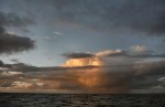
Two days ago, at 4pm, I write in my journal; “Since early this morning we’ve had 25-30 knots of wind, and chunky seas. We made 146 miles yesterday, equaling our best day yet. It’s 300 miles to Nuku Hiva – if we can keep up this pace, we’ll be in on Wednesday, will try and arrive in the light”.
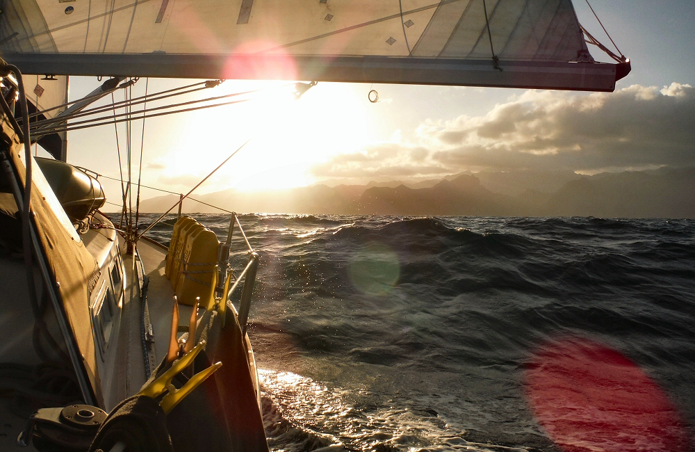
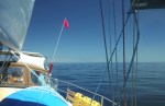
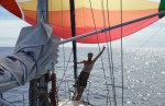
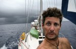
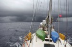
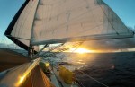
I decide to aim for an evening arrival, before dusk. I’m not happy coming into a new port at night, so if we don’t make it, it may be a case of waiting around offshore for the night, which would be nasty, and an anticlimax. We need to do 300 miles in 48 hours. That’s more than we’ve managed in any of the 48 hour periods since Mexico. Ambitious. The wind stays up, and we are under full sail, trying to average over 6 knots. We’re on a broad reach, with the strong trade winds coming from our port side, and I’m trimming the sails all the time to keep up speed. There’s a current with us, giving us a welcome boost of more than a knot at times, and we sometimes see 8+ on the speedo as we surf down the face of the bigger waves. Hoping for the wind to stick with us.
50 miles from land, I’m looking out across the horizon every 5 minutes, but really we’re still too far offshore to see anything. At 6 feet above sea level you can see for 4 miles before the curve of the earth gets in the way, unless you or your target are higher, in which case you can see further. On a clear day you can see France from the cliffs of Dover, which is 22 or 23 miles, because you’re higher up. So even though the islands here rise to more than 1000 metres, I think 50 miles is a bit optimistic. But I keep looking!
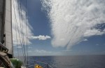
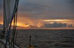
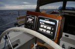
Now late morning on Wednesday, and there should be an island 20 miles off to port, 600 metres high, but I can’t see anything yet. It should be there. These days it’s not a case of worrying about whether you’re in the right place, using the sun and stars for navigation. My GPS chart plotter says land is right there, and I trust it. But it’s hazy. I’m wondering whether the island will slowly rise over the horizon, or whether it will appear out of the haze. I keep looking. And then at 1210 I see the slopes rising into the clouds! Land! Faint lines, only just visible, could almost mistake them for gaps in the cloud. But within a few minutes it’s clear, this is LAND! It’s Ua-Huka; not the island we’re aiming for, but pretty special after having completely empty seascapes for nearly a month. We’re still scanning the fuzzy hazy horizon ahead for signs of Nuku Hiva… which appears mid afternoon as we get within 15 miles.
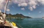
It’s dramatic. Looking from the left, the land rises vertically out of the sea to about 600m, and then climbs up into the clouds along a vicious crenelated ridge. Sometimes there’s a fuzz on the ridge where a stand of trees has managed to grow. The peak is hidden in cloud; first a horizontal band of streaky grey and white, and then out of the top of that, a fluffy bumpy mass of cumulus, bubbled up by tropical afternoon heat on black volcanic rock. Further to the right (the island is pretty close by the time we see it), a number of steep ridges tumble back down out of the clouds, closer ones being darker, and gradually getting lighter as they go around the island, like mountain ridges fading into the distance.
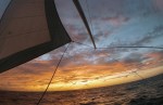
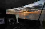
Within a couple of hours we’re approaching the cliffs on the left hand side, and around the corner is first Baie de Controlleur, and then Taiohae bay, the Port of Entry. Are we going to make it before dark? It’s still a close call, and we have to keep up speed. The sun is starting to get lower, dropping behind the clouds that cloak the island, silhouetting it against a grey sky, so we can’t see any of the fabled lush green slopes. Only gnarly black shapes – the land looks young and unweathered, fresh out of the sea just a few million years ago.
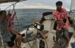
Dolphins race, twist and surf in the waves around us to welcome us in; Eva says “whales to say goodbye [from Mexico], dolphins to say hello” – it’s a pretty special arrival. I have to interrupt her photo session to get the genoa gybed and up on the pole out to port so that we can keep up the pace. Still a few miles to go, and the light is leaving us. We’ve sailed fast, and beaten our best day by a long way; 156 miles noon to noon! But we’re not finished yet.
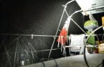
Finally we turn the corner into the bay, get the sails down, and motor in past a huge white quartz cross, slicing through the cliff on our starboard side from summit to sea, maybe 200m high and 400m wide. The horizontal band is a little darker, harder to see than the vertical stripe, so at first in the half-light it looked like a huge waterfall pouring off the top of the island straight into the ocean.
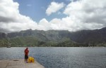
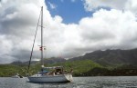
Loads of boats! Maybe forty or fifty other yachts here – I’m really surprised to see it so busy. I think we’re only the third boat in from Mexico this season, so the others will have come in from Panama and the Galapagos, or else perhaps Tahiti and other places west of here. Just as it’s getting too dark to see, we find a spot in between a few catamarans, close in to shore, and drop the hook. I pick up the scent of evening flowers. Lights of cars move up and down the sea front, sailors buzz back to their boats in noisy little dinghies after an evening meal ashore. So many new things for the eyes, nose and ears to deal with – it feels more than a little surreal.
Anchor down. Engine off. Rafiki lies still and quiet for the first time in weeks. Passage over. Amazing. We made it! 28 days at sea, 2712 miles as the seagull flies, 2919 miles sailed (and drifted). Nothing (major) broken on board, nobody injured. We rustle up some pasta, a celebratory gin and tonic (I forgot to put the champagne in the fridge), and before I know it I’m asleep in the cockpit, job done.