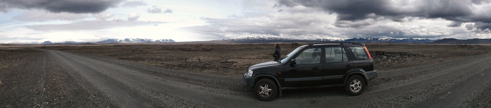
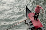
Kite surfing day! It was still blowing a hoolie. My smallest kite is a 9m and I knew that still had a puncture in one of the struts, so first stop was Airtime Kites, perhaps the world’s leading kite repair centre, conveniently based right here in Hood River. They fixed me up with a new strut, so off we went down to the launch site. So many hyper-cool dudes and girls all in one place, just like every other kiting spot in the world I’ve been to. It can be pretty intimidating, especially in a fairly hardcore spot like this, where the wind is cranking, the river current is running and the launch is on a cross-wind sandbar which you have to wade across to. At least all the riders head way upwind once they’ve launched. Even though there must have been over fifty kites on the river, it wasn’t a crowded launch zone.
Pumping up on the grass by the river, it didn’t take me long to find out that one of the other struts also had a delaminated valve. Ugh. Back to the repair shop. Repaired the valve and bought plenty more repair kits – it’s only a matter of time before every valve on my ancient kites has the same problem. Hopefully not when I’m out kiting…
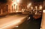
Hood River town is full of dudes driving beat-up trucks with some kind of extreme sports accessory on the roof or on the back; windsurf, kite or bike gear. It’s got a relaxed feel about it, with a bunch of nice cafes, and everything (in the centre at least) within walking distance. I could definitely see myself spending some time here.
Back at the launch zone it was still blowing well over 30 knots; really too much for my 9m kite, but there’s no way I was going to pass up the opportunity to have a session at a spot I’ve been reading about ever since I started kiting. I launched the kite, and yes it was a struggle to hold it down but I was on the water! The experience from the middle of the river was amazing. The white snow-covered peak of Mount Hood rose above the southern edge of the gorge, and the view both up and down river was dramatic – cliffs and forest right up to the water.
At one point I got caught by a strong gust, was hoisted into the air, and lost my board on re-entry. The current runs upwind, and I’d heard horror stories of people losing boards for ever, so I went into body-dragging overdrive, swimming hard upwind to get it back. Back on the board I decided it was really too windy for a 9, so headed in. Great to get a session though.
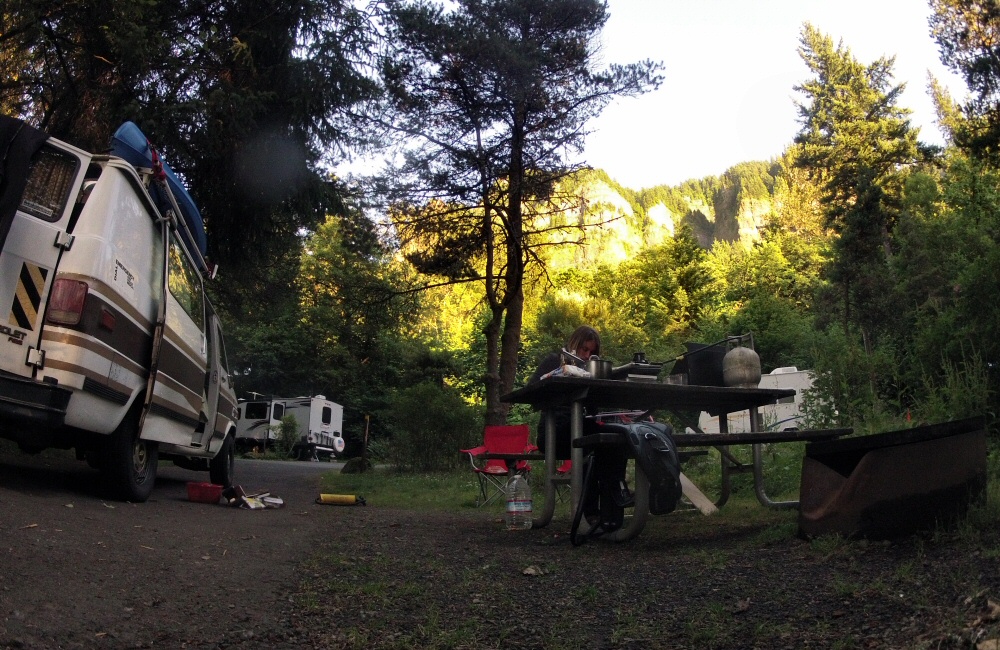
We drove down the I-84 a short way towards Portland and stopped in another State Park campground, again with a train track running along just behind the van!
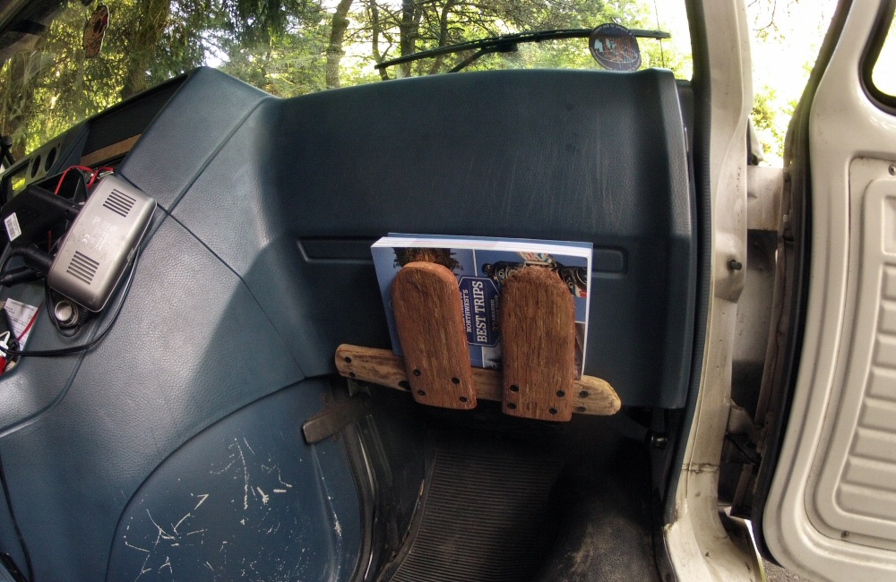
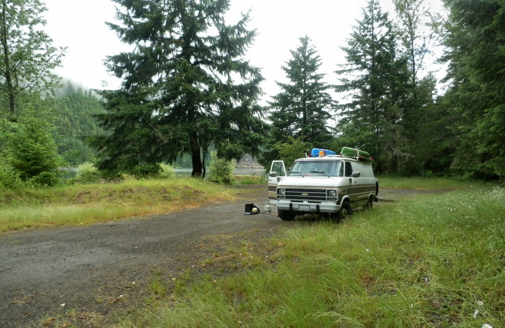
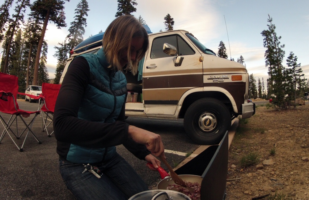
The van’s been a bit cramped and cluttered so I spent some time making a couple of extra storage areas for the things we use frequently; a shelf on the dash for books and a shelf in the back for cooking stuff.
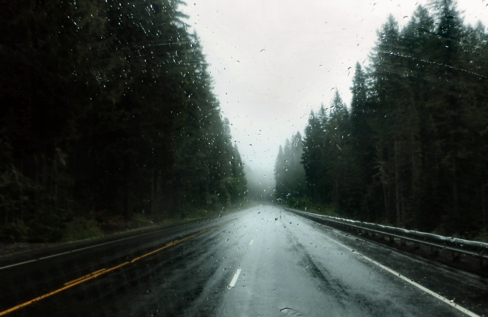
Yes, it’s definitely Hills Creek Lake. We followed it all the way to the end through more typically Oregonian scenery; hills and trees. I don’t think I’ve ever seen so many trees covering such vast areas of wilderness. The original plan was to do a mountain bike loop in Oakridge, just at the end of the lake, with a promised 7 mile downhill section; but the weather was wet and raining so I wasn’t up for a ride. Rose wasn’t up for wet, smelly bike gear in the van either, so we headed on to Bend.
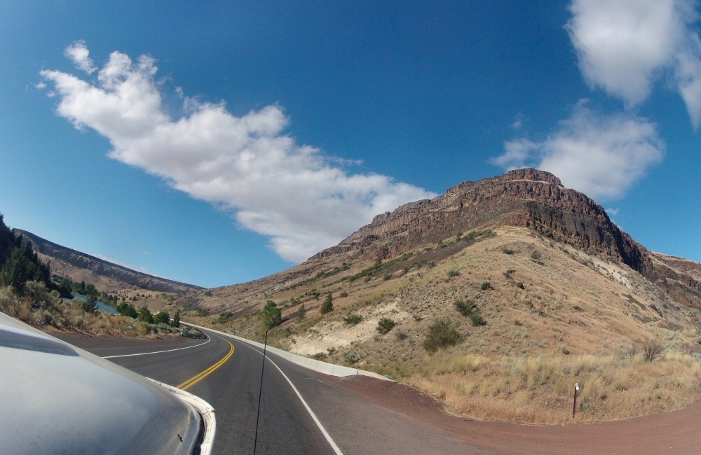
The Oregon Cascades Scenic Highway took us through the Deschutes National Forest, past lava flows and along more empty, tree lined roads. It’s not a place I’d fancy hitching. There’s nobody around! All the talk of an overpopulated planet is a little harder to understand out here. Makes you realise quite how much humanity has flocked to urban centres.
In Bend we stopped off at a bike shop to get an idea of where the best riding spots are (Bend has a reputation for being a biking mecca), to get a real coffee and to check in on some emails. We’ve had zero phone reception for days. No phone reception and no traffic would mean a long bike ride to get help if we had any trouble with the van… but a lot better than the same distance on foot!
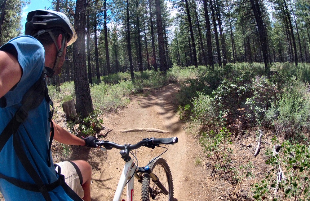
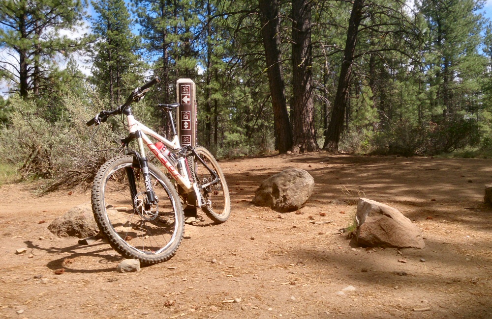
Spent a couple of hours riding in the forest just above Bend; from Phil’s trailhead. There are a load of marked trails here; some of them one-way so you can really crank it. Not especially technical, but very flowy, so it was lots of hard pedalling. I felt the altitude, but otherwise not in bad shape. Out on the trails I met a couple who’d come down from Seattle for a few days biking holiday, and a guy who’d moved to Bend from Idaho 6 years ago and says “it’s the best thing he’s ever done”. Otherwise it was pretty empty. Great to be back on the bike in the dust.
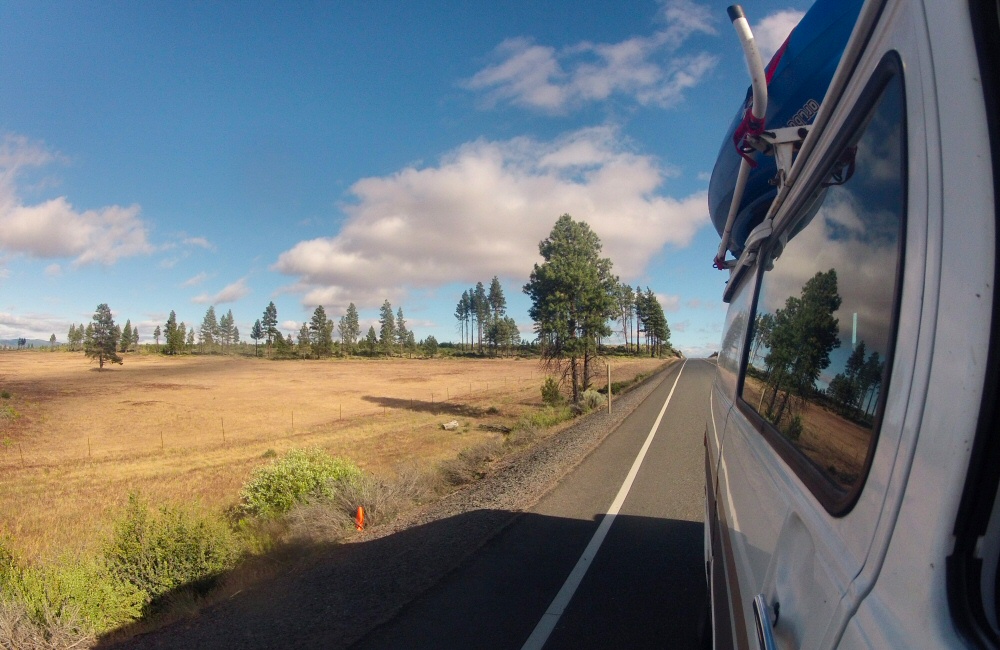
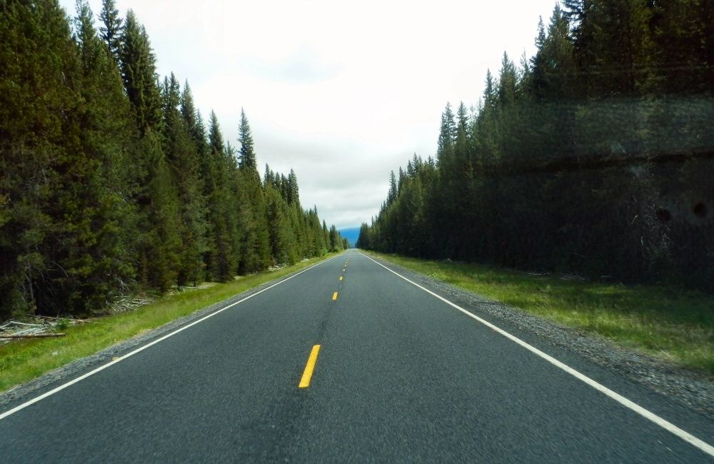
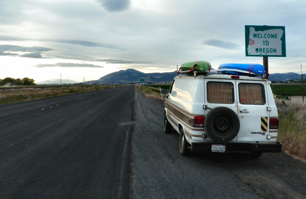
From Bend we headed north through Madras and over the Warm Springs Indian Reserve. I’m not quite sure what an Indian Reserve is; all we saw was lots of open land and yet again, new and impressive scenery. Beyond the Indian Reserve we headed up into the hills, into the cloud and rain again, before going over the summit at Barlow pass and down the Hood River gorge in the late afternoon light.
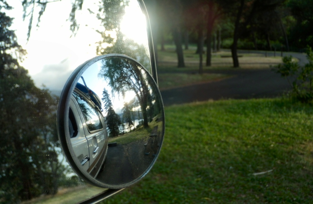
A shower was on the to-do list for today so we found a State Park campsite just along the freeway from Hood River (the town), at Memaloose. This place is windy! I was expecting wind since it’s one of the world’s top kite surfing spots, so shouldn’t really have been surprised. A train track ran along the bottom of the campground, so every hour or so during the night there was a thunder of engines followed by the rumble of hundreds of rolling stock going past. I (as usual) slept through everything but Rose found it a bit harder.
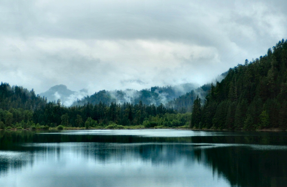
We’re sitting in the van, in the rain, near what I think is Hills Creek Lake, just south of Oakridge. I’m not 100% sure though. We’ve come over the top of the mountains from the south on an unpaved road, with only a national road atlas to go by. We’re definitely in Oregon, anyway. I thought that this atlas would only show the major roads (Oregon is about 12 inches top to bottom on the paper), but when it comes down to it on the ground, there really are no other roads here. It’s pretty wild. The atlas shows when roads are paved or not, and there’s not a lot of options between gravel and the interstate freeway.
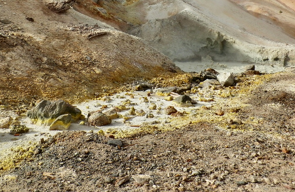
So anyway, we had our second night in Lassen and then headed back into the park on Sunday to have a look at Bumpass’s Hell hot springs area. Now that’s more like it; lots of big, bubbling pools, steam and hot ground. Definitely tops my list of geothermal sites. No molten lava though. I might end up having to go to Hawaii for that.
We had an early start, and were out of the park by mid-morning. As we dropped back down into the valley towards the I5 (Interstate #5) the temperature soared. Hot, sticky vinyl seats, sunburnt driving arm, windows open for breeze, dehydrating more and more every minute… We stopped off to buy provisions and a few things on the “left it at home” list- stuff like a chopping board, cutlery, washing up bowl.
Onward. Northbound we rounded Mount Shasta, leaving it to starboard in a rush of gasoline fumes and noise. It was one of the places I’d wanted to spend some time around, but with our tighter schedule due to van repairs, we had to move on.
Lava Beds National Monument seemed like a good place to stop for the night, so we headed off the highway and soon found ourselves buzzing along a gravel track, kicking up a right dust storm behind us. The road went on. And on. And on. Hmmn. Our fuel gauge was hitting the red and we were still deep in wilderness. Not ideal. At a cross roads just 4 miles away from the Lava Beds area we found a “road closed” sign which meant that we had to take a longer way round, and meant we’d miss the stuff we’d come for, including lava tubes that you can explore in. And it meant that we were touch-and-go with fuel. We emptied the 2-gallon spare into the tank and crossed our fingers. Eventually we crept into the small town of Tulelake, where the local store was still open and also had some gas. Result!
We trucked on, over the Oregon border, up past Klamath lake and found a nice quiet spot just off the road on a “winter recreation area”. I couldn’t quite figure out what this was; a large expanse of concrete with a winter shelter at one end. I think it’s where people park in winter before heading into the back country on show shoes, skis or snow mobiles. No snow around there now.
Wow, so that was all just yesterday.
This morning we continued north to Crater Lake National Park – Oregon’s only National Park. The ring round around the lake was shut; so we had to continue on the main road which did run along the western rim for a bit so we did get to see the awesome views. The deepest lake in the USA at over 500m, and also the clearest water; they say algae grows over 400 feet down! It was cold up there though; still snow drifts metres deep, and frost on the windward side of the trees.
We only stopped for a few photos, then headed on to Toketee falls. Toketee means “pretty” in Chinook; they certainly were. The walkway stopped high above the plunge pool, I hopped over the barrier and scrambled down to the water for a very quick, very fresh swim. Such a beautiful spot; shame it wasn’t warmer.
Next was a spot supposedly just 4 miles up the road; Umpqua hot springs. After at least half an hour and many miles into the mountains later, we still hadn’t found it. On the way back down we spotted a sign in marker pen pointing up a road we’d not yet tried. Someone trying to keep the hot springs secret!
Not far down the bumpy gravel road a chap was sitting at the side of the road with a broken motorbike. His chain had come off and a load of links were bent. I stopped, we had a wrestle with some tools to the point where it looked like he could at least limp back to the main road. We left his bike by the side of the track, he hopped in the van and we headed up to the springs together. A bunch of folk were living there full time, in tents by the river. The springs themselves were 4 or 5 separate pools perched on the edge of a cliff, the hot water feeding the top pool. Each pool further down was a little cooler than the one above it. Nice to have a soak for a bit.
Jim (with the motorbike) decided that he could probably make it back to Eugene to get a new chain on his own, so we left him to it. He ended up leaving his towel in the van; luckily he’s from Vancouver so we’ll drop it off in a few days’ time.
Just half an hour later we were on gravel tracks again, heading north, aiming for Oakridge. This time we made it all the way over the mountains without any closed roads or fuel scares, and here we are by the side of Hills Creek Lake, bellies full of steak sandwich. I’m pretty sure it’s Hills Creek Lake. We’ll find out tomorrow!
Finally, after 4 days waiting for the van to come out of the garage, I got the call from Joe to say it was all done. I picked it up, paid the bill, we packed up and got on our way in the late afternoon. It was nice having a few days going slow in the marina, but both our minds were ready to start travelling; and we want to spend some time around the Vancouver area before catching up with family in the Rockies at the start of July, so we don’t have all the time in the world.
After 6 hours of hot driving up through the vast agricultural central valet of California we pulled into a campsite just inside the north western entrance of Lassen Volcanic National Park, in the dark. I like arriving at new places in the dark, as long as we have somewhere safe to park, because the next morning is much more of a surprise. The campsite was fairly full, but still space left for us.
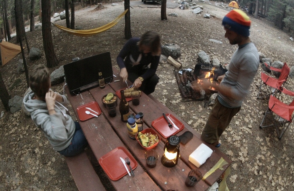
This morning we spent a few hours sorting out the van, preparing it for living in. Tins in one box, quick-access food in another, fixed a new magazine rack to the wall, shuffled stuff around. It feels like we’ve got a lot of stuff, but nothing I can think of that’s not going to be needed. Two bikes plus biking kit, two kayaks with paddles and buoyancy vests, a bag of climbing kit, my kitesurfing bag tucked away under the bed, a tent and backpacking kit, cooking gear, a stack load of books and a bag of clothes each. As everything finds a home it will probably feel more organized. We’re using the gas tank from the boat as I hate the thought of having to throw away loads of the disposable propane tanks that they seem to use for everything here. Hopefully we’ll be able to find places to fill it up.
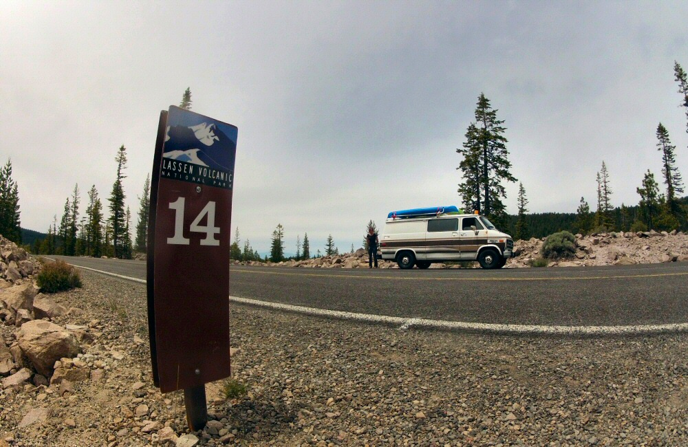
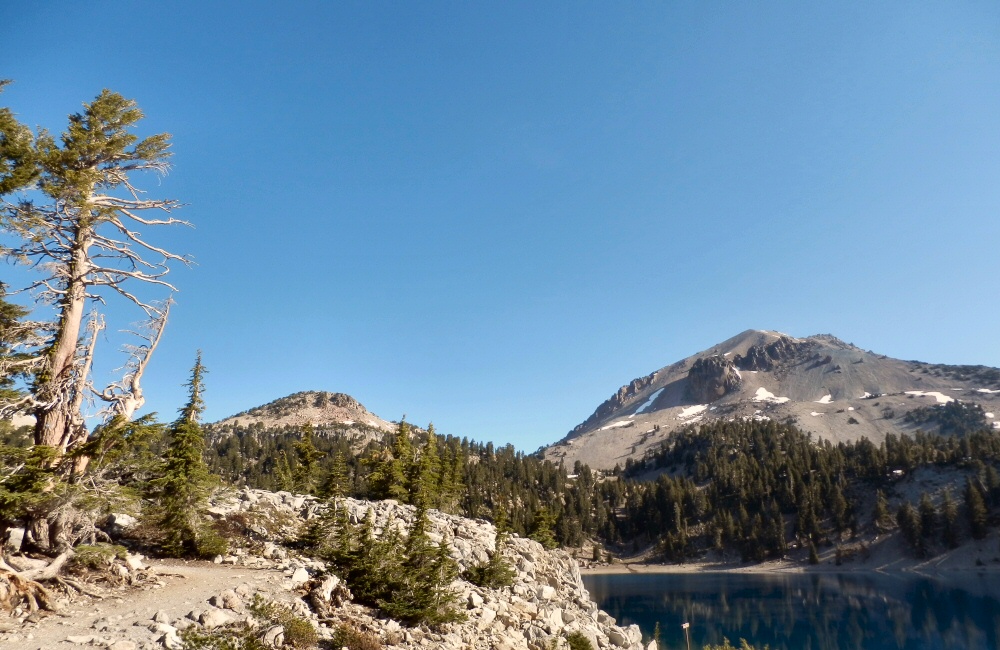
We hiked up Lassen peak today; the highest point in the park at 10,000-odd feet. Starting at around 8,000 meant that it only took just over an hour and a half to get to the summit, where it was a lot colder than the car park. Still a fair bit of snow around. It’s funny seeing other walkers stepping oh-so-cautiously along easy snow sections, sometimes sliding down on their bums or crawling on all fours. Reminds me of one of my first trips to Scotland with Ian and a couple of other buddies from Sheffield. We went to Glencoe, aiming to climb Stob Corrie Nan Lochan, but it was far too warm and wet for any mixed rock and ice routes, so we just hiked up a snowy couloir in the rain. Ian taught me that walking in soft snow is all about confidence, you need to commit to each step and understand how the snow moves under your feet; you’ll never slide far, especially if you’ve got a walking pole or ice axe for balance.
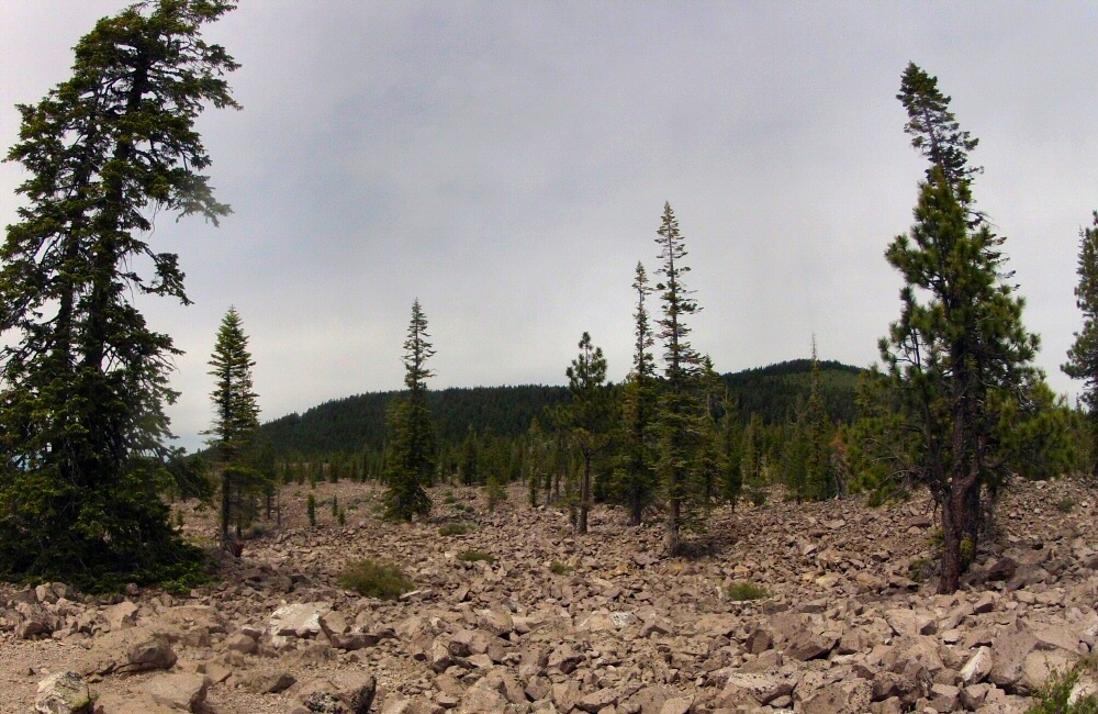
The road through the park is closed in winter and is used as a cross country skiing loop. That’s got to be dramatic. Lassen volcano last blew its top in 1915. The summit was strewn with new rock, less than 100 years old, and the crater looks pretty gnarly now with lots of freshly (in geologic terms) hardened lava.
Whenever I’m wandering around on the slopes of a dormant volcano, I wonder how much warning you get before an eruption. These days there are so many tourists around, if it blew up now we’d all be in a lot of trouble. I’ve not seen any signs about eruption warnings. Back in the bay area there are loads of signs “You are entering a Tsunami hazard zone” when you go anywhere near sea level.
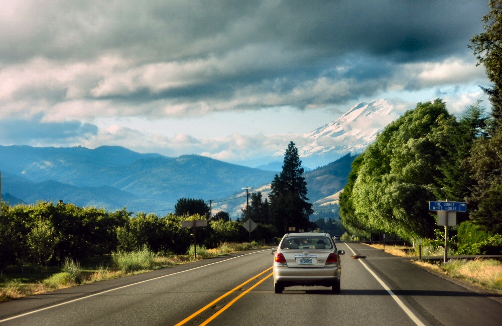
In the distance is Mount Shasta; another volcanic cone rising from the flat plains. It looks a fair bit bigger than Lassen, and probably has deep snow on its upper slopes. Not one to tackle this trip though.
Tonight we’re parked just inside the southern entrance to the park. There’s a small “walk-in” campsite by the parking lot and a bunch of RVs dotted around. Seems you don’t have to pay if you’re not using the campsites; but we still get the convenience of water and toilet block. Just up the road is a hot, bubbling mud pit and sulphurous steam vents.
Funny to think we were seeing the same steaming ground and smelling the same eggy hydrogen sulphide just last week in Iceland.
So far the “volcanic” aspect of Lassen hasn’t really been impressing me; we’ve seen a few dormant, non-smoking volcanoes and a few steam vents. Perhaps it’s because we’ve just been in Iceland. Tomorrow we’re going to take a look at Bumpass Hell which is the largest geothermal centre in the park – which does look quite impressive from the photos I’ve seen.
The park has a relaxed feel, it’s not busy; in fact two of the camp grounds in the centre of the park are shut (Silver Lake north and south). It’s half way through June so I’m quite surprised. There’s no snow on the ground at those sites. Shame, as they looked nice.
“Land of Fire and Ice” they say… I was really looking forward to seeing some red hot molten lava. We ended up with a few days of rain showers and no sign of “fire” … so a bit disappointing in that respect but man, what awesome scenery! I’ve seen plenty of mountains before, but Iceland was definitely different.
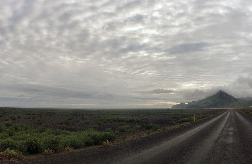
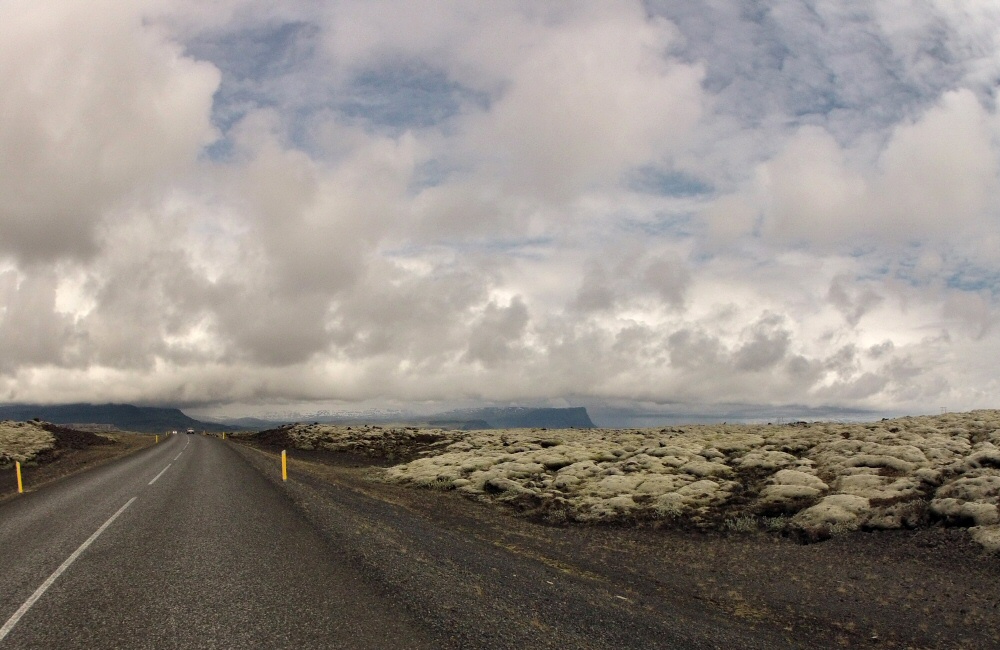
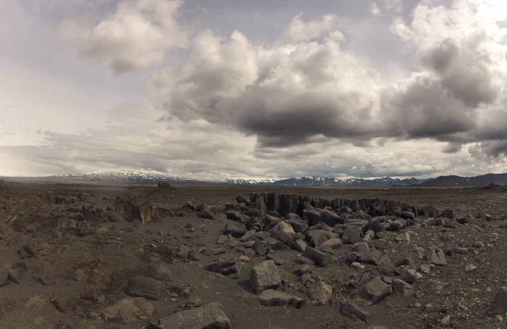
Huge, flat plains ring the mountainous highlands in the centre island; we saw two distinct types. One; solidified lava flows which look like a monstrous, cracking tarmac road, and the other; miles of desolate volcanic gravel washed down epic rivers fed by ice and snow melt. Out of these plains rise vertical cliffs and steep, black crags. More often than not the tops were in cloud which gave a distinct feeling of us existing in a thin slice of planet between the underground and the sky. You can almost believe the Icelanders’ stories of trolls and elves in the distant, inaccessible mountains.
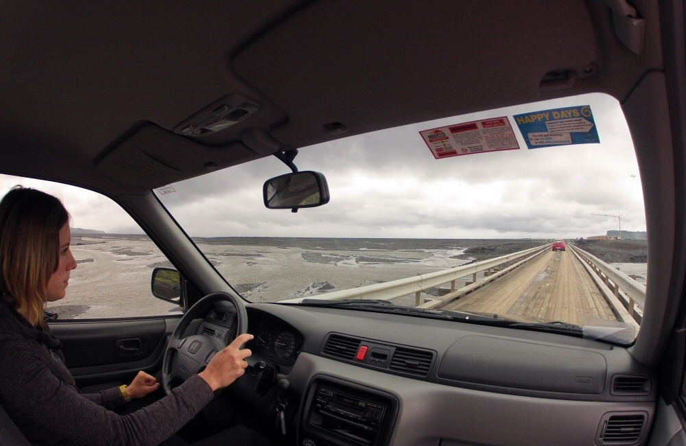
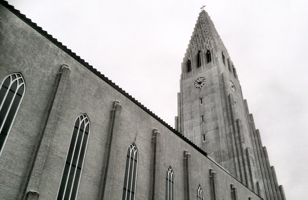
There’s one main road which runs all the way around the island. It’s called road number 1, and narrows from two lanes down to single lane to cross many of the bridges. Iceland’s population is only 350,000 and two thirds of that is in Reykjavik, so I can’t see road number 2 coming along any time soon. The rest of the island is rugged, inhospitable mountains, plus a bit of farmland. We spent our first day in Reykjavik, and then rented a 4×4 for a couple of days so we could explore.
Day 1
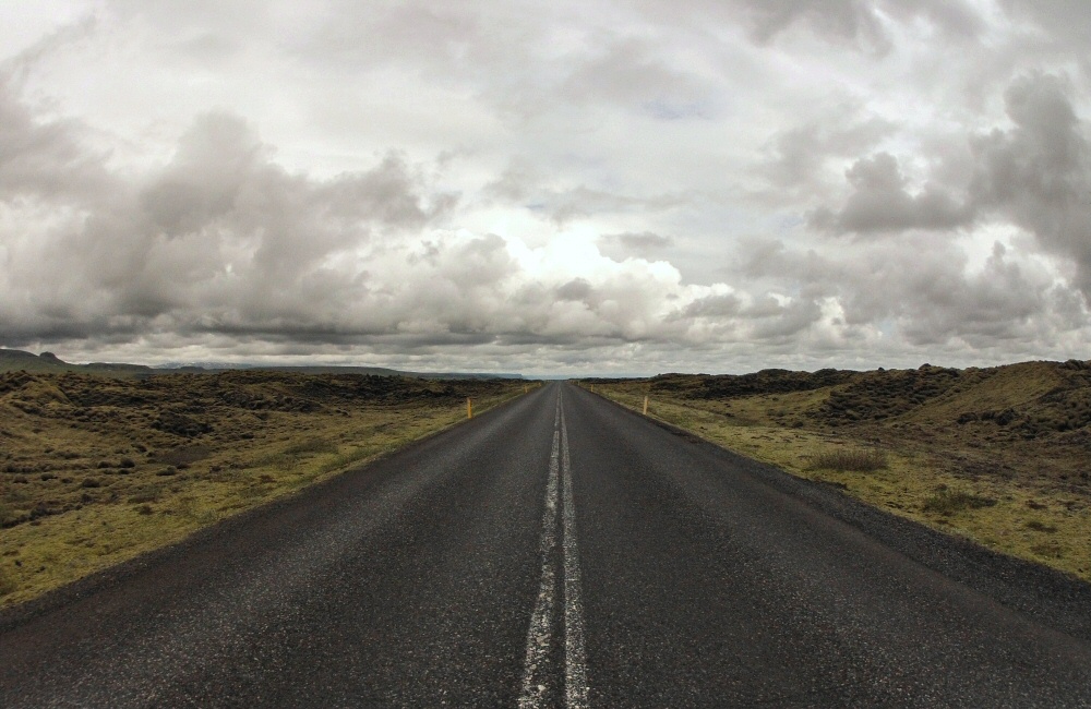
Headed east along road number 1 with the goal of getting to Skaftafell. It was pouring with rain for most of the morning, so although we passed a bunch of interesting sights (which in Iceland is usually waterfall, geothermal vent or hot spring) we didn’t stop. We had the car for two days and figured that as it was light all the way through the night, we could check them out on the way back if the weather improved.
The road wound over the plains, the sea to our right and the mountains to the left. Generally we were quite a way inland so we didn’t get to see the ocean. The lava was covered in a deep, soft layer of moss – we had to stop and get out to feel it – such a surreal landscape.
In between the rain squalls we had views for miles and miles. The air is so clear. Reminds me of the skies in northern Scotland and the Isle of Skye.
After a good few hours of driving the weather improved and the views opened up even more.
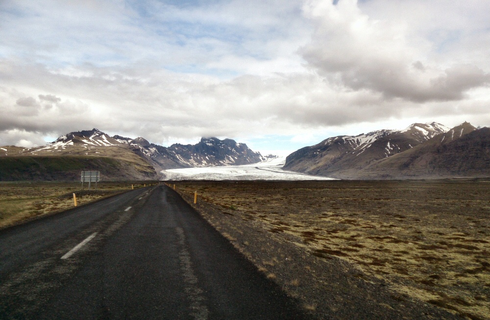
We parked up near the snout of the Skaftafellsjökull glacier and tucked into lunch. I’d read in our guidebook that a typical Icelander’s lunch is made up of rye bread, some Harðfiskur (hard, dried fish) and some Skil yoghurt, so that’s what we’d brought along. Rye bread, fine, we can deal with that – I quite like it. But boy the Harðfiskur was horrible. I tried a few pieces to see if it was a taste that grew on me but nope, it wasn’t happening. The rest of it went in the bin. Other Icelandic staples include rotten shark. No wonder the american style hot dog stand in Reykjavik is so popular.
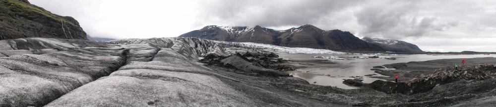
We wandered over to the glacier to have a poke around. It feels a bit tired. A load of dirty ice. Glaciers get more impressive higher up the mountain; down here in the melt zone it’s still impressive, but lacks grandeur. Reminds me of a climbing trip in the Alps with buddies from Sheffield – we tramped across a glacier high in the mountains on our way to climb a route, bivvying out at night on the side of the ice in a small cave.
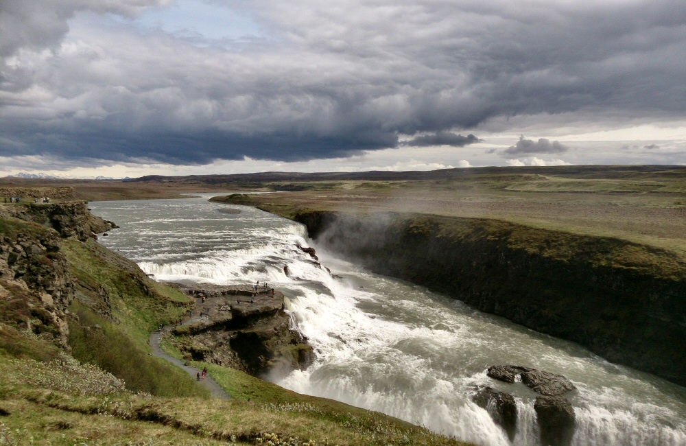
Late afternoon we hopped back in the car for the mission drive back to Reykjavik, stopping off at Gullfoss, a large waterfall, on the way. We also picked up a Canadian hitch hiker who was also heading the same way. There were quite a few hitch hikers – I guess partly because there’s only one road, and partly the laid back casual attitude of the Icelanders. Rose said he was a bit smelly.
Day 2
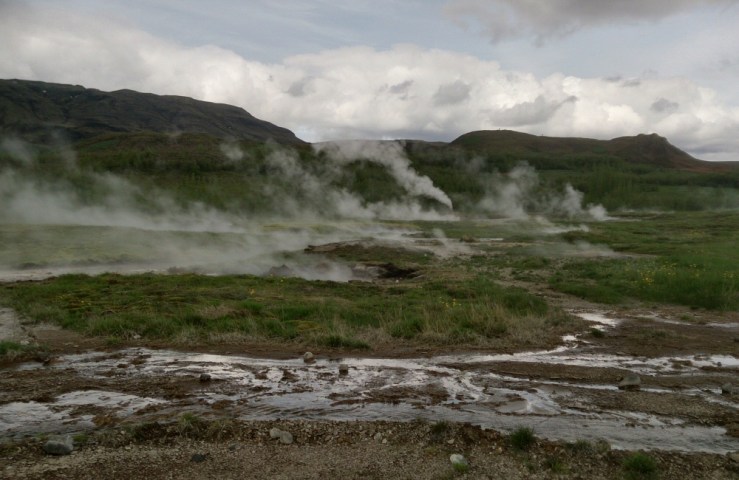
Most tourists to Iceland spend a day doing the “Golden Circle” which is a bunch of sights in a loop not far from Reykjavik. Since we were there, it made sense to take a look. First we stopped by þingvellir – an impressive fissure in the bottom of a rift valley which sits between the European and American tectonic plates. Further south, this same join between the plates forms the mid Atlantic ridge. The plates are moving apart at about 18mm per year, and while there’s no active volcanic excitement at the surface (like the hot molten lava I came all this way to see…), the valley is full of geothermic centres and hot spots.
We also stopped in at Gullfoss (another waterfall) which is an impressive two-level beast.
And then Geysir, which itself doesn’t erupt unless there’s just been an earthquake. Just a few yards away is Strokkur, a slightly smaller but much more reliable geyser which pops its top every few minutes. We dropped into see a geyser in California with Ant and Anna – so this is our second set of geysers this year. Hopefully we’ll get to swing by Yellowstone and Old Faithful later in the summer. The Grand Geyser Tour of 2104.
Heading back towards þingvellir we picked up more hitch hikers – this time a couple from Czech republic and Macedonia. He was in Iceland for a conference and she came out to join him for a few days’ holiday at the end of his work week.
We’d rented a 4×4 because we wanted to get off road and explore deeper into Iceland. We didn’t really know what to expect, and explored up a couple of gravel tracks. On the first we were thwarted by a river that we weren’t confident to cross. It would probably have been fine but we were a little short on time, needing to get the car back by 4pm – and we had no idea whether the rest of the route over the mountains was clear. Making our way back to the main road we were passed by one of the huge Icelandic “super-jeeps” with monster tyres, blasting his way along the small track like it was the main highway. Next time that’s how we’re going to see Iceland!
A bit further down the road we did find a track over the mountains that looked a bit of fun, and just about doable in the time we had left.
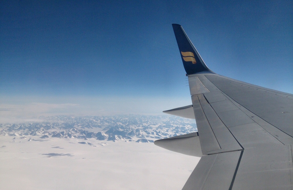
Flying over Greenland on the way back to the USA was pretty cool. Plenty of icebergs, mountains and snow. Definitely need to get there at some point. I spotted an advert in a sailing magazine a couple of days ago; “Crew wanted for expedition to Greenland and Arctic in old wooden Bristol pilot cutter” … now that would be an adventure. One day I want to buy a steel hulled boat and spend some time north of the Arctic circle. Greenland, Canada, Norway …
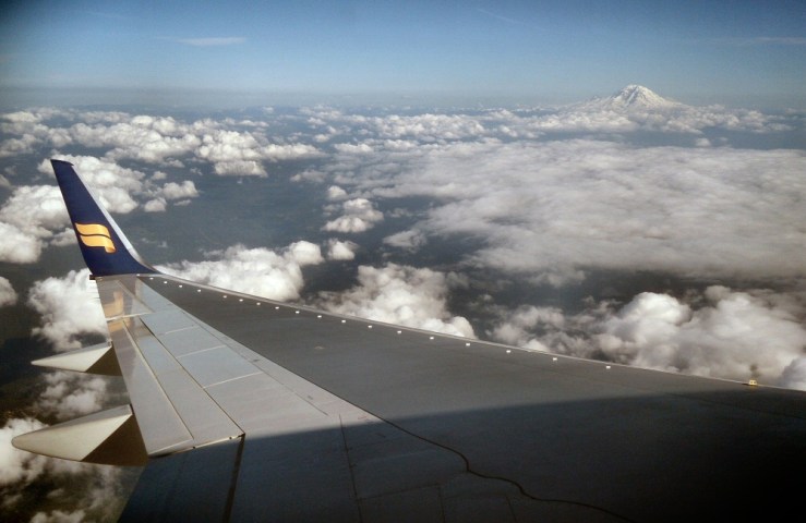
The flight went via Seattle, where we got an awesome view of Mount Rainer as we came into land. I never knew it even existed. We’re going to be coming back up this way in just a couple of weeks, so that’s now on the list of places to see.
We landed in Reykjavik yesterday afternoon after a comfortable 3 hour flight from Heathrow. Changed some money and booked a bus for the 45 minute trip into the city – across miles of lava flow, which looked just like old, cracked tarmac road on a huge scale. Checked into our hostel – a private double room in a place not far from the centre of town – and then headed out for a walk to find some supper. We ended up at “the most northerly Pakistani restaurant in the world”, and had a really tasty curry. I figured that we were probably going to struggle to find a decent curry in America over the next few months and we didn’t really get a decent one back in the UK.
I don’t really feel like our travels have started, yet we’ve flown half way around the world and are in a place I’ve never been to before – we’re still due to have a few days at home on the boat in San Francisco before we get going in the van next week at some point.
Plans for the next few days are to hang out around town today then book a 4WD for Monday and Tuesday to explore the island. It feels like the season hasn’t really kicked off here – guidebooks talk about crowds but it feels empty, even last night on a Saturday evening. Maybe we were out too early? Walking back to the hostel at 10pm it was still light as day, and (Rose tells me) it didn’t get dark at all during the night. Her eyelids are really thin (that’s my theory anyway) so she finds it hard to sleep if it’s not fully dark. Here in Iceland we’re just outside the arctic circle and only a few days away from the summer solstice, so we’re going to have to find some eye shades!
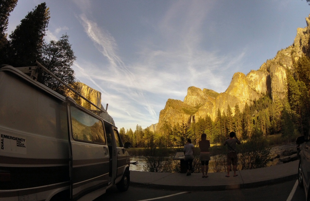
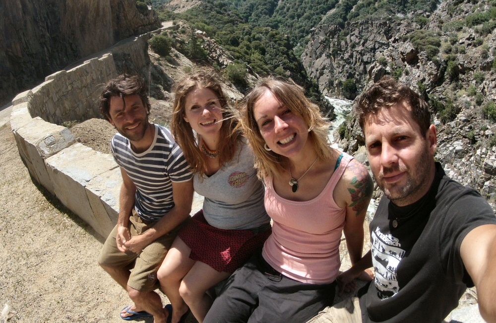
After a day or two of chilling out in San Francisco, the four of us headed off in the van to see some hills. First stop, Yosemite. I’d booked a camp site right up in the valley, next to the Merced river. We’d been looking forward to getting some swimming in, but it was freeezing cold so that didn’t happen.
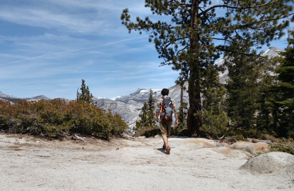
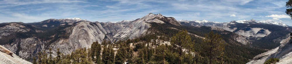
Ant and I wanted to get some exercise and decided that Half Dome was a good target. We’d thought about getting passes to climb the cables right up to the summit, which involves an online lottery to restrict the number of visitors each day. We’d checked out the website but the entries had closed for the day. We decided that it would still be worth hiking up there anyway. Leaving late in the morning meant we had to put the pedal down, and were pretty much at a jogging pace. Three and a half hours in we’d reached the base of the granite dome, poking its head out above the tree line. This was also the half way point – we had another 3 1/2 hours to get back to meet the girls in the car park. After tucking a pot of macaroni salad away, we half-walked, half-ran the 7-odd miles back to the valley floor.
The girls picked us up in the van and we headed out of Yosemite as the sun was sinking below the valley horizon. Which is way, way higher than the real horizon, which mean that we still had loads of daylight. The plan was to head down to Kings Canyon and Sequoia National Park and see some big trees.
We ended up spending the night in a motel in Fresno, and then putting away a big breakfast at Blossom Trail Café just outside town. Every time we sit down for an American breakfast we see “biscuits and gravy” on the menu – which to our British ears sounds less than appetizing. We persuaded Ant to give it a go. What turned up appeared to be something like scones in a hollandaise / vanilla / custardy sauce. Hmmn.
As we headed into the foothills of the Sierra Nevada again, we passed a field full of shining cars and bikes. I spun the van round (that sounds easy, but with its crap turning circle it means a twenty-point turn in the road, which was fortunately deserted) and we spent an hour or so checking out muscle cars, trucks, bikes and lots of hairy christian Americans.
Driving higher into the mountains, we kept passing the usual altitude markers that seem to be so popular round here. I’d read that Americans are into their sports trivia and statistics – I wonder if altitude clocking is along the same lines? Not that it’s much of an achievement; you just drive up the road and you get higher. Not like the old days when these mountains were first being explored – that must have been epic.
We got into the park and turned left for Kings Canyon. Supposedly the second deepest canyon in the lower 48 states, after the Grand Canyon. Yep, some pretty impressive views.
Though I’d booked a campground further south, we figured that it wasn’t worth the time driving all the way down there, so we found a nice place near the King river near the road head. The road winds its way up the valley but doesn’t go anywhere, which made me wonder why it’s here. It’s not like it’s an old trade route. The effort that’s gone into building the road is amazing – can it be just for tourism? There were a load of cars parked up at the head of the trail, and a few hikers packing their kit for a weekend in the wilderness. That’s the way to explore this park – on foot. I don’t think we’ll be coming this way again though.
The drive back to San Francisco was fairly straightforward … a long way though in the heat, and the van is noisy. We had a great time with buddies; camping, mountains, sun…
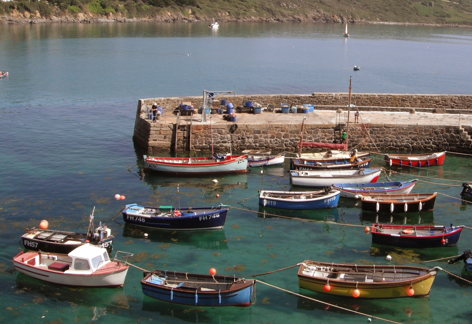
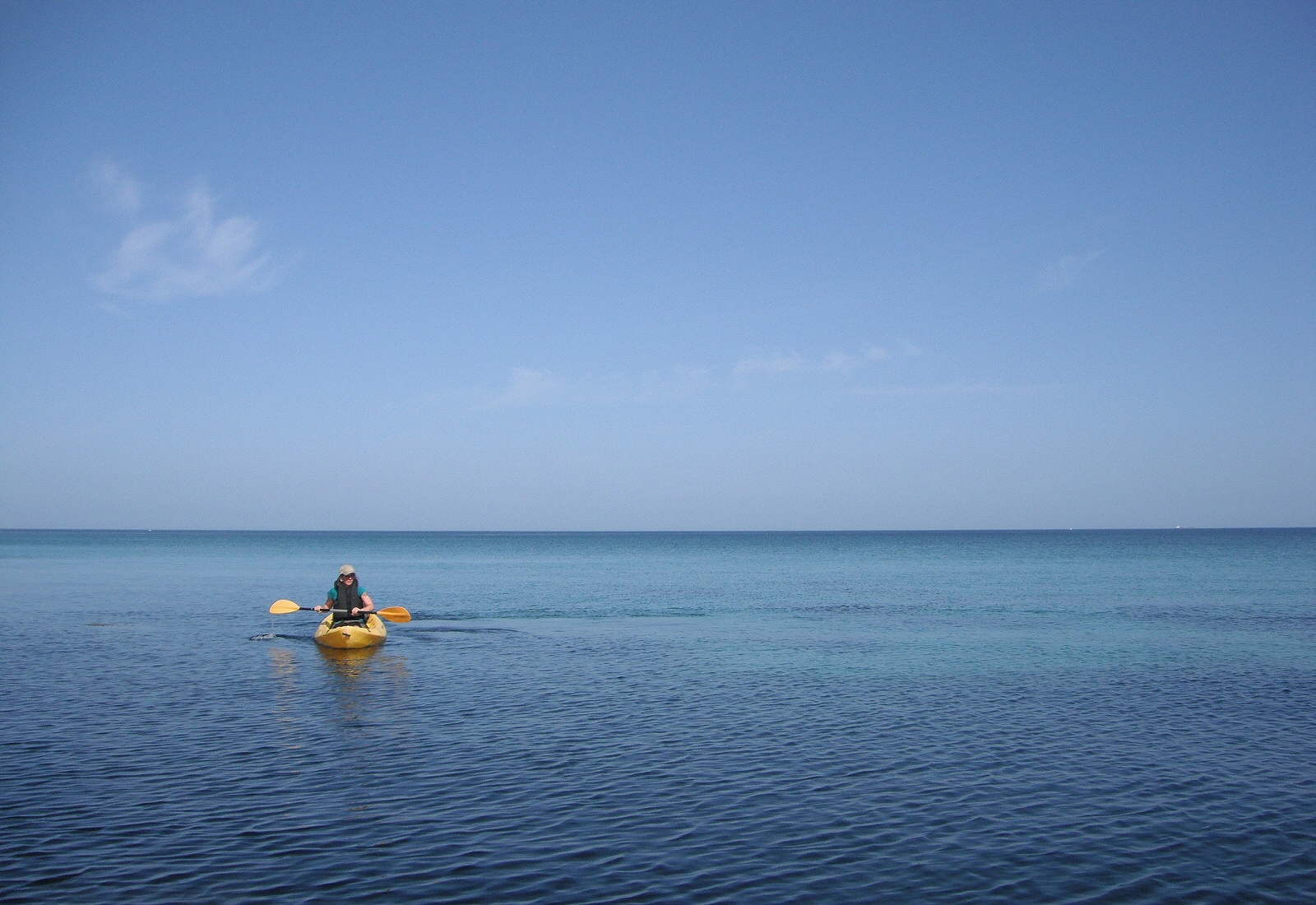
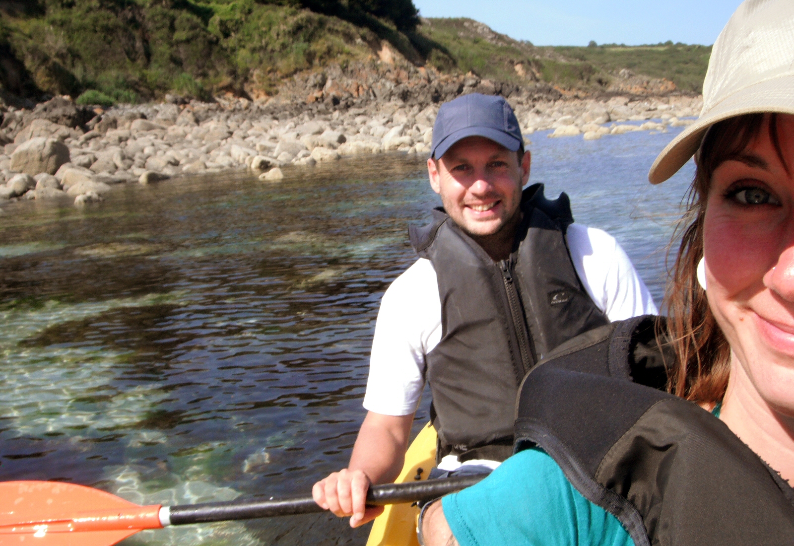
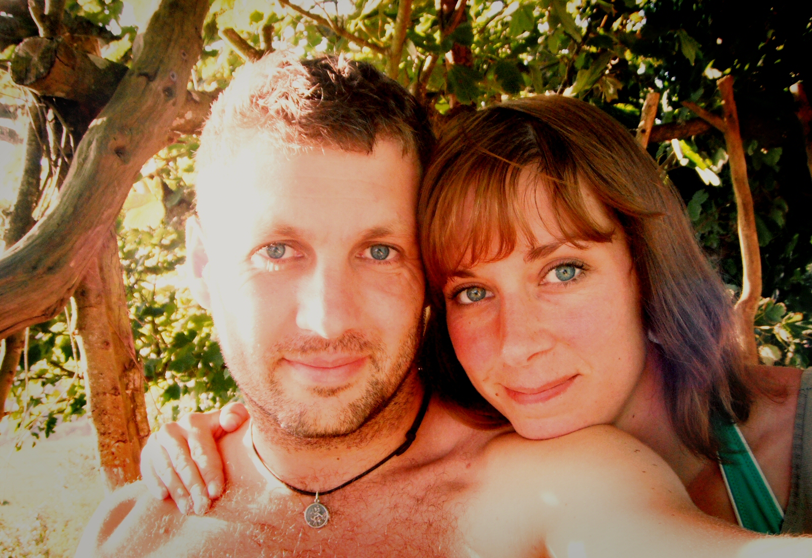
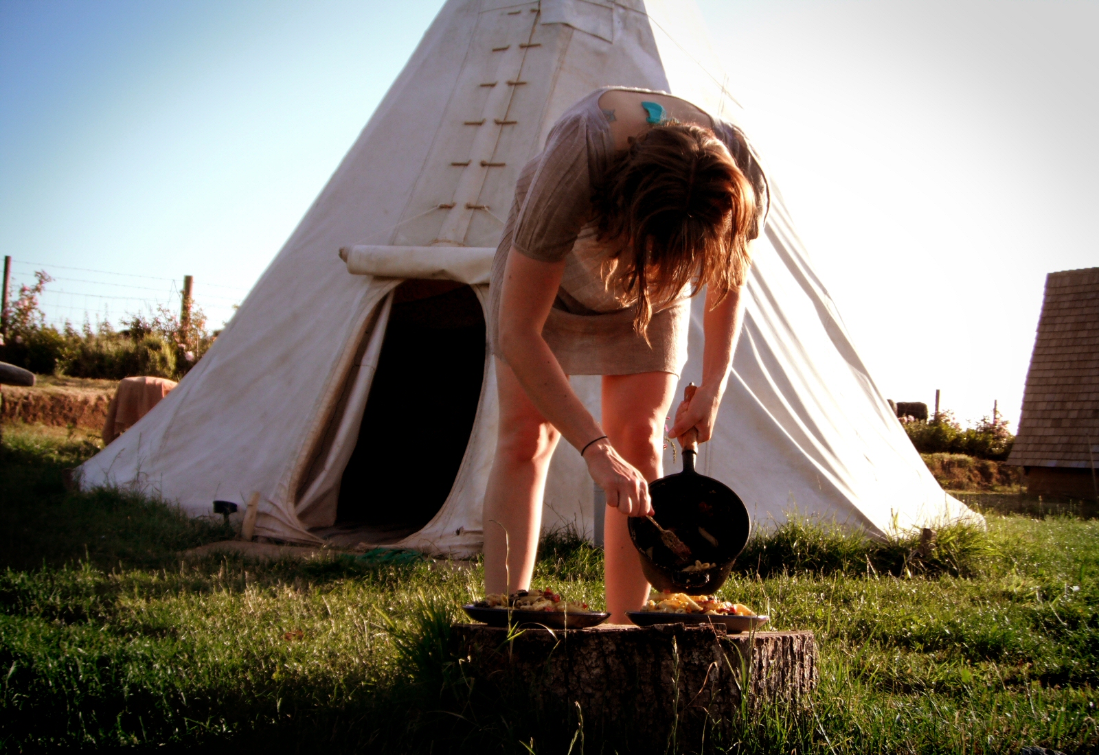
Me and la chica just had an awesome weekend down in Cornwall, and boy was it hot. About 30 in the shade! We stayed in a wigwam and a tree house, completely disconnected from the hustle and bustle of the rest of the world. I can see why people want to live down here. We had some great swims, and rented a kayak for a couple of hours – we want to buy a kayak for the boat when we move out to the states, so it was good to have a bit of first hand experience with a 2-man sit on top.
Nice DodgeGlad I had a map…Not as common as I’d expected
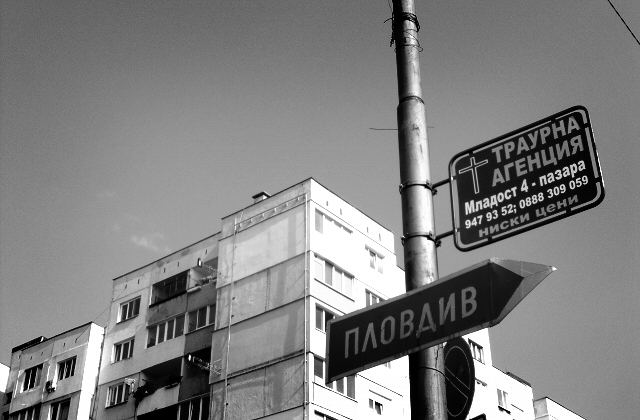
So I’ve just finished the last of 4 days here in Sofia, Bulgaria – training up a team of people to work with Brightpearl on customer implementations. I’ve been pretty slack in that I’ve just been spending time between the office, which is 5 minutes away, and the hotel. We’re about 20 mins out of town by cab. 8 hours training during the day plus catching up with the rest of work doesn’t really leave much time for getting around …
First impressions of Bulgaria? Everyone is super polite. In fact that first struck me when getting onto the plane at Gatwick! No jostling, no pushing, just courteous blokes and gals. Nice. The stereotypical eastern-bloc hi-rise apartment building are everywhere, looking a little worse for wear. The roads are in a bit of a state too; but so are California’s.
It’s been nice and hot; last week they say it was up to 35 degrees. Mmmm. As usual, it’s a bit strange staying a hotel for a few days; lots of time on the computer, dining alone (nice food though) – making small talk with the staff. The usual “travelling on business stuff”. I’ve not been to the gym; even though I did bring shorts; my toe is still in a bad way from a kite surf wipe out two weekends ago at the Gower.
Back to UK tomorrow; it’s a mission of a journey; Gatwick isn’t the best place to fly from if you live in Bristol!