We spent a couple of awesome weeks on the road; Sheffield, Dumfries & Galloway, Scotland, Northumberland and one last night in the Yorkshire Dales. Had two nights with Rich and Sam near Sheffield, the first parked up by Redmires reservoirs (memories from Sheffield Uni days!) and the second in a slippery campsite near Bakewell. Caught up with Si and Sue Berry, Kate and Paul Testa and their families.
Drove up to meet John and Helen (and Billy-bob and Rio) in Dalbeattie. Then over to Kirroughtree, and up to Loch Lomond and across to Aberfeldy. Back down via Northumberland, a night in a campsite … then through the Yorkshire Dales … a night way out on the top of the moors where our gas finally ran out; not even enough for a cup of tea 😦
It’s now September 22nd and we’ve been in San Francisco for more than two weeks – and I’ve only just got around to finishing writing up our road trip. I’ve been busy on other things. More about that another time. So here’s a catch-up post.
Monday 1st
Stowaway! In the night, something ran over Rose’s arm and woke her up. A cheeky kangaroo rat had made its way aboard somehow, and was hunting among our packets of food. Throughout the hot night there was a shuffling and scuffling around in the bottom of the van, and by the morning it was gone. We were up early to catch the sun rise over the stunning red landscape, and explore before the sun got too hot. We made a trip across the park to see Elephant Rock which had been on Rose’s “crazy American scenery” list.
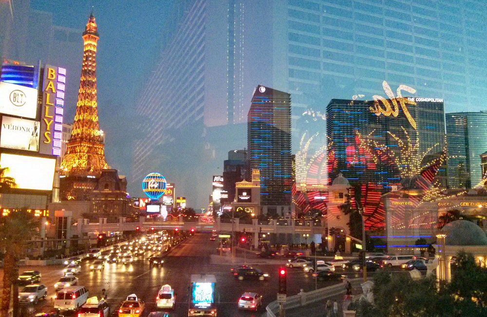
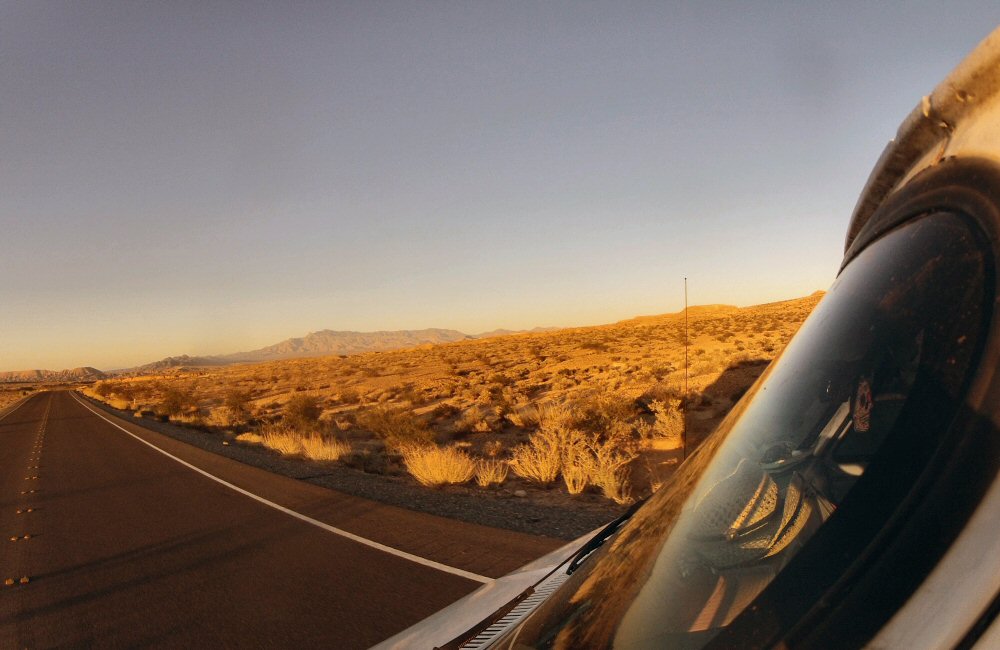
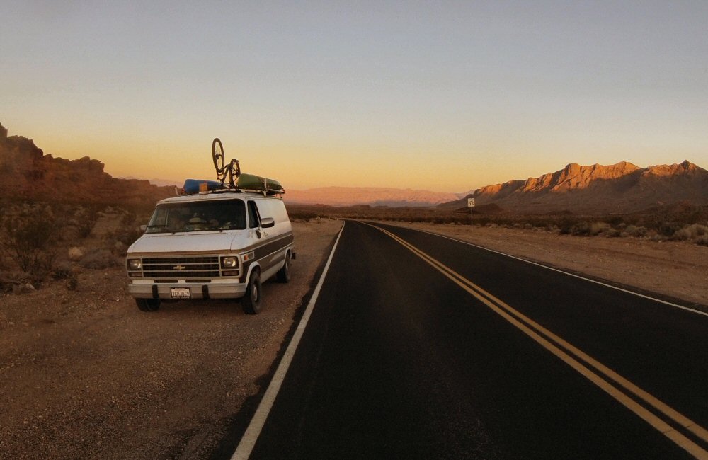
Saying goodbye to the desert, we drove the final few miles into Las Vegas, found a motel and crashed out in the cool, air conditioned rooms for the afternoon.
I’d been to Las Vegas before, so I had an idea of what to expect – but last time was for a software conference which was hosted in a fairly exclusive hotel. That time, we stayed in a budget hotel but it was out of town, so I never got to see “the strip”. This time, our motel was only a couple of blocks away. Time to party! Actually we’re not the kind of people that would come here by choice, but as we’re here for J&H to fly out, we thought it would be worth spending a night in town. Las Vegas is definitely a spectacle. Bright neon lights, tacky entertainment, halls filled with gambling machines, hotels, shows, everyone here to let off steam. A complete contrast from the emptiness of the desert!
We wandered around, had a drink at a run-down “Mexican beach bar”, had an amazing dinner at a faux-Parisian street restaurant, blew away our gambling money (all 5 bucks of it) and then made our way back to base.
Tuesday 2nd
Early start for Jon and Helen – flight out was 7am so I took them to the airport a couple of blocks away and then went back to bed. Rose and I spent the rest of the morning hanging out in the motel, sorting photos and enjoying the luxury of air conditioning. Found breakfast at “Farmer Boys” (or something like that), which turned out to be yet another fast food chain, even though I thought I’d searched out an organic, healthy food place. After gobbling down a breakfast burrito, which actually turned out to be not so bad, we went directly onto find a Starbucks for coffee and internet. Normally we’d try to hunt down a nice small independent coffee shop, but I thought the chances of finding something like that in Las Vegas was pretty remote. It was getting pretty hot, so we enjoyed a couple of hours in the air conditioning, reading, writing and not doing very much – just stalling for time so as not to get into Death Valley too early in the day.
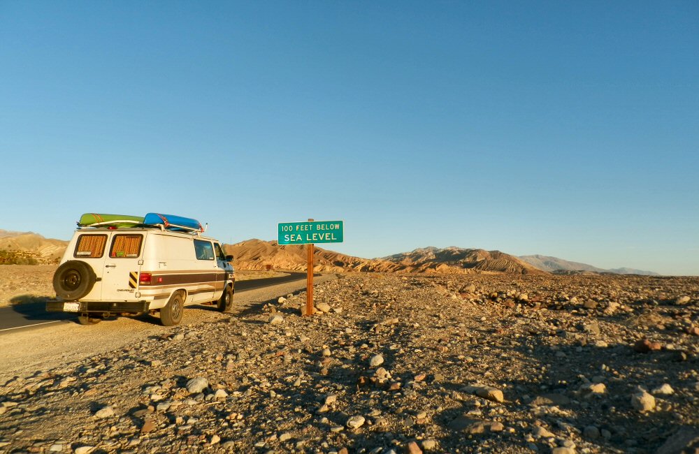
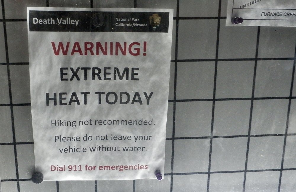
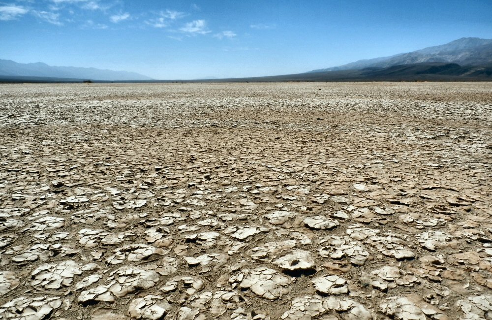
Eventually, late afternoon, it was time to get going. It’s not a long drive into Death Valley from Las Vegas, just a few hours through hot, arid desert. We arrived at the visitor centre at Furnace Creek where the temperature was 117F; over 47 centigrade, at 6pm! We made a dash up the valley to catch the sunset, and then found a campground.
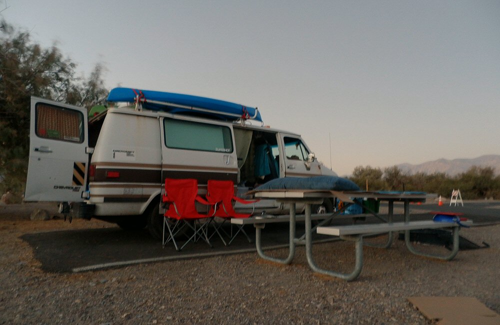
Here the seasons are back-to-front. Summer is the quiet period when most things are closed, including half the campgrounds – it’s just too hot. There was one open, just open gravel pitches and a picnic bench. Not even shade, which was surprising considering that we’d had decent [man made] shade in Utah camp sites. Maybe it’s a state thing – we’re now back in California. It didn’t cool down much, I think overnight it just about dipped below 100F.
Wednesday 3rd
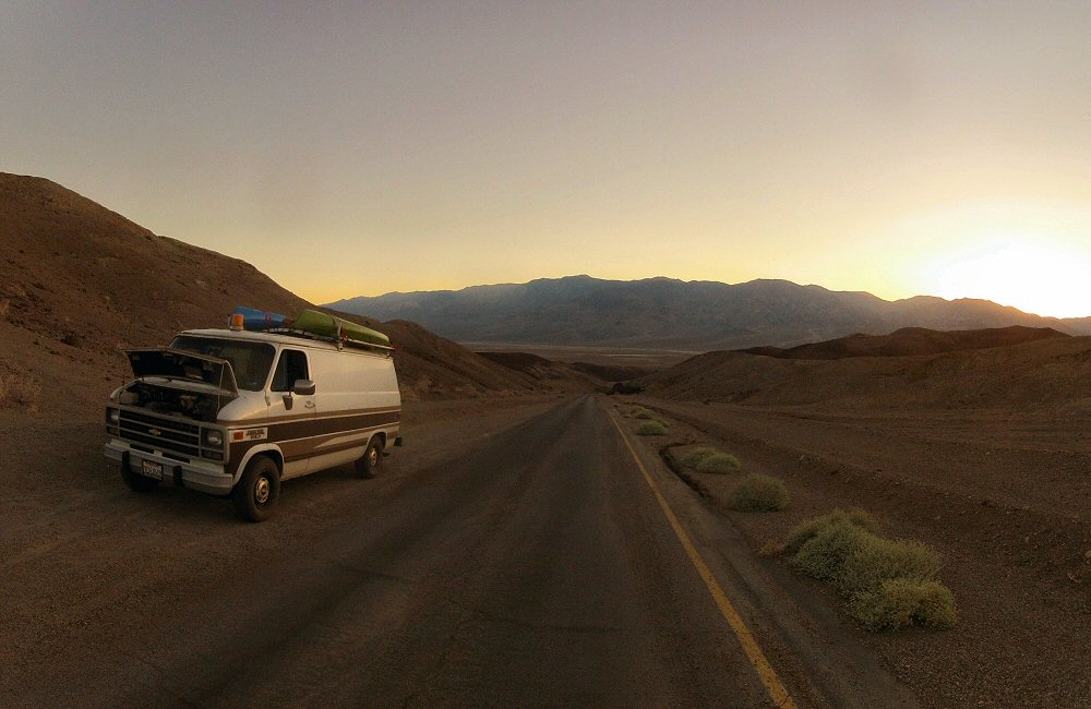
Woke up feeling surprisingly refreshed, considering I’d spent the night on the picnic table outside, in an attempt to stay in the breeze and keep cool. “Breeze” makes you think of a cool, gentle wind – but here it’s more like standing in front of the door of an open furnace. In fact the campsite is called Furnace Creek… but I think that might be because of the borax mining and processing that used to go on here rather than anything to do with the temperature. Camping in Death Valley in August eh. Nutters. A guy nearby started working with a chainsaw at about 5am – the coolest time of the day.
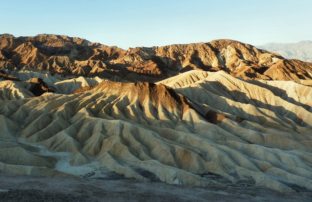
So anyway, yeah, it’s hot. We drove up to Zabriskie Point to watch the sun rise, and we’re now sitting back in camp in the shade of a tree waiting for the visitor centre to open at 9, where we’ll pick up some info, maybe a cold drink and then dash across the baking desert into the Sierra Nevada Mountains.
##
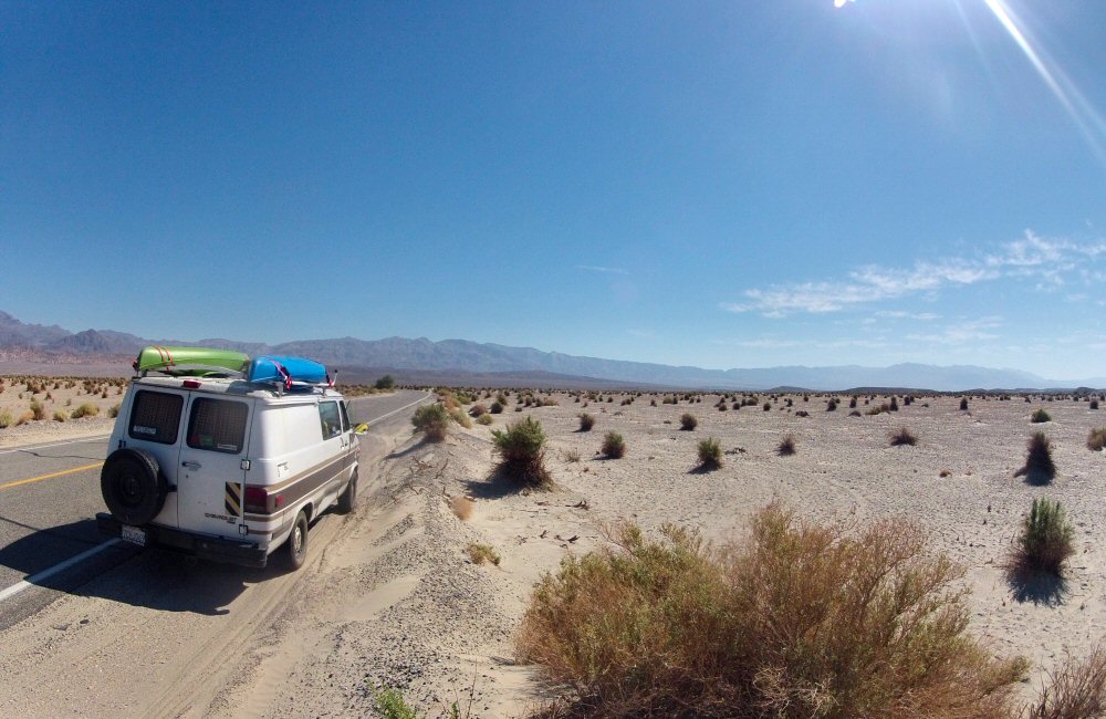
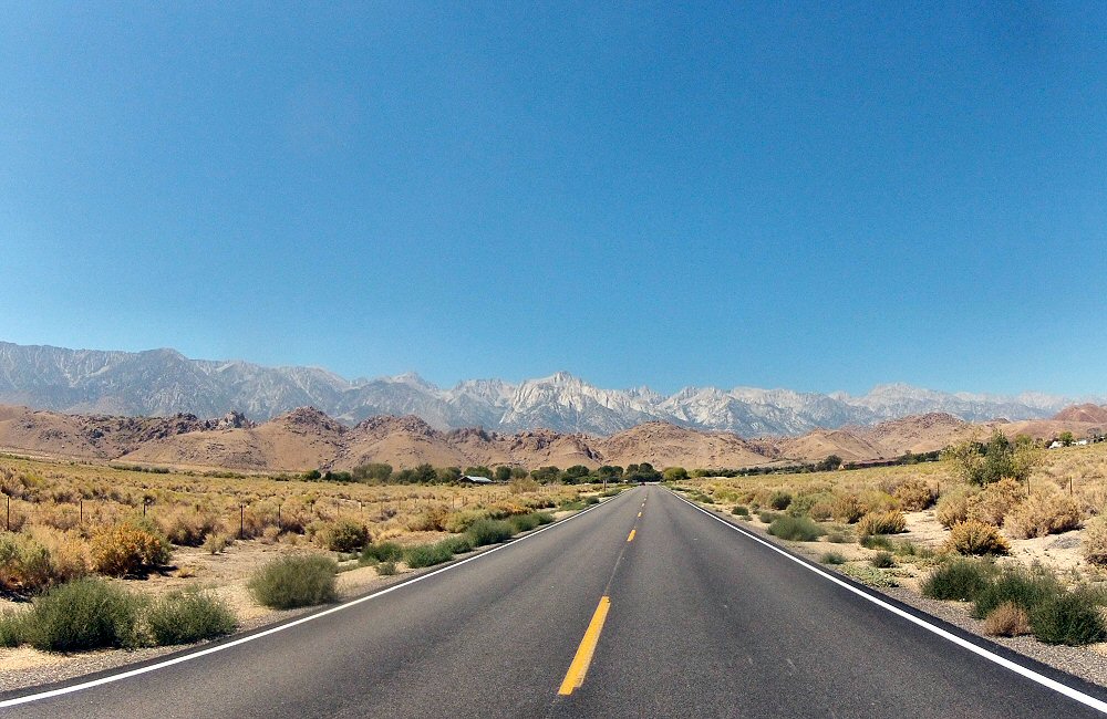
Driving up along the east side of the mountains, things are starting to looks more “Californian”. It’s hard to put my finger on it – it’s arid, like everywhere else. And mountains, sand, dust, long straight roads. I think it’s the trees – big solid looking trees, not pines, but more like a cross between oak and eucalyptus. Drove through Bishop, which is a town I’d known about as a climbing and outdoor hub ever since my days at Sheffield, where I was immersed in the climbing world. A place I’d always wanted to go to, and here we are just driving on through. Just not enough time! Maybe if we spend more time in California in the future… it’s only “just” over the mountains from San Francisco.
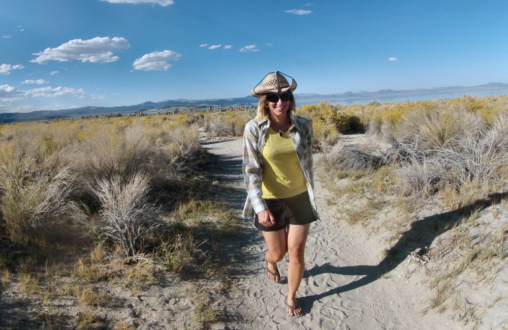
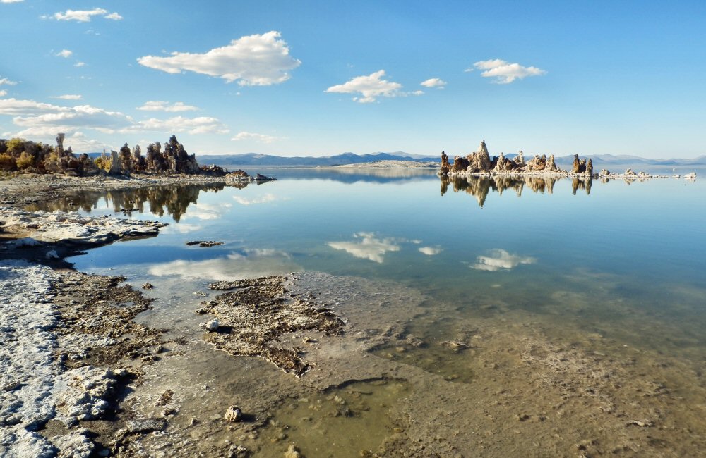
Before turning left into Yosemite and over the last range of mountains before home, we stopped off briefly at Mono Lake, an alkali lake with incredible tufa formations. Like every lake it seems, the level is really low. Only recently have local authorities recognised that they need to think about water usage to prevent these lakes from drying up completely.
Just a few miles up from Mono Lake is the Yosemite park boundary. Back in pine and rock country. Huge granite domes and cliffs. We’d never been over this side of the park before – the Tioga Pass has always been closed due to snow each time we’d been, so it was good to finally get to drive through it. Just driving through one of the most amazing National Parks in the world feels like a crime, but we’re nearly home now and having been on the road for 3 months, we can “smell the barn”. Looking forward to getting back to the boat, seeing San Francisco friends again, and having some time in one place.
[This post added later in September … I’m still catching up] Just one day left before Jon and Helen leave… they’ve been with us for 3 weeks, it’s been awesome having them over, and we’ve all managed to get on just fine – even though we’ve hardly been more than a few yards apart from each other the whole time. Spending time as a gang of four is very different from when it was just Rose and I – lots more time chatting and being sociable, but it’s meant I’m well behind on writing up our travels.
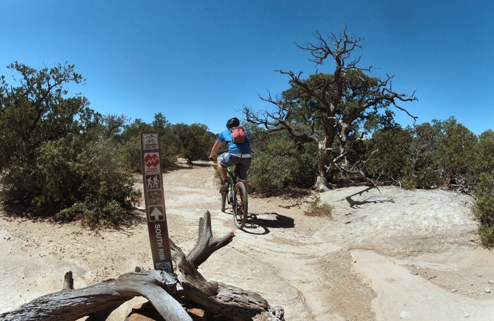
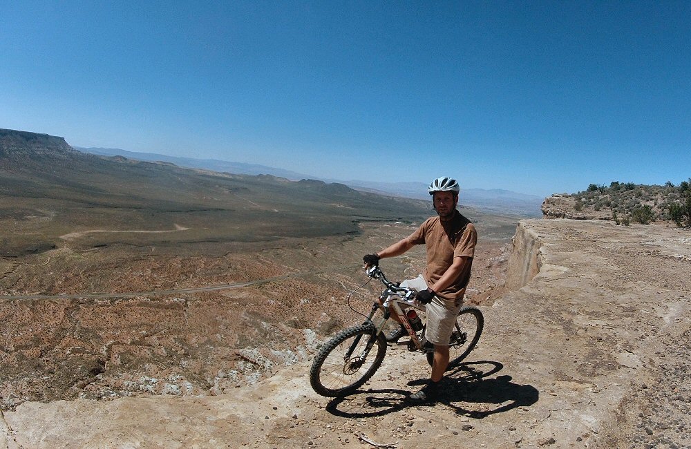
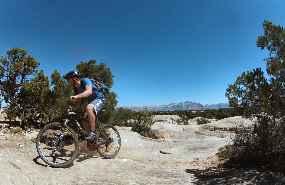
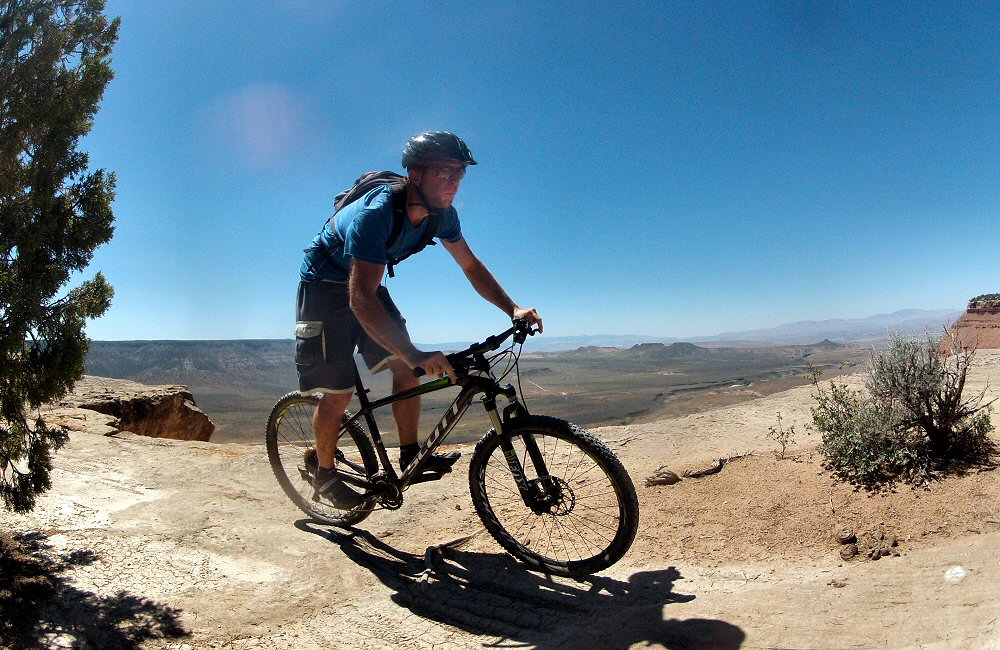
Jon and I wanted one last bike ride before they headed back, so we swung by Gooseberry Mesa to ride the classic loop around the top of the mesa (mesa is Spanish for “table” – the mesas round here are plateaus of land formed from harder rock when everything around it has been eroded away. It was the middle of the day by the time we got to the trailhead, along a few miles of bumpy dirt road, and pretty hot. But the ride was epic – yet again different scenery and a different type of riding. Some slickrock, some dusty singletrack through old gnarled Utah Juniper trees, and some donteventhinkaboutfallingoff riding along the very edge of the cliff.
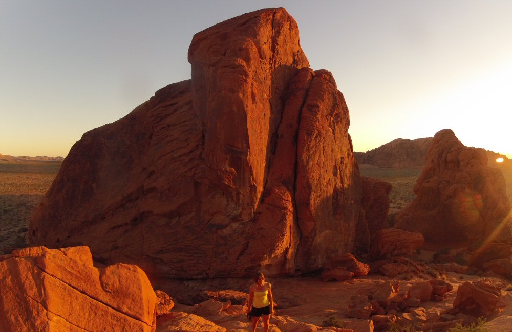
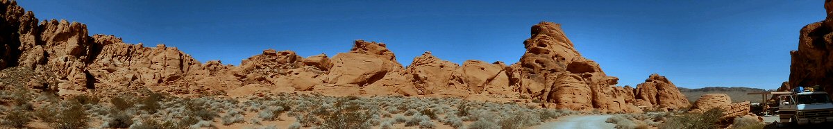
Jon and Helen had been given a tip-off about somewhere to stop in on the way to Las Vegas, a place called Valley of Fire State Park, just 50 miles from the city. It was a long, hot drive from Zion, but we managed to make a small detour to Lake Mead where we had a swim to clean off and freshen up. It’s strange coming across huge expanses of fresh water in what’s otherwise barren, arid desert – this place is “the largest reservoir in the United States by maximum water capacity” – though at the moment it looks pretty low.
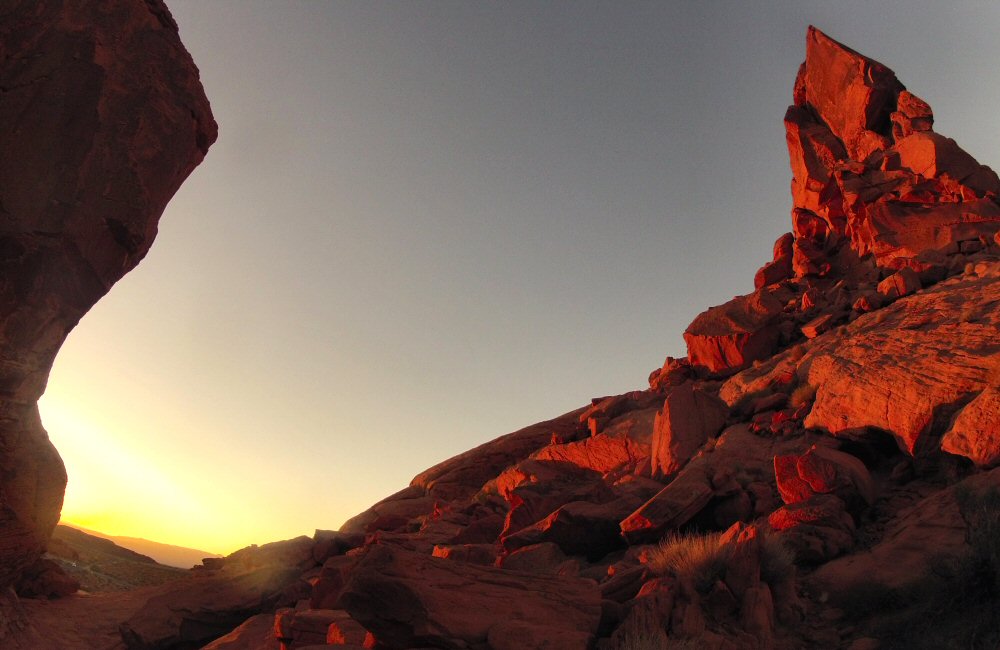
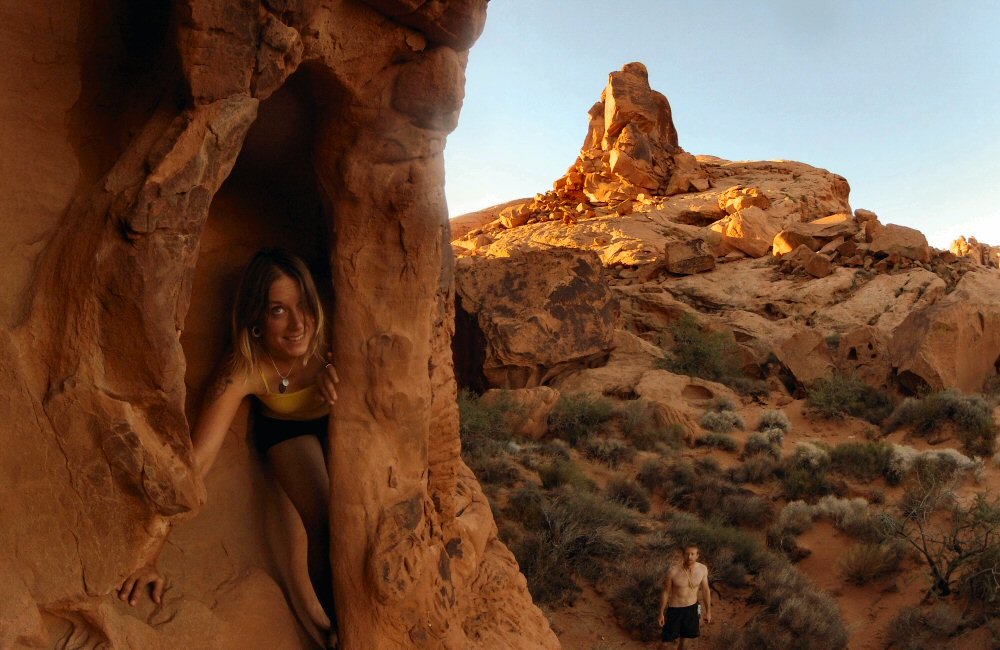
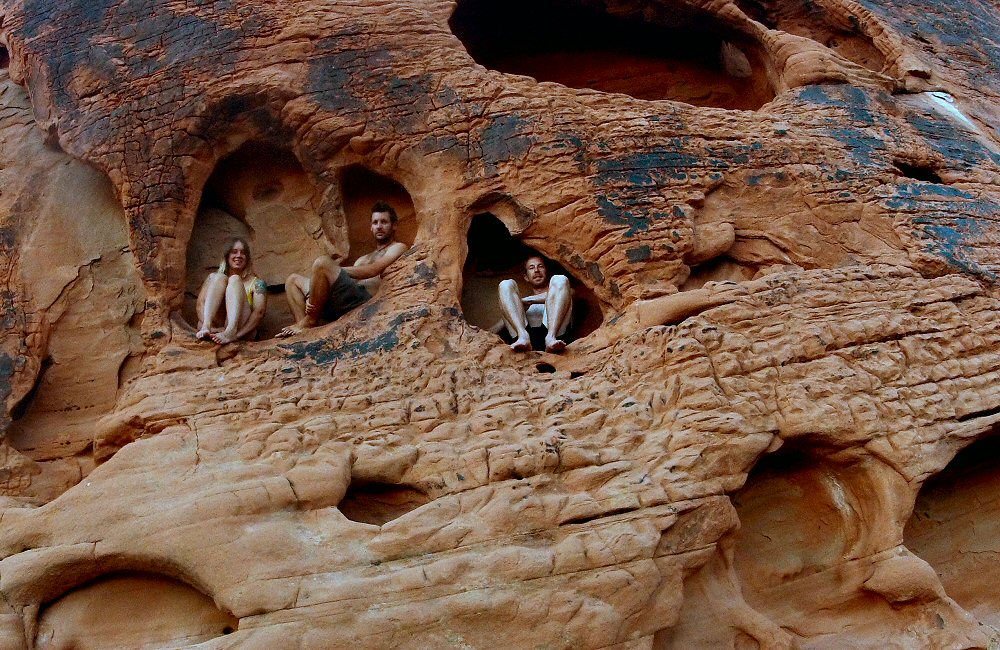
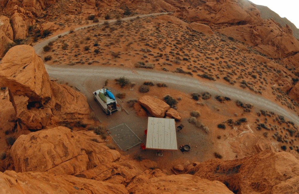
Valley of Fire State Park was stunning – outcrops of red rock poking up through the valley floor and catching the last light as the sun set. We found a campsite tucked right in under the rocks, and there was only one other group there! Such a contrast from Zion. Just goes to show how you don’t need to follow the crowds, and how you can find the best spots off the beaten track. For me, the emptiness and silence makes this kind of place much more special. In some ways it’s sad that more people don’t come out and enjoy it, yet if they did, it wouldn’t be quiet, empty and beautiful. We scrambled up the boulders behind the camp with a beer to watch the sunset, and soak up the hot desert evening.
Sometimes it feels like we’re just trucking around ticking off the national parks, skipping things in between, missing out on wilderness and hidden gems, as though we were on a short package tour. Today we went straight from Bryce Canyon to Zion Canyon National Park – another crowded spot, particularly as it’s the long Labor Day weekend here in the US. But we are in Utah, where 65% of the state is federally owned land, much of which is national park. And the parks here really are different from each other, even though it’s almost all rock of some sort or another. I have managed to learn a bit about the history of the area, about the Indian tribes and early settlers. There’s not a huge amount of information about though; the exhibits in the visitor centres go a small way but are naturally conservative, having to avoid offending anyone. I’ve a good list of recommended books to stock up the boat library, and now that we’ve seen a bunch of places they should make good reading over the winter.
Zion Canyon appears out of nowhere, after a couple of hours’ mediocre drive from Bryce (mediocre compared to the rest of Utah at least). The park road starts winding through tight, steep gorges flanked by monster slabs of pale sandstone, the surface of the stone all creased up like an old mountain man’s face. Then you’re plunged into a dark, long, twisting tunnel, bored through solid rock. Every few hundred yards there’s a small viewing hole, where you can see glimpses of a vast empty space, and lots of red rock. After a mile or so you burst out into the sunlight, onto the side of a monster canyon, the road dropping away to the right down tight switchbacks. The view really is impressive – made better by the fact that you don’t know what’s coming until it’s suddenly there in all its massiveness – and this isn’t even the main canyon. Definitely the best way to enter this park.
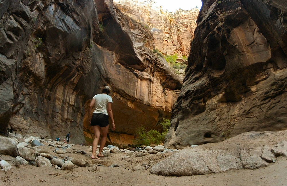
Saturday on a bank holiday weekend was always going to be busy, so we were pushing our luck a bit trying to find a free camp spot. Luckily the first place we tried, just outside the park on the western side in Springdale, had a cancellation just as we were about to leave. We set up camp, then walked into the park via a coffee stop. You can’t actually drive up into Zion Canyon itself – back in 1997 the park decided that lots of car traffic was going to kill the experience, so they introduced a free shuttle service to take visitors to all the spots in the park. Getting on the bus makes it feel a bit like Disneyland or Alton Towers, but there’s a good commentary, and not driving meant I could soak it all in. We got off and headed out for a hike to Emerald Pools, thinking that getting off the main track would provide some solitude from the crowds. Nope, just as busy out on the trails. And the pools were more like disappointing puddles, hardly shimmering emerald lakes. Maybe a bit of the scenery desensitisation creeping into our attitudes again here, exaggerated by the hordes of people… While we were in the valley we decided to wander up to the most well-known hike in the area – The Narrows – which runs along and through the river at the bottom of a tight slot canyon for perhaps 20 miles. Again, SO many people! Looks like this is definitely the Thing To Do when you come to this park. A local business was doing well renting out river shoes and walking sticks… we explored the first mile or two in bare feet, and then called it a day.
Rose exploring up The Narrows, before it got narrow
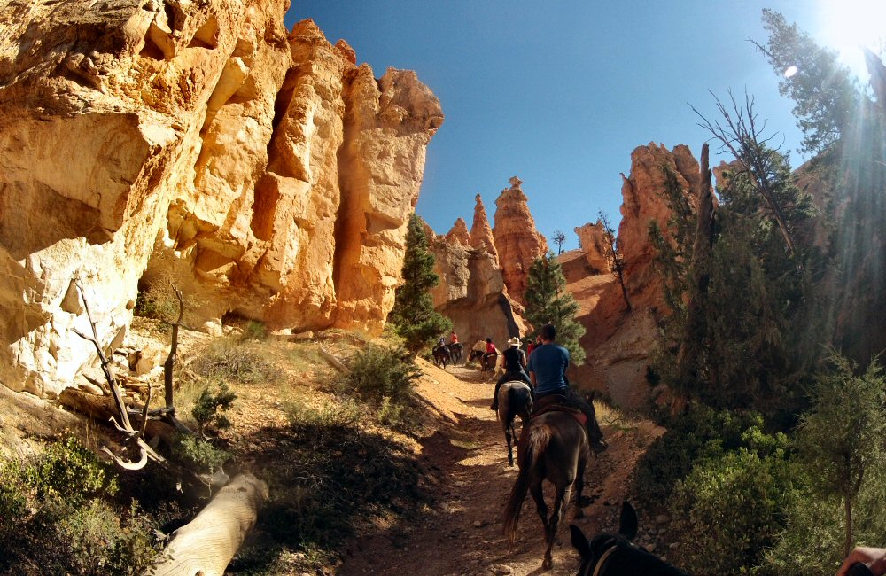
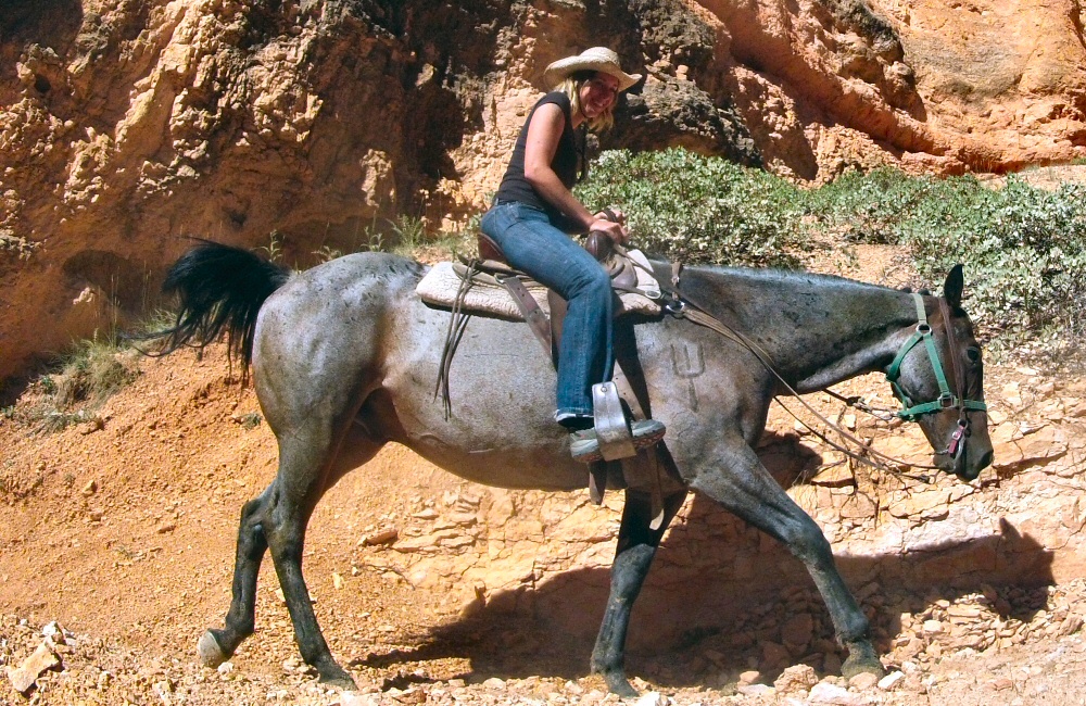
Horse riding into the depths of the “canyon” this morning. I think the last time I rode a horse was when I was about seven! This little trip was easy as we were all following-the-leader along a single file trail, and the horses were all on autopilot. I’ve always found horse riding a little strange, mainly because it’s been an activity done in the English countryside where I’d always rather be mountain biking or walking – so not something I’d ever pay to do as a “punter”. Here, too, it felt a bit strange to be a “tourist” on a packaged trip – but it did make me think it would be interesting to do a multi-day backcountry trip where having horses meant you could carry a lot more than if you were just backpacking. Maybe somewhere in South America, into the Andes. With llamas.
To get to Zion early enough to find a camp spot, we decided to spend a second night in Bryce and leave sharpish in the morning. Even though we’d not been into the southern end of the park, we all felt a bit overwhelmed by loads of people, and wanted some down-time not driving around or sightseeing, so we spent the rest of the day relaxing in camp, then headed into Bryce Canyon City for a cheap, quick and dirty meal at a diner, and a wander around the rock shop.
Rock shops eh. These places are crazy – selling every kind of rock you can imagine, in all kinds of shapes and sizes. Some are “raw” that you get cut open for you once you’ve bought them, a bit like a scratch card – not knowing what’s going to be inside. What do you do with a 10 kilo lump of rock? Some of them are decorative and I could see them perhaps being a tourist’s souvenir, but many are really just lumps of rock. If you’re a rock collector, would you buy your collection bit by bit in places like this? Maybe, since it’s so arid round here, people don’t have plant gardens, they just have rock gardens? So a rock shop is a bit like a garden centre. In amongst all the glitter there were some pretty cool sandblasted shapes made from an Arizona sandstone, but I’ve never really been into rock buying so they stayed on the shelf.
Another day of driving – though not as much as we were doing when it was just the two of us, where we were regularly doing well over a hundred miles a day. Today, it’s about 90 miles from our camp to Bryce Canyon National Park, through the Grand Staircase Escalante National Monument.
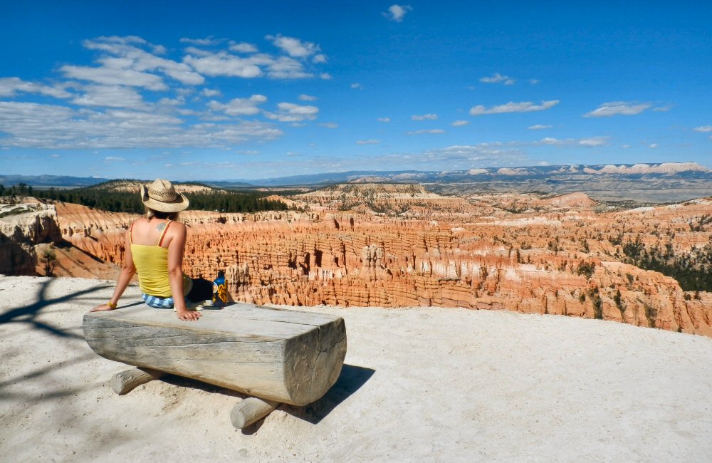
Arrived at Bryce in time to get a spot in one of the park first-come first-served campsites, and then walked the Rim Trail along the edge of the canyon. Bryce Canyon isn’t technically a canyon – it’s the edge of a plateau, where the underlying sandstone and mudstone is eroding away to leave an impressive vista of gullies, hoodoos and towers. As expected, even a couple of days before the weekend, it’s pretty busy. And so many Germans! It seems like 9 out of 10 parties are German, maybe their school holidays haven’t finished yet? Since we’ve not really been around much humanity, we find ourselves watching the people more than taking in the scenery.
For some reason I’m a little underwhelmed by Bryce Canyon. Maybe it’s because we’ve been immersed in such endless mind-blowing landscapes for so many days that I’ve reached saturation point. I remember driving past some pretty small hoodoos in Canada and being impressed. Now I wouldn’t give them a second glance – that’s the danger of new experiences and broadening horizons – it has the potential to reduce the impact of everything else…
Bryce is one of the “Dark Sky Parks” – far from any light or air pollution, so you can see more than you would be able to in other parts of the USA. I’m no stranger to dark skies – growing up in Africa and spending nights at sea – but I still gaze up into the huge, starry night filled with awe. I’m trying to learn more about the constellations, but, like other learning, unless you do it frequently, it’s easy to forget things. But this trip we’ve had clear, dark skies for many nights in a row, so I think some of it is sticking. Of course what you can see changes on the time of the year and time of the night, too. I learnt that Orion was a cocky old chap, boasting to the goddess Artemis that he could kill every beast on the earth. Artemis was a guardian of all creatures and took offence to this, so she sent a scorpion to kill Orion. You can never see them both in the sky at the same time – every winter Orion hunts in the sky, but he flees under the horizon each summer when Scorpio comes along. At the moment Scorpio is up, and the new moon is just setting with the sun, so the sky is dark and it’s full of stars.
The park runs an astronomy evening a couple of times a week and fortunately one was running this evening – starting with a talk given by a very enthusiastic ranger about how the night sky was interpreted by the Native Indians. The Great Bear (Big Dipper) is still a bear to the Mik-Mak Indians of north eastern Canada, but instead of the trailing stars being the bear’s tail, the bear is much smaller and the following stars are hunters; Robin, Chickadee and some other tag-alongs. The story goes on to say how the birds chase the bear around and around the sky as the night and seasons progress, and then when the bear finally drops below the horizon, Robin has wrestled it to the ground and is all covered in blood – hence the Robin’s red breast. I think the bloody murder happens in autumn, and it explains why the maple tree goes red at that time of year. That’s the quick version anyway.
After the presentation we all trooped out to a set of telescopes lined up in a dark parking lot behind the visitor centre, where we got a quick peek at Saturn, a globular cluster, a gas cloud and an exploding supernova. I’m looking forward to nights on the boat where the sky really is huge – a whole hemisphere where you can see stars rise and set without anything in the way.
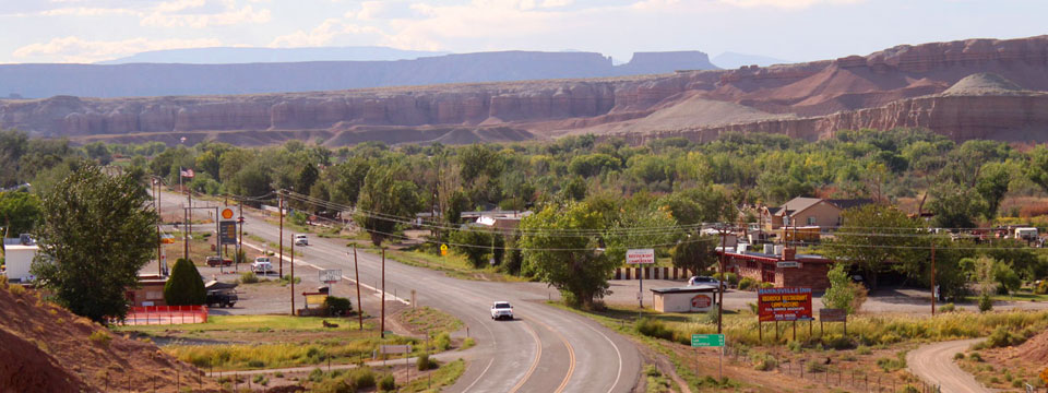
It’s quick and easy, but breakfast in camp every day doesn’t really give us the experience of seeing local places. So today we stopped at Duke’s Slickrock Grill in the small town of Hanksville, deep in the middle of Utah for a classic American breakfast – pancakes, eggs, maple syrup … the works.
Hanksville and Duke’s Slickrock Grill (photo from Google)
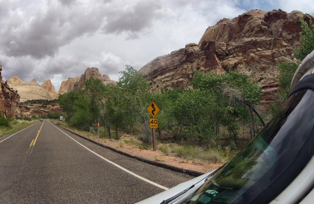
Not much further down the road is Capitol Reef National Park – running north/south along a geological formation called the “waterpocket fold”. More impressive from the air than from the road, it’s still pretty awesome. So many different colours of rock and sand in one place.
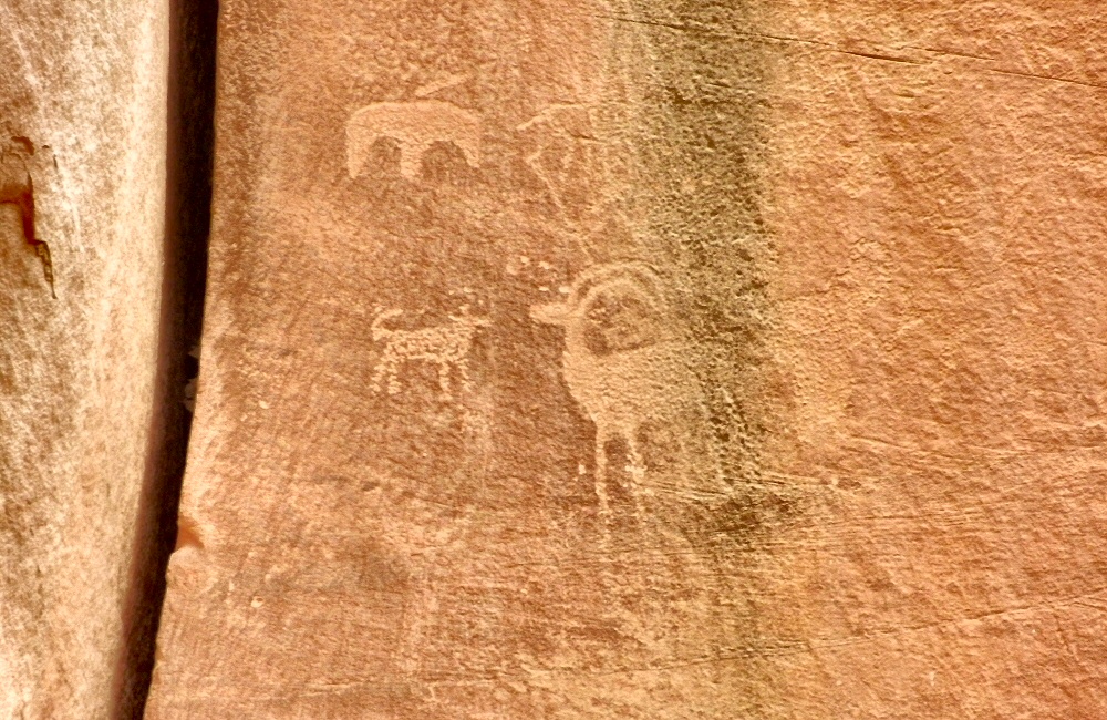
Dramatic driving, Fruita, Capitol Reef NPPetroglyphs in the Fruita area of Capitol Reef
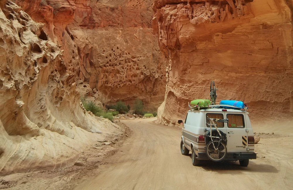
We headed down the short 20 mile scenic drive which dead-ends at a dirt track in Capitol Gorge (pic by Jon).
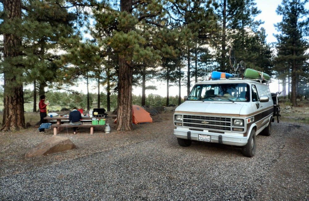
Back on the main road just outside the park, we grabbed some lunch and did a round of laundry in Torrey, before heading south and up into the hills. Trees! We haven’t seen trees for days… “Scenic Highway 12” winds along through aspen and pine forests, ending up in the Grand Staircase Escalante National Monument – a huge expanse of rock, canyons and more Utah epic-ness – but that’s tomorrow’s drive. We pitched camp in the Dixie National Forest, Singletree campground, at about 9000 feet, and got down to “craft night”. Rose had found some instructions for making some dream catchers, and we’d bought thread, wire and beads in Denver.
As the sun went down, so did the temperature. We talked late into the night, huddled round the camp fire under a cold, clear, starry sky, dream catchers hanging in the trees, protecting us from those nasty dreams…
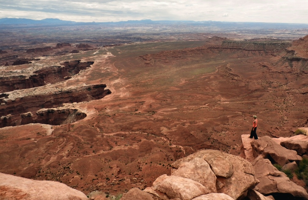
Canyonlands. Wow. I’m running out of ways to describe yet more amazing scenery. The view stretches for miles and miles and miles – from the overlook on the end of the mesa above the confluence of the Green River and the Colorado River. Each geological layer is clearly visible, and a 100 mile 4WD track called white rim trail runs all the way around the park – it looks tempting – the van can handle a lot of off road stuff, but we’ve not got the 3 days it would take, and we probably would get stuck. We’re not set up for real off roading. A trip to save for the bucket list.
Starting to feel a little jaded by endless expanses of rock and huge views, we didn’t spend long in the park … and with a fair bit of distance to go to the next stop, we headed off early afternoon. After a long drive around the top of the Canyonlands, we turned off the desolate, empty highway to Goblin Sate Park just in time to avoid a monster thunderstorm. Pulled over on the side of the road, we watched the lightning sizzling into the ground no more than a mile away.
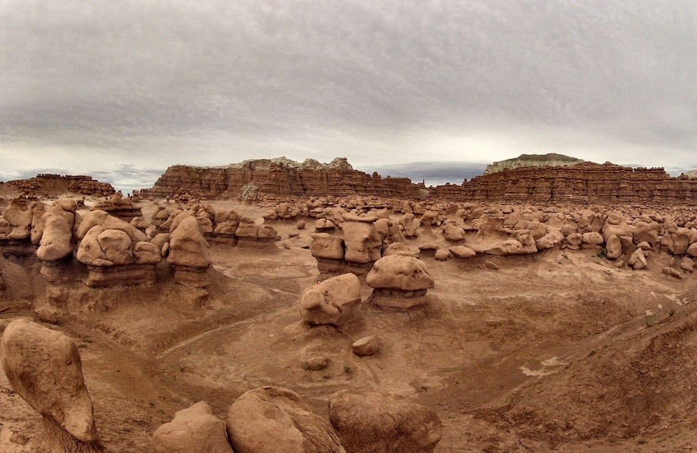
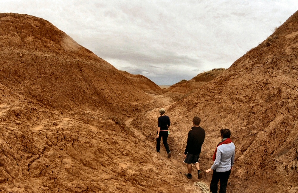
Goblin Valley; hat a crazy place. Day after day we’re coming across rock and sand formations like nothing we’ve ever seen before – this place is definitely the most bizarre yet. The soft sandstone has eroded into lumps, pillars and hoodoos that really do look like goblins. When the rain stopped, we walked a mile and a half from camp along a muddy ravine to the Goblin Valley, where we spent a couple of hours exploring the weird landscape.
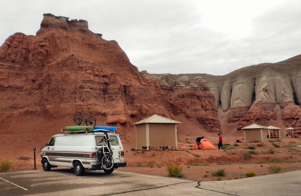
This campground has a little cabin for each site – protection from both sun and rain. More RVs than tents, which meant people with noisy generators, including our neighbours who spent the evening watching a movie with theirs running until late in the night. Still a pretty awesome site, surrounded by crumbling sandstone cliffs and buttresses, a bit like being in a huge inside-out gothic cathedral.
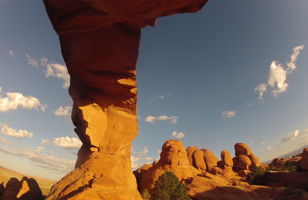
Excited to check out the rocks in the dawn light, I got up early and explored while others slept. The sandstone is perfect for scrambling around on – in bare feet it’s got almost limitless friction, and you can get up high onto outcrops and into arches all over the place.
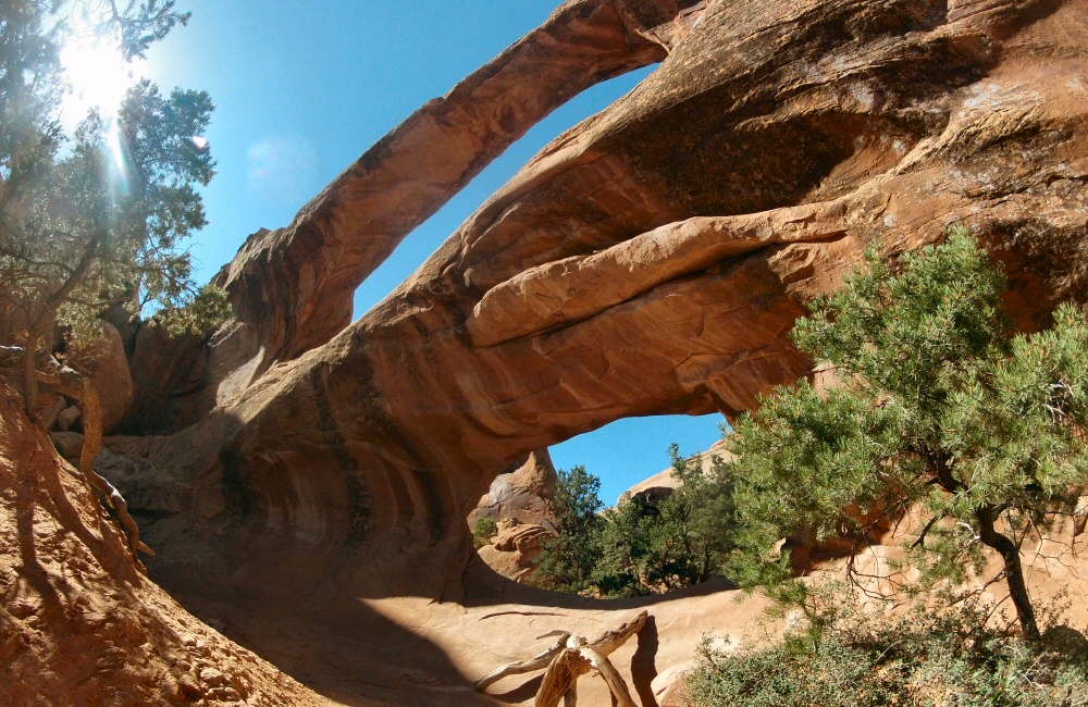
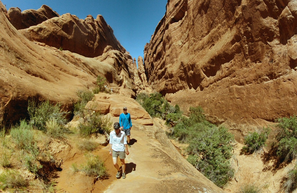
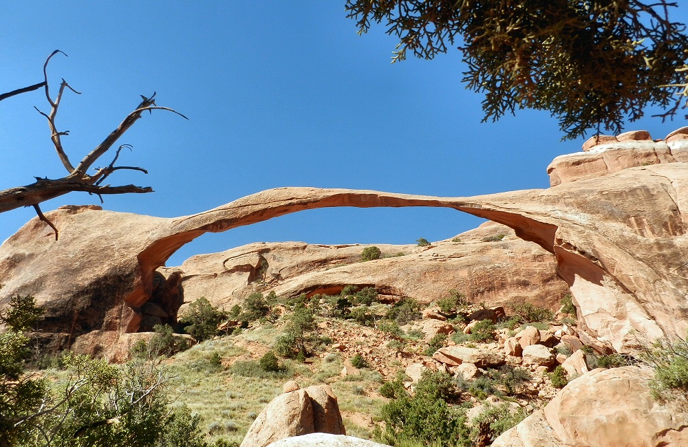
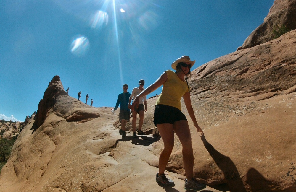
Before it got too hot, we all walked the Devils Garden loop – a 6 mile hike/scramble through yet more mind blowing scenery just to the north of the campground. I was surprised at how technical and sometimes exposed the trail was. Normally Americans put barriers and signs up all over the place, but out here it’s just a few cairns marking the trail along thin arêtes, down steep sandstone faces and along precipitous edges.
Everyone has to come here at some point in their life. It’s incredible.
Starving after our expedition, we rustled up a gourmet egg muffin lunch at the picnic site, trying to tuck under the shade of a tree in the baking heat. Then back into Moab for fuel, and onwards to Canyonlands!
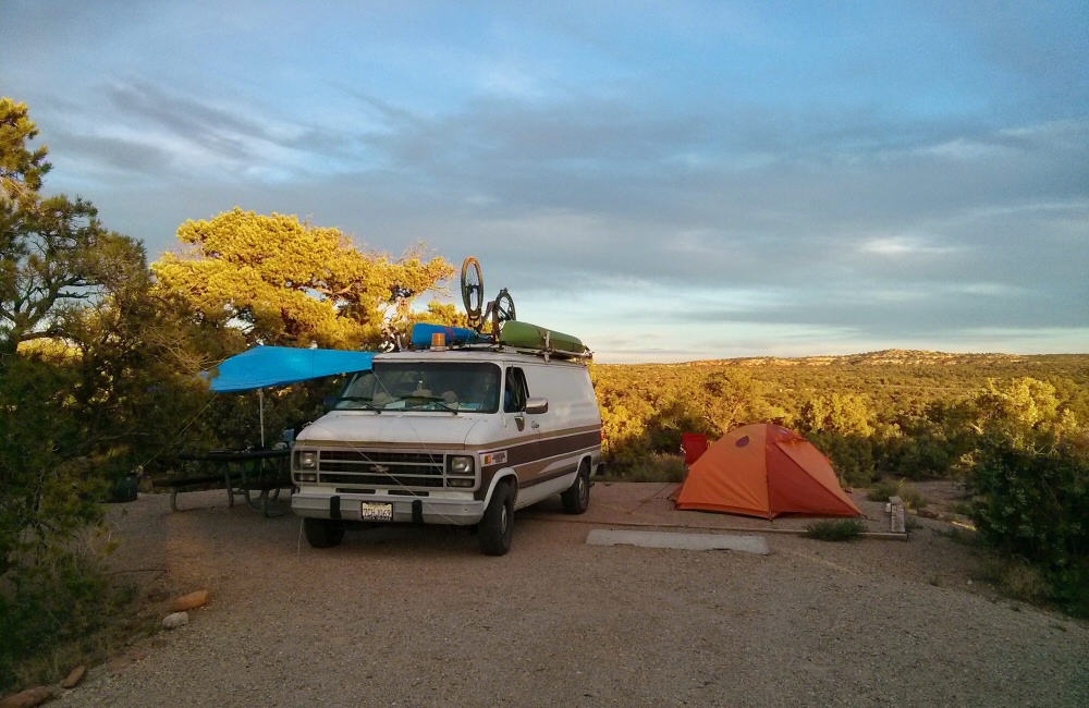
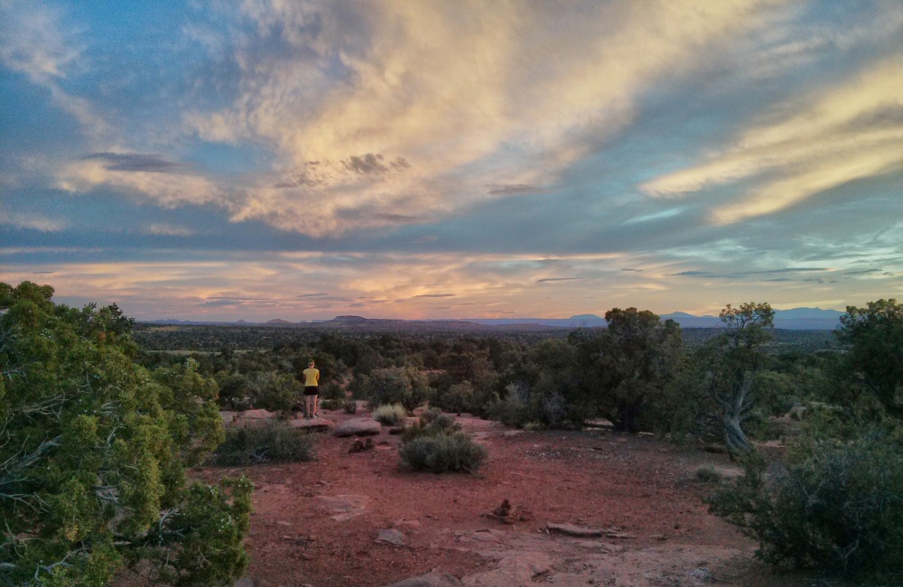
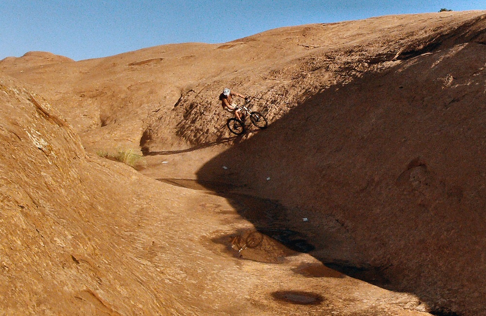
We found a peaceful camp spot at Horsethief campground, just before the entrance to the park, set up the tarp as an awning, chilled out for the afternoon and then wandered off into the desert for an incredible sunset. A couple of photos from Jon:
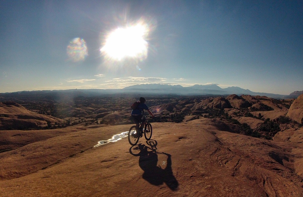
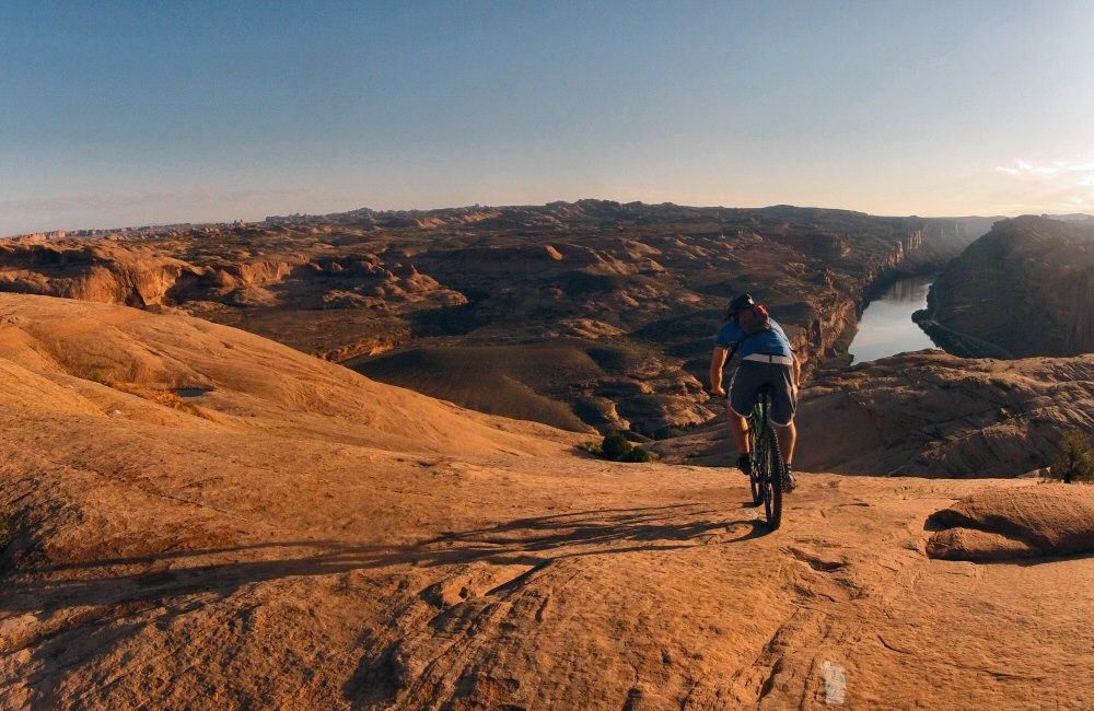
Jon and I got up just after dawn, to ride the famous Slickrock Trail before the sun got too hot. Though it wasn’t our first experience on slickrock – that was last night – it was an awesome loop, 10 or so miles over grippy, rolling rock, following the painted white dashes. The views over the Colorado River were amazing in the early light. By the time we got back to the van it was scorchio-hot, I wouldn’t want to do this in the middle of the day!
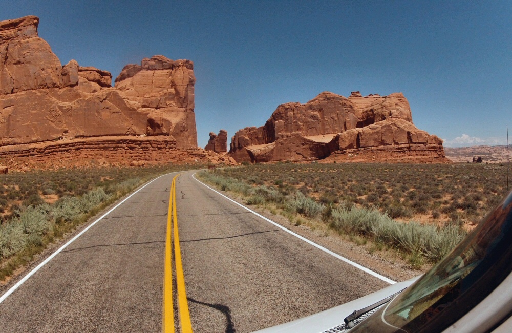
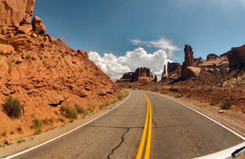
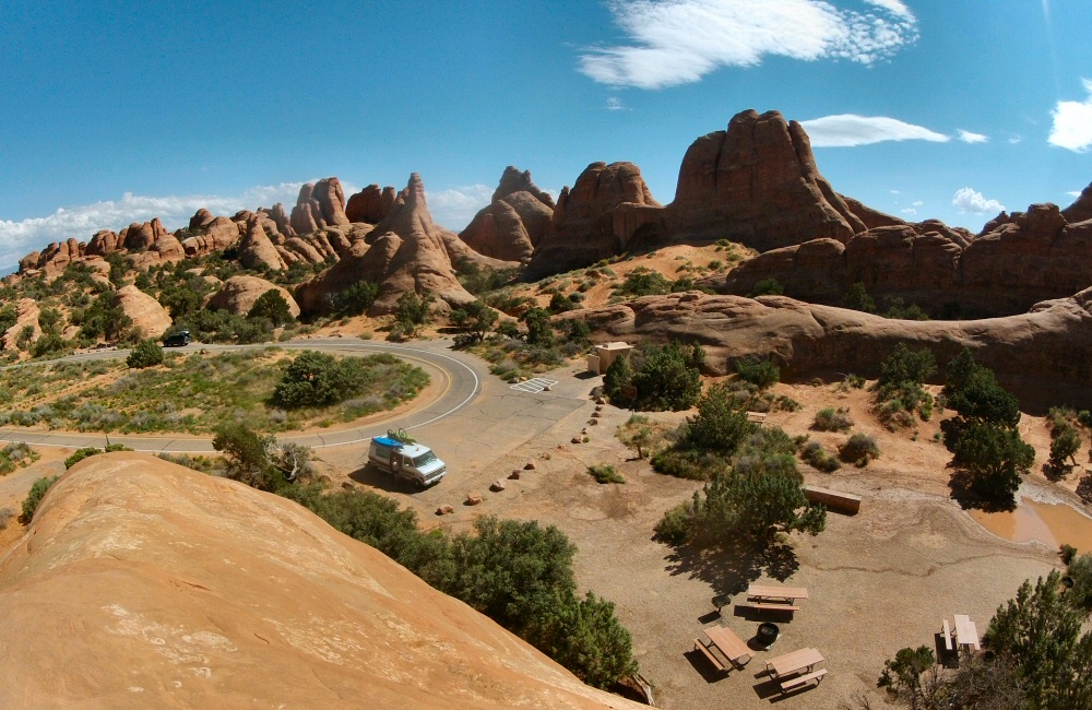
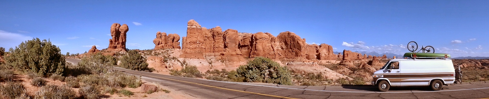
We’d run out of food again, so we stocked up in the supermarket. We can fit about 3 days’ worth of fresh food in the fridge, after which we have a couple of meals of non-perishables, and then need to find a shop again. We’re eating out now and then, but generally cooking in camp. Heading north out of Moab we drove into Arches National Park, only a few miles out of town. The plan was to head straight to campsite which was shown as being full, but in the past we’ve had success finding a space where someone had cancelled, or the rangers hadn’t quite got things right. This time it really was full. It’s a small site and all the pitches are reservable, and it supposedly fills up months in advance. But Rose chatted up the camp host and he let us stay in the group area – result!
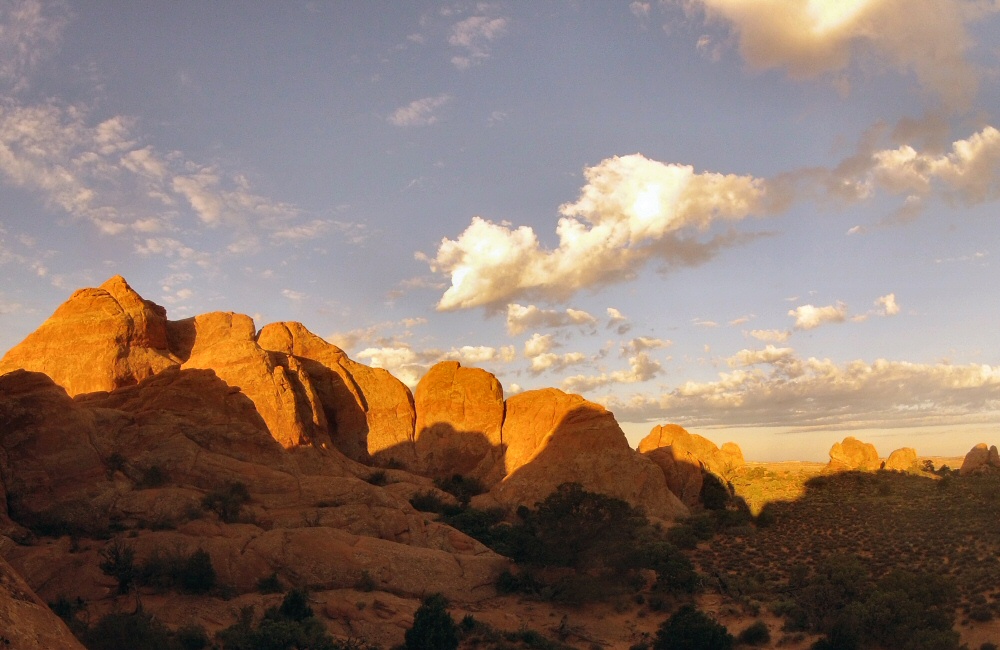
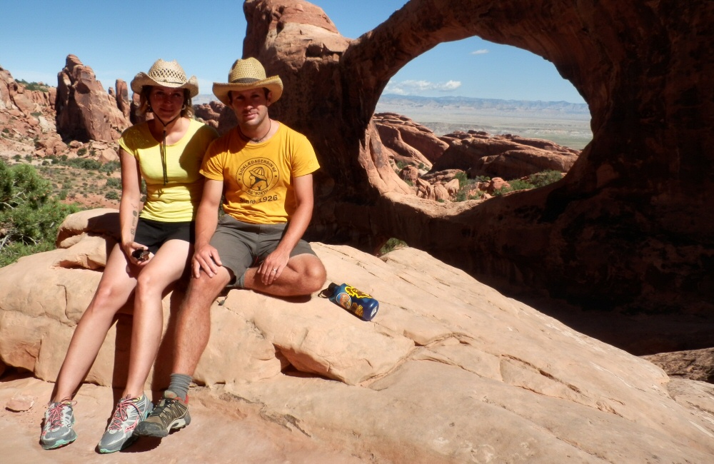
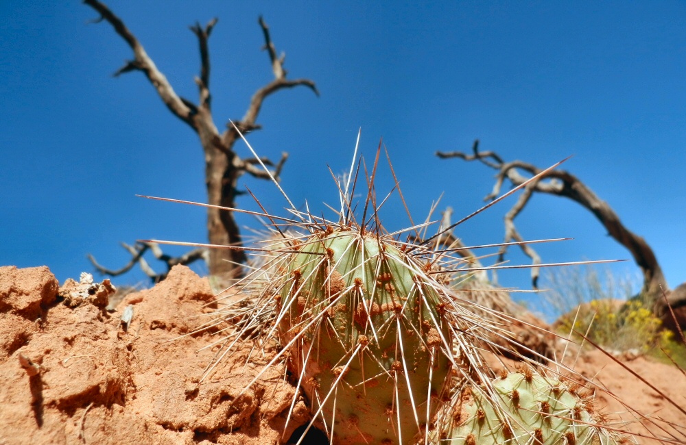
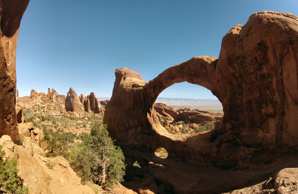
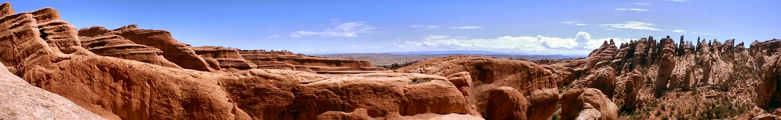
The arches park is stunning. Driving in from the visitor centre you climb a steep, twisty road between huge red walls of rock, overlooking the Moab geological fault which created the valley below. Even though the whole town is surrounded by rock, cliffs and desert, it still feels like you’re entering a different place. The ochre coloured walls are so steep, so big and such a strong colour. Amazing shapes everywhere – not just arches. After a while you think you’re getting desensitised to incredible scenery, but then something comes along that sets the barrier even higher – the Arches National Park is one of these places. We explored a few spots, took a bunch of pictures and soaked it all up.
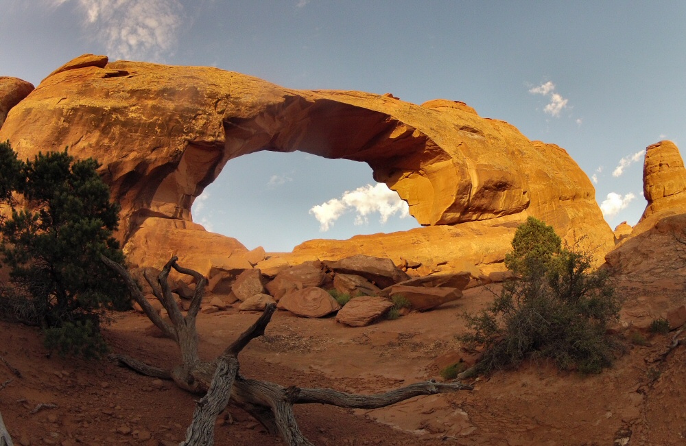
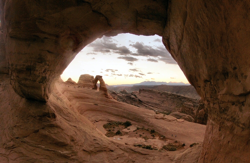
The classic sunset Thing To Do is to hike up to Delicate Arch, Utah’s state symbol, which catches the setting sun. It’s a mile or so away from the parking lot, but even though it’s a strenuous walk there were crowds of people up there waiting to get their own classic photo. It’s an impressive amphitheatre of rock, with the arch sitting on the back rim. Mr Sun wasn’t playing ball tonight though, and tucked behind a big bank of storm cloud early in the evening, so no glowing gold sunset for anyone.
Back at camp, it got really windy which meant no camp fire, but on the plus side also meant no mosquitoes. The sky cleared up to reveal gazillions of stars. I love the night sky in the desert – usually with no trees around you get a good view of the whole hemisphere – and you’re miles away from any bright city lights. We’ve not had a moon for the past couple of weeks, so the night skies have been sensational.