Landfall Tuamotus

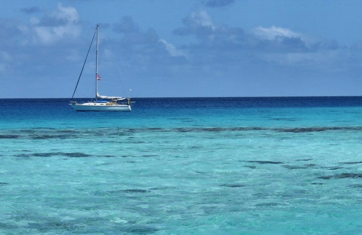
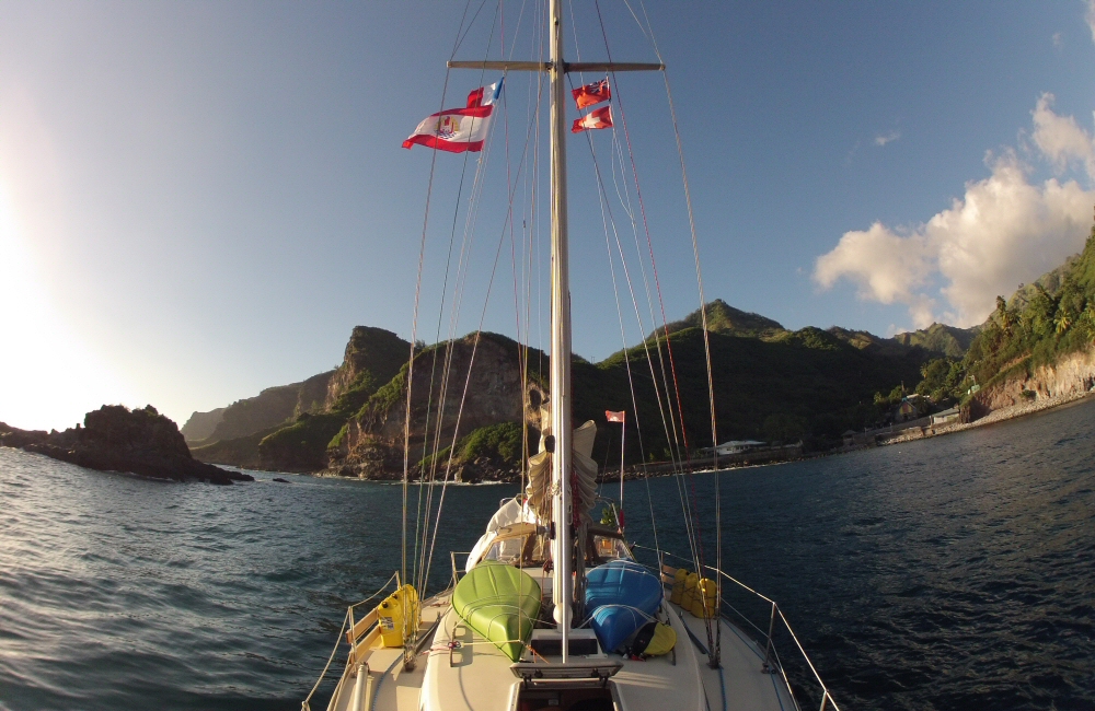
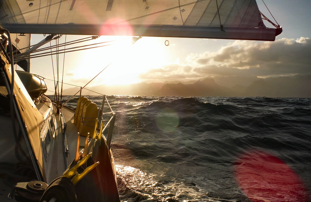
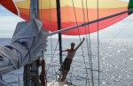
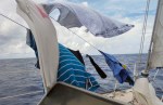
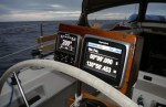
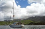
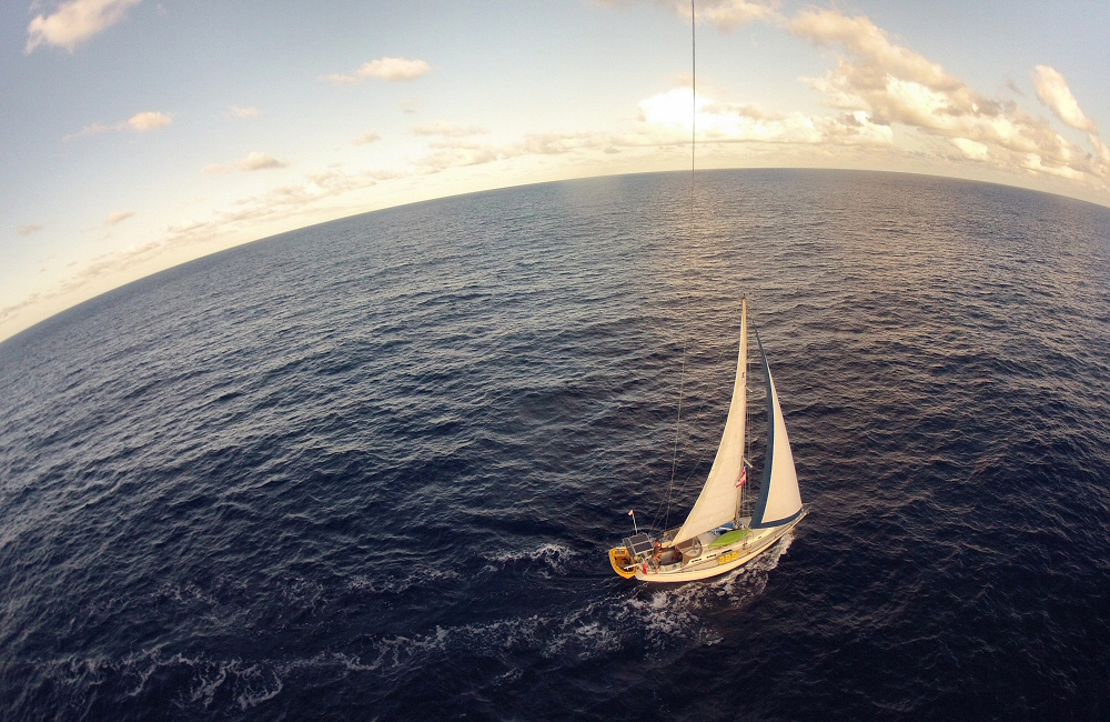
Up until last night, the passage from the Marquesas to the Tuamotus was one of the easiest, most perfect trade wind sails I’ve ever done. 3 days of non stop 20 knot winds on the beam with almost no swell; Rafiki was cruising along in the high sixes under double reefed main and full jib, very comfortably. We just passed the time reading, sleeping, watching the sea go by, watching the sky … it’s amazing how days disappear.

Tuamotus here we come 2015 04 13 1800 Cirrus at dusk

2015 04 15 0700 Dawn clouds 2015 04 14 1900 Evening clouds

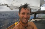
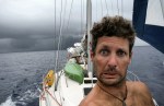
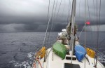
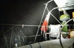
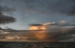
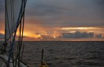
Then in the evening, a thicker band of clouds built on the southern horizon, just where we were heading. The night ended up being dark, wet and squally. New moon is in a couple of days so no light from Mr Blue Cheese, and thick clouds hid the usual canopy of stars and Milky Way. Wind shifting all over the place, and varying from nothing to 35 knots, so we were all kept busy on our watches. I’m always the standby guy for the others when they are on watch, so I didn’t get a lot of sleep.

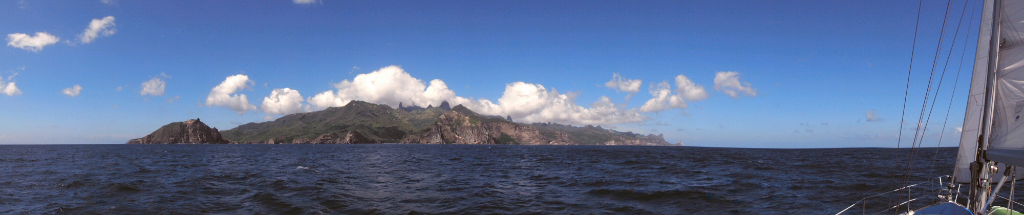
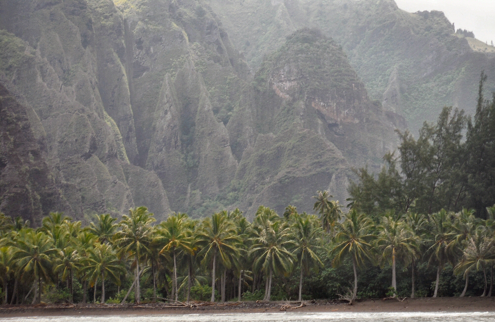
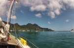
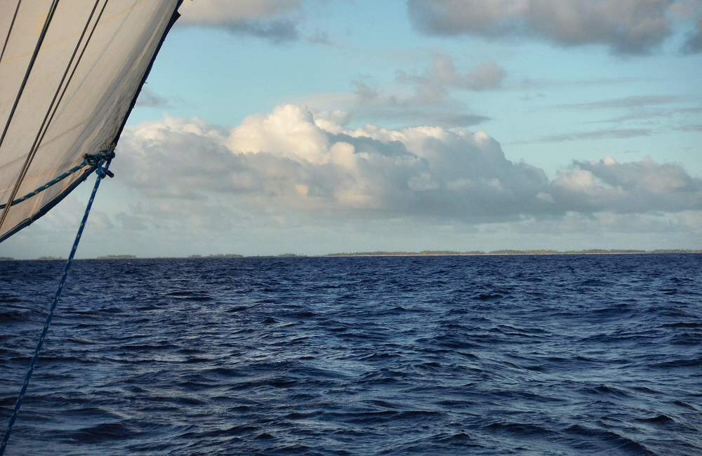
Dawn at 0530 brought a treat, as we left the darkness of the night behind us … land! At first it just looked like regular waves do on the horizon – lumps that come and go – but these lumps weren’t moving. Low and subtle, but definitely land. It’s the atoll of Makemo, a thin strip of land surrounding a lagoon – our first stop in the Tuamotu archipelago. 40 miles long and about 15 miles wide, the strip of land rarely more than a few hundred metres across, and only going partially around the lagoon. It couldn’t be more of a contrast from the towering peaks of the Marquesas; the atolls are just sand and a few coconut trees.

2015 04 16 0500 Cloudy dawn 2015 04 16 0700 Landfall Tuamotus

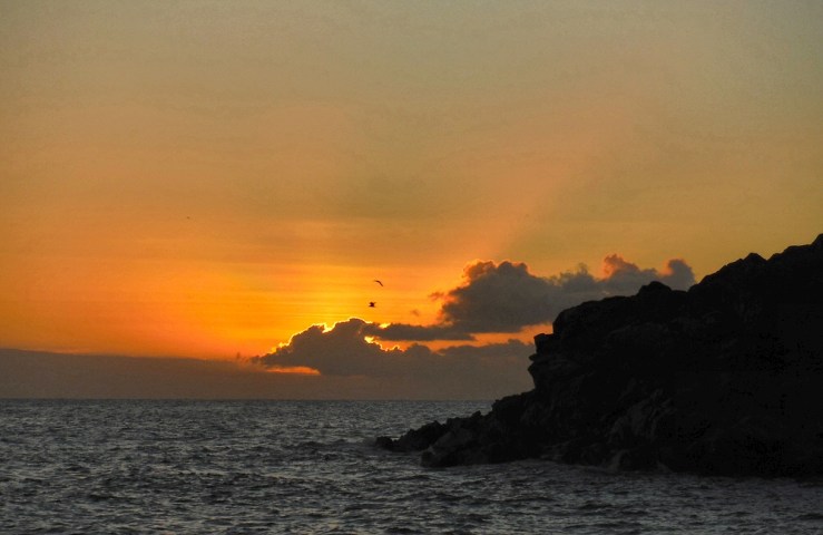
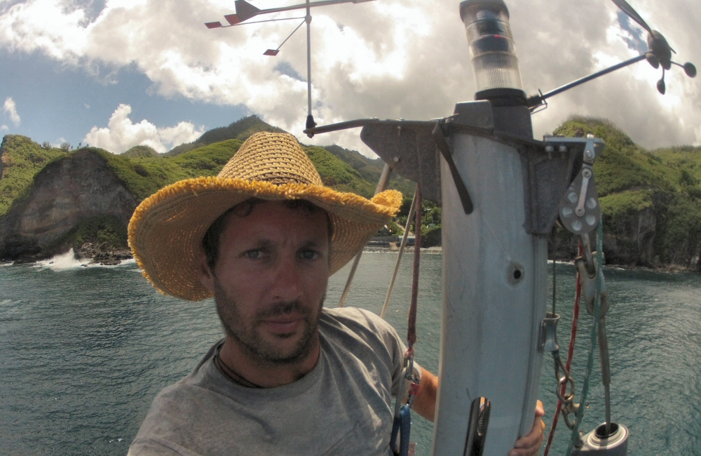
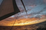
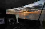
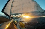
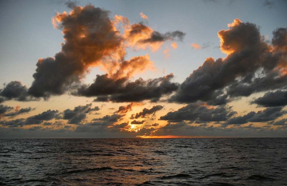
I spent a couple of hours tacking into the wind toward the island while the others slept, and at 0830 we made our final approach to the pass. I love the morning hours when I have the boat to myself. Just me and the ship. I usually make a fresh cup of coffee and just watch the night emerge into day. At sea you can see for such a long way. The sunlight catches the tops of tall clouds way over in the west well before there’s any sign of it appearing on the eastern horizon. Gradually greys and blacks turn to lilac, peach, salmon and eventually the hot piercing blue of another tropical day. When the others get up I have to make a conscious effort not to get grouchy, the peaceful solitude disappearing in a flash with the first word of conversation.

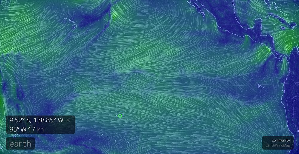
Some atolls are completely closed, we’re not visiting any of them as it’s not so safe to anchor on the outside (and it’s really really deep – over a kilometre just a few hundred yards off the reef). Some have one pass in the fringing reef, and some have more. Where there’s a pass, the tides bring the sea in and out twice a day. All the water in the lagoon needs to channel in and out through the pass, so it’s usually deep, but narrow – with fast, boiling currents at peak flow. Also, most atolls have a low, exposed, reefy south western side, which lets the waves crash over the top when the wind is blowing from that direction. The water can’t get back over the reef, which adds more water into the mix, so that sometimes, even when the tide is coming in, water is still flowing out of the pass. When the current in the pass is flowing in the opposite direction to the wind, then nasty standing waves can kick up, making things pretty dangerous. Add to this the fact that there aren’t accurate tide predictions for most of the atolls, and it becomes quite a navigational challenge.

My first atoll pass – a few butterflies in the stomach, but visibility good, approaching half an hour before estimated low tide, and not much wind or swell for the last few days to fill the lagoon with extra ocean. Spinning out of control and running the boat onto the reef is not something I want to do however, so as we made the final push into the narrow pass, I was on full alert. The current flowing out was fairly weak – 2 knots – so we motored hard against it and gradually edged our way into the lagoon, the water around us a confused mix of prickled wavelets and whirling eddies. Amazing colours. The sea has been an incredible shade of bright blue for days, even when it’s overcast, and when it gets shallow over the reef or sand it just explodes with vivid colour. Palm trees line white sand beaches just up from the surf on the reef, colourful buildings from the village stand amongst trees on the right hand side as we go in, and a couple of leading marks ahead guide us through into the deeper water. We’re through!

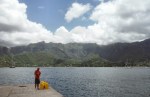
This is the south pacific I’ve been waiting for. We anchor in crystal clear water just off the village, D&E take the dinghy ashore to explore, and I tidy the up boat, have a swim, dive to check the anchor, and relax. We’ve found some wifi, so I’ve added some photos to previous posts too. The plan is to spend a few days in this atoll before moving on.

2015 04 16 1110 Rafiki Makemo
Anchored at Makemo
2015 04 16 1200 Drying bananas
All the bananas going ripe at one, drying some

Ua Pou

Sat Apr 11th. The 30 mile passage to Ua Pou was fast- 30 knots of wind most of the way, with a reasonably large sea. Wind and waves from our port side, on the beam, and not too choppy – not uncomfortable. The easterly trade winds are funneled between the islands of Nuku Hiva and Ua Pou, accelerating them to a strength sometimes twice as much as normal. I’m always amazed by the way that two land masses relatively far apart and relatively low can make such a difference to the wind and sea.

2015 04 11 1200 Ua Pou panorama
Ua Pou

By early afternoon the dramatic skyline of Ua Pou had cleared out of the haze. Sharp needles, towers and spires of bare rock scratching the bottom of a layer of cloud. Reminded me a little of the Isle of Skye. An incredible sight as we approached – Eva and David comparing it to the Torres del Paine in Patagonia, but here surrounded by a thick tropical green carpet and blue, blue ocean. As soon as we rounded the NW corner into the lee of the land, the wind disappeared completely, and then after a few minutes, further down the coast just a few hundred yards, it strengthened from the other direction, coming around the other side of the island, which is about 8 miles north to south and 6 miles east to west. To shelter from the easterly wind, I picked an anchorage on the west coast – Hakamaii bay – a small indentation in the rugged and rocky coastline just big enough for a boat to anchor. As we approached I wasn’t so sure it would have the protection from wind and swell that we needed, and it was pretty small – the tightest spot I’ve taken the boat into so far, on a remote rocky shore at least. But after a few minutes motoring gently about in the middle of the bay, I felt more comfortable, so in 12m of water we set the bow anchor with a buoy (to retrieve it more easily if it snagged) and a stern anchor to stop us swinging into the rocks on each side.

2015 04 12 1200 Picking up the stern anchor
Dave retrieves the stern anchor
2015 04 11 1900 Hakamaii sunset
Hakamaii sunset

Nestled in the bottom of the valley at the head of the bay was a small settlement with a colourful church facing the sea, the cross on its spire a little wonky, a few modern looking houses, a pickup truck, a clean white satellite dish and on the hill to the south, banana trees and a brown horse precariously munching on grass on the cliff edge. The sea crashed into the land on a beach of large, light coloured boulders, at the top of the beach a row of traditional outrigger canoes, and in the water a load of kids playing noisily. As we anchored, a guy in a canoe paddled out of the bay and around the cliff to the south. Seems like a gently, happy place.

Sun Apr 12th. A peaceful night at anchor. Church bells ringing early in the morning wake me up – I managed to spend all night dozing in the cockpit without getting rained on, though some very light drizzle in the early hours made things a little damp. Not long before the hot sun dries everything out. Rowed Dave and Eva ashore to take a look around the village, but the surf crashing on the rocky beach put us off landing. An old man waiting ashore signaled to us that the southern side of the bay was another landing spot, from where you could climb the cliffs and walk around to the village, so I dropped them off on the rocks instead. I suspect we’re the first boat to anchor here this year, and he was looking forward to foreign visitors. But D+E didn’t manage to get up the cliffs or into the village, just spent some time exploring the rocks.

2015 04 12 1000 Ua Pou Hakamaii bay Hakamaii bay, Ua Pou

Checking the gear at the top of the mast Masthead view

Crew hauled me up the mast to check masthead and rigging, I sealed the bulkhead of the aft cabin with silicone where water had been coming in from the stern compartment following the heavier rain squalls, and then we weighed anchor to set off for the Tuamotus at midday. It’s a 480 mile passage, and at an average speed of 5 knots I’m expecting 4 nights at sea, planning to arrive at the atoll of Makemo early on Thursday morning, just before slack tide, so we can go in through the pass in the coral reef without too much current.

Even though we’ve spent almost no time in the Marquesas archipelago, Ua Pou is our last island here. I feel like I’ve got a good sense of what the place is like, and we have limited time. I want to spend a couple of weeks in the Tuamotus before meeting Rose in Tahiti at the start of May, so we have to push on…

Nuku Hiva

In the morning, the sun shows a dramatic view. Taiohae bay is surrounded by high mountains, all rich with green vegetation apart from where black volcanic features show through; rocks, caves, cliffs. It’s hot and humid already. There was rain in the night, which has washed the salt of the passage off the decks. We drop the dinghy in the water and motor ashore. There’s a concrete wharf and a few buildings, large wooden tables on the dock where the local fishermen butcher their catch. Cars, people, so much to look at! It instantly feels like Polynesia; palm trees, black sand beach, stone carvings and big men with tattooed faces. All the women wear a flower behind their right ear; usually a white frangipani but sometimes a red hibiscus. The land smells damp and earthy. Behind the dock there are a few buildings- a snack shop/restaurant under a marquee because their store front is being renovated, a small clothing shop, and a door to a place called Yacht Services. There are a few fresh veg stands under a roof nearby – we’ll come back later for that.

We have a wander around town – it’s not large, I think there are about one to two thousand people here; but it’s still the largest town in the Marquesas Islands. There’s a tarmac road along the waterfront, and a few other roads running up into the hills behind. The buildings are all in good shape and it all looks smart. First stop; Gendarmerie, to clear in to French Polynesia. As we’re EU citizens, it’s a quick and painless process; just a few forms to fill, and then post one off from La Poste opposite, where we also find a cash machine to get some money out. We pick up a baguette sandwich from a man that is trying his best to be a woman, find out where we can get the propane tank refilled, and catch up with folk back home briefly on the internet.

Coming ashore again later in the morning, the rusty ladder I’m climbing up breaks and lacerates my foot deeply. Blood everywhere – pumping out of the wound with each heartbeat – so I lie down and stick my foot up in the air to slow the bleeding. Another sailor comes by with some iodine and a bandage, we wash the cut, I slap the dressing on, and decide to hobble up the road to the local clinic. We have all the medical stuff we need on board; cleaners, creams, stitches, antibiotics – but as we’re near professional help I may as well make the most of it.

After a couple of hours in the clinic, chatting in French to the jovial nurses Roland and Jean, waiting for the doctor to come back from lunch break, and getting the job done, I’m ready to hobble back to the dock. Annoying, since I need to keep it out of the water until it’s fully healed to prevent coral infection … fortunately the Marquesas aren’t a beach or snorkelling spot, and hopefully by the time we get to the Tuamotus in a week or so it will be all better. Just a good reminder of how careful we need to be. Eva and David start up in song … “Captain hinkbein [and the rest in German]…” – something about a peg-leg captain hobbling along. Ha ha.

Next day when the local supply ship has moved off the dock, we fill all our bright yellow jerry cans with diesel, pick up the gas tank and by mid afternoon, set sail for the next bay 5 miles along the coast. The sun sets just as we’re getting in, but there’s enough light to show an incredible backdrop of huge black fluted cliffs, rising straight up to 1000+ metres.

In the morning the dramatic anchorage really impresses. The cliffs are viciously jagged, climbing into the clouds so steeply that it’s mostly bare rock, green bushes clinging on here are there, with a light dusting of yellow blossom. On the other side of the bay, the hills are lower and rolling. There’s only one house, in a clearing cut from the trees. Smoke rising from a fire, cockerel squawking, washing hanging on a line, a couple of small motorboats anchored just offshore. The bay is in two sections; like rabbit ears, the east lobe where we’re anchored, and the west lobe where there’s a black sand beach, and a row of palm trees under the cliffs. We get the kayaks off the deck, put the dinghy in the water and all paddle round to the beach.

2015 04 10 1600 Palms and cliffs

2015 04 10 1000 Paddling in

Dave and Eva wander up the valley to the “3rd highest waterfall in the world” – a 5 hour round trip hike – and I sit on the beach for a while. With just one operating foot, getting ashore through the surf, and then dragging the dinghy up the beach was interesting. Thinking maybe it’s not so wise to be hanging around under the coconut trees, I move down onto the sand and just sit there, soaking it all in. Soon the biting bugs arrive, so I head back to Rafiki to relax for the day.

6 hours later I get a call on the radio – “We need a pickup!” – Dave and Eva have found a young polynesian couple and bought more fruit than they can carry in the kayaks, so need me to row round in the dinghy. They carry the fruit out to me as I wait in the small surf; papaya, pamplemousse, star fruit, guava, lemons, oranges, and half a tree of green bananas. We’re going to have to work hard to get through all this before it goes off! It’s dark by the time we get back to the boat; we have dinner and then, as usual, I fall asleep in the cockpit soon afterwards.

2015 04 10 1700 Fruit pickup

It’s a calm, quiet anchorage, with two other boats here, one of whom we made the crossing from Mexico with, and the other a Canadian boat who is on a similar schedule to us, so we might see them again further down the line. Tomorrow, we’ll set sail south for Ua Pou, the next island.

Day 28 – Landfall

Two days ago, at 4pm, I write in my journal; “Since early this morning we’ve had 25-30 knots of wind, and chunky seas. We made 146 miles yesterday, equaling our best day yet. It’s 300 miles to Nuku Hiva – if we can keep up this pace, we’ll be in on Wednesday, will try and arrive in the light”.

I decide to aim for an evening arrival, before dusk. I’m not happy coming into a new port at night, so if we don’t make it, it may be a case of waiting around offshore for the night, which would be nasty, and an anticlimax. We need to do 300 miles in 48 hours. That’s more than we’ve managed in any of the 48 hour periods since Mexico. Ambitious. The wind stays up, and we are under full sail, trying to average over 6 knots. We’re on a broad reach, with the strong trade winds coming from our port side, and I’m trimming the sails all the time to keep up speed. There’s a current with us, giving us a welcome boost of more than a knot at times, and we sometimes see 8+ on the speedo as we surf down the face of the bigger waves. Hoping for the wind to stick with us.

50 miles from land, I’m looking out across the horizon every 5 minutes, but really we’re still too far offshore to see anything. At 6 feet above sea level you can see for 4 miles before the curve of the earth gets in the way, unless you or your target are higher, in which case you can see further. On a clear day you can see France from the cliffs of Dover, which is 22 or 23 miles, because you’re higher up. So even though the islands here rise to more than 1000 metres, I think 50 miles is a bit optimistic. But I keep looking!

Now late morning on Wednesday, and there should be an island 20 miles off to port, 600 metres high, but I can’t see anything yet. It should be there. These days it’s not a case of worrying about whether you’re in the right place, using the sun and stars for navigation. My GPS chart plotter says land is right there, and I trust it. But it’s hazy. I’m wondering whether the island will slowly rise over the horizon, or whether it will appear out of the haze. I keep looking. And then at 1210 I see the slopes rising into the clouds! Land! Faint lines, only just visible, could almost mistake them for gaps in the cloud. But within a few minutes it’s clear, this is LAND! It’s Ua-Huka; not the island we’re aiming for, but pretty special after having completely empty seascapes for nearly a month. We’re still scanning the fuzzy hazy horizon ahead for signs of Nuku Hiva… which appears mid afternoon as we get within 15 miles.

It’s dramatic. Looking from the left, the land rises vertically out of the sea to about 600m, and then climbs up into the clouds along a vicious crenelated ridge. Sometimes there’s a fuzz on the ridge where a stand of trees has managed to grow. The peak is hidden in cloud; first a horizontal band of streaky grey and white, and then out of the top of that, a fluffy bumpy mass of cumulus, bubbled up by tropical afternoon heat on black volcanic rock. Further to the right (the island is pretty close by the time we see it), a number of steep ridges tumble back down out of the clouds, closer ones being darker, and gradually getting lighter as they go around the island, like mountain ridges fading into the distance.

Within a couple of hours we’re approaching the cliffs on the left hand side, and around the corner is first Baie de Controlleur, and then Taiohae bay, the Port of Entry. Are we going to make it before dark? It’s still a close call, and we have to keep up speed. The sun is starting to get lower, dropping behind the clouds that cloak the island, silhouetting it against a grey sky, so we can’t see any of the fabled lush green slopes. Only gnarly black shapes – the land looks young and unweathered, fresh out of the sea just a few million years ago.

Dolphins race, twist and surf in the waves around us to welcome us in; Eva says “whales to say goodbye [from Mexico], dolphins to say hello” – it’s a pretty special arrival. I have to interrupt her photo session to get the genoa gybed and up on the pole out to port so that we can keep up the pace. Still a few miles to go, and the light is leaving us. We’ve sailed fast, and beaten our best day by a long way; 156 miles noon to noon! But we’re not finished yet.

Finally we turn the corner into the bay, get the sails down, and motor in past a huge white quartz cross, slicing through the cliff on our starboard side from summit to sea, maybe 200m high and 400m wide. The horizontal band is a little darker, harder to see than the vertical stripe, so at first in the half-light it looked like a huge waterfall pouring off the top of the island straight into the ocean.

Loads of boats! Maybe forty or fifty other yachts here – I’m really surprised to see it so busy. I think we’re only the third boat in from Mexico this season, so the others will have come in from Panama and the Galapagos, or else perhaps Tahiti and other places west of here. Just as it’s getting too dark to see, we find a spot in between a few catamarans, close in to shore, and drop the hook. I pick up the scent of evening flowers. Lights of cars move up and down the sea front, sailors buzz back to their boats in noisy little dinghies after an evening meal ashore. So many new things for the eyes, nose and ears to deal with – it feels more than a little surreal.

Anchor down. Engine off. Rafiki lies still and quiet for the first time in weeks. Passage over. Amazing. We made it! 28 days at sea, 2712 miles as the seagull flies, 2919 miles sailed (and drifted). Nothing (major) broken on board, nobody injured. We rustle up some pasta, a celebratory gin and tonic (I forgot to put the champagne in the fridge), and before I know it I’m asleep in the cockpit, job done.

Photos – Mexico to Marquesas

We’ve arrived in the Marquesas! Made landfall at Taiohae Bay on Nuku Hiva, just before sunset, the day before yesterday. 28 days at sea, 2800 miles, and 2 timezones later. Just a few photos for now… lots of things to do now that we’ve reached land.

Goodbye land. Hello ocean.

Boat’s ready, crew’s ready. Time to go! I’m just about to untie the dock lines and say adios to continental soil for a very long time. The passage ahead fills me to the brim with excitement. It’s going to be an experience different from anything I’ve done before, and I’m looking forward to the challenge. It will be a test of determination, endurance, motivation, engineering, navigation, leadership and most of all, seamanship.

The first leg is 2,800 miles to the Marquesas Islands, which I expect will take between 23 and 28 days, depending on the weather. The first challenge is to get off the coast of Mexico into the NE trade winds. The weather can be quite calm for hundreds of miles out to sea, so the trick is to wait for a pulse of wind coming down from the north to carry us out into the stronger wind. Many boats are still waiting here, watching the weather forecasts for a significant signal to go, but a few are now starting to push out from Mexico to try and find wind. I think it’s better to be making some headway, if only slowly, than sitting in a hot, airless marina twiddling thumbs.

We sail south west for about two weeks (!) to the northern tip of the doldrums – an area just north of the equator where the NE trades and SE trades meet. Up until this point it should be pretty plain sailing, with the wind behind us or off to one side, warm and relatively calm. Often, sailors complain of too little wind. Once we get to the doldrums (otherwise known as the ITCZ – Inter Tropical Convergence Zone) the weather gets much more unsettled – think monster tropical thunderstorm cells, squally weather, and rain … interspersed with dead calms. The idea is to cross through this as fast as possible, which is why the line on the map above ducks southwards for 500 miles or so. We might have to motor through here, so I’ve loaded up with many cans of extra diesel.

You can see the current wind conditions on earth.nullschool.net, an excellent representation of the GFS global weather data. The green dot on the image below is the Marquesas islands.

Pacific winds on 9th March
Pacific winds on 9th March, showing a wide band at the doldrums (ITCZ)

Once we’re through the doldrums, we turn to starboard and with the south east trades behind us, make the final 800-odd miles to either Hiva Oa or Nuku Hiva in the Marquesas. We should be able to average 4 knots or so, which means we average 100 nautical miles a day. That’s the plan, anyway.

I’ll be sending updates from the satellite phone to the blog, but no pictures. It’s only sea and sky anyway, so nothing much to see! Though I’m expecting some pretty epic skyscapes as we go through the doldrums…

Mother earth, give us fair winds and calm seas.
Rafiki, do what you do best and carry us safely through whatever conditions come our way.
Off we go!