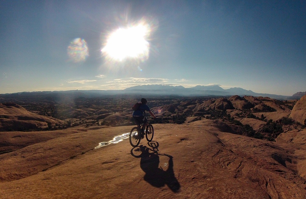
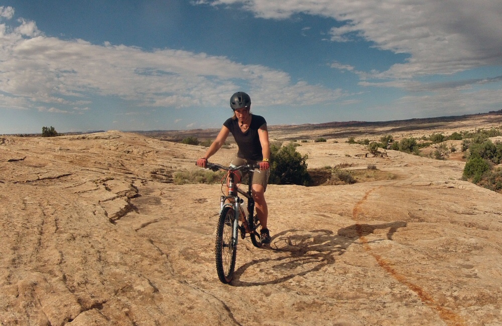
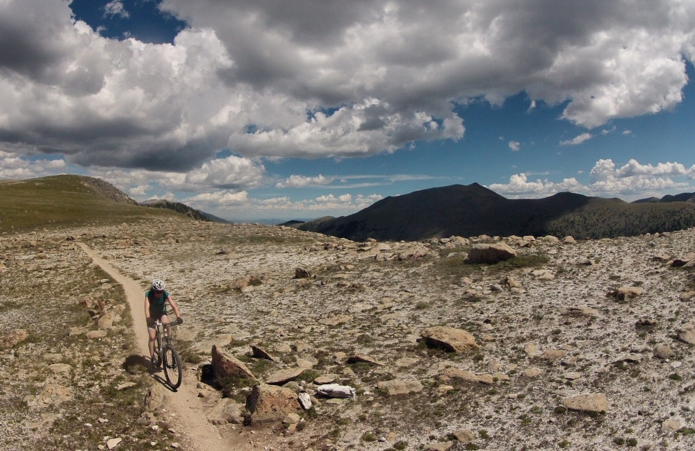
Jon and I got up just after dawn, to ride the famous Slickrock Trail before the sun got too hot. Though it wasn’t our first experience on slickrock – that was last night – it was an awesome loop, 10 or so miles over grippy, rolling rock, following the painted white dashes. The views over the Colorado River were amazing in the early light. By the time we got back to the van it was scorchio-hot, I wouldn’t want to do this in the middle of the day!
We’d run out of food again, so we stocked up in the supermarket. We can fit about 3 days’ worth of fresh food in the fridge, after which we have a couple of meals of non-perishables, and then need to find a shop again. We’re eating out now and then, but generally cooking in camp. Heading north out of Moab we drove into Arches National Park, only a few miles out of town. The plan was to head straight to campsite which was shown as being full, but in the past we’ve had success finding a space where someone had cancelled, or the rangers hadn’t quite got things right. This time it really was full. It’s a small site and all the pitches are reservable, and it supposedly fills up months in advance. But Rose chatted up the camp host and he let us stay in the group area – result!
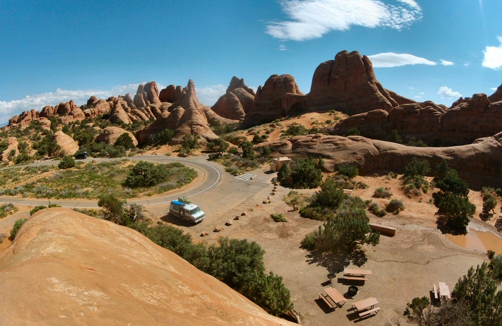
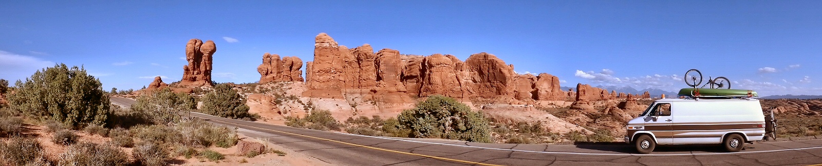
The arches park is stunning. Driving in from the visitor centre you climb a steep, twisty road between huge red walls of rock, overlooking the Moab geological fault which created the valley below. Even though the whole town is surrounded by rock, cliffs and desert, it still feels like you’re entering a different place. The ochre coloured walls are so steep, so big and such a strong colour. Amazing shapes everywhere – not just arches. After a while you think you’re getting desensitised to incredible scenery, but then something comes along that sets the barrier even higher – the Arches National Park is one of these places. We explored a few spots, took a bunch of pictures and soaked it all up.
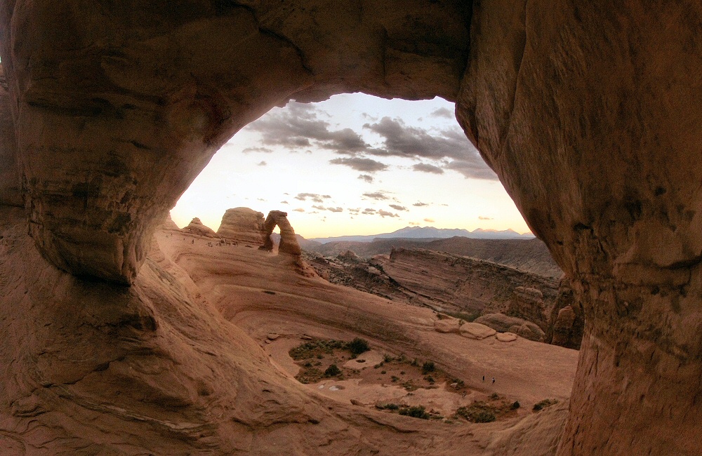
The classic sunset Thing To Do is to hike up to Delicate Arch, Utah’s state symbol, which catches the setting sun. It’s a mile or so away from the parking lot, but even though it’s a strenuous walk there were crowds of people up there waiting to get their own classic photo. It’s an impressive amphitheatre of rock, with the arch sitting on the back rim. Mr Sun wasn’t playing ball tonight though, and tucked behind a big bank of storm cloud early in the evening, so no glowing gold sunset for anyone.
Back at camp, it got really windy which meant no camp fire, but on the plus side also meant no mosquitoes. The sky cleared up to reveal gazillions of stars. I love the night sky in the desert – usually with no trees around you get a good view of the whole hemisphere – and you’re miles away from any bright city lights. We’ve not had a moon for the past couple of weeks, so the night skies have been sensational.
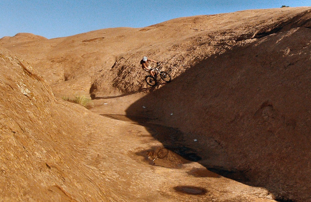
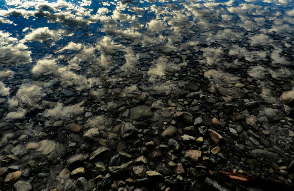
Maybe the most picturesque campsite yet? We woke to amazing views – colossal sandstone cliffs forming a cove around the camp, and dry, scrubby desert stretching out to the horizon. Somewhere out there is canyon country! We spent the morning scrambling around, testing the limits of friction on the steep, grippy rock.
As we were only a few miles away from the Needles Overlook – a viewpoint perched high on a cliff above the Canyonlands National Park, we made the detour. Woah. Huge. While not as deep as the Grand Canyon, the views out over the Canyonlands are supposed to be just as impressive, and the distances to the far side are greater. It’s so arid. Just crumbling rock and sand for miles and miles. So much to look at, it’s impossible to soak it all in.
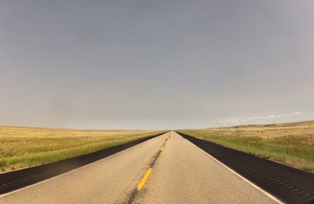
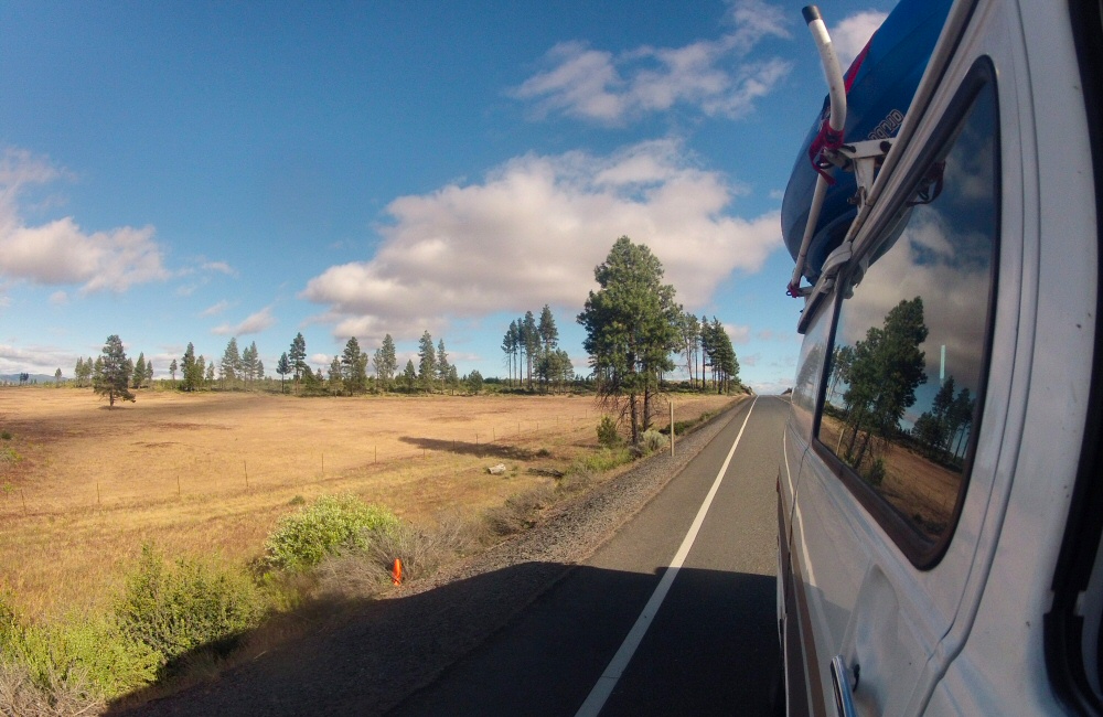
The drive to Moab was exactly how I’d expected Utah to be – lots of open scrubby desert, big rocks and awesome scenery. Just like the whole of the rest of the trip, every minute on the road has been interesting in some way or another. There’s just so much to look at and soak in, even out here in the desert. It’s only when we double back on ourselves and drive the same road again that we get the opportunity to focus on anything other than gawping out of the windows. We passed Wilson’s Arch on the way into town and of course scrambled up there too.
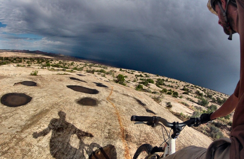
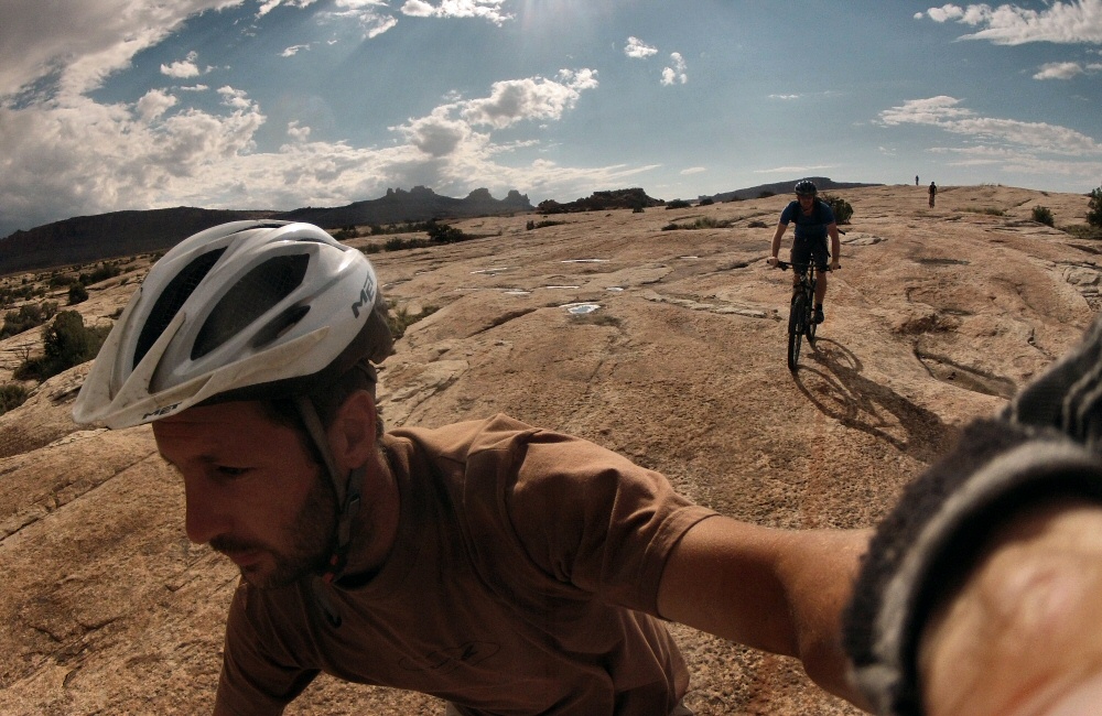
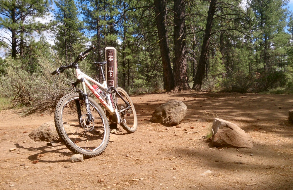
After setting up camp in town at Slick Rock Campground, the temperature had dropped a bit so we headed out for a ride at the “Bar-M” trails area just north of town, ending up doing the Circle-O loop – following a painted line on the slickrock for a few miles. A big storm was drenching the Arches National Park and the El Sal mountains to the south, but it rolled on past without hitting us.
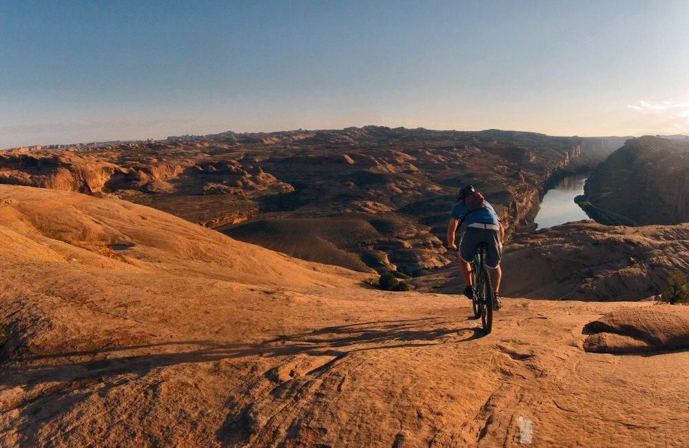
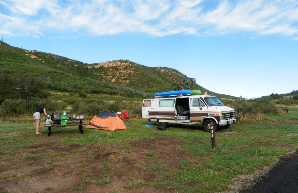
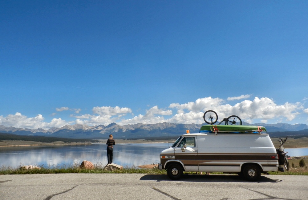
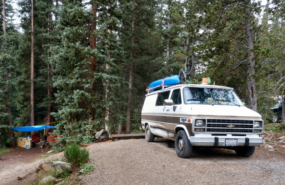
Moab is perhaps one of the world’s most famous mountain bike towns, mainly due to the unique, endless slabs of rock surrounding the town. Not only is this place a mountain bike mecca, it’s also a top spot for 4-wheel-drivers and off-roading, river rafting and general outdoor adventures – but not a place I’d like to live. Too hot in the summer, and not much else going on as far as I can tell.
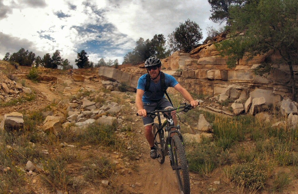
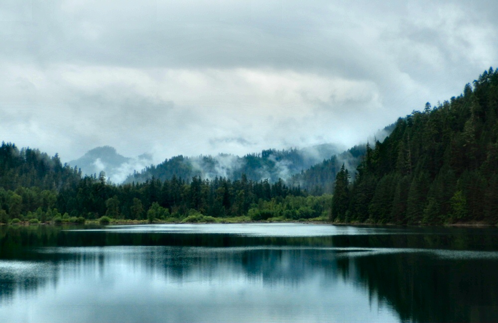
I got up early and wandered down to the lake overlook. Not much of a lake really. The water had clearly been much, much higher when the local maps were made, but now there was not much more than a pond sitting in the bottom of the valley. Back into Colorado, where we stopped at Durango, another mountain bike hub. First port of call was a place called Steaming Beans for coffee and internet catch-up, and to make plans for the next few days with the maps and guide books out. Jon and I tackled another of Colorado’s Top Ten Rides – a double black diamond rated route up onto a ridge and down a super rocky, technical descent – more like trials riding than mountain biking, with a huge vertical drop into the valley below if you get it wrong. So not many pics.
At the top we met a couple of locals, Andy and Ivan, who showed us some more awesome riding over the back of Horse Gulch and Telegraph Hill, including an epic swooping twisting downhill called Sidewinder. We met the girls for dinner at Steamboat brewery, then piled back into the van for a late night drive to Mesa Verde National Park, where we camped.
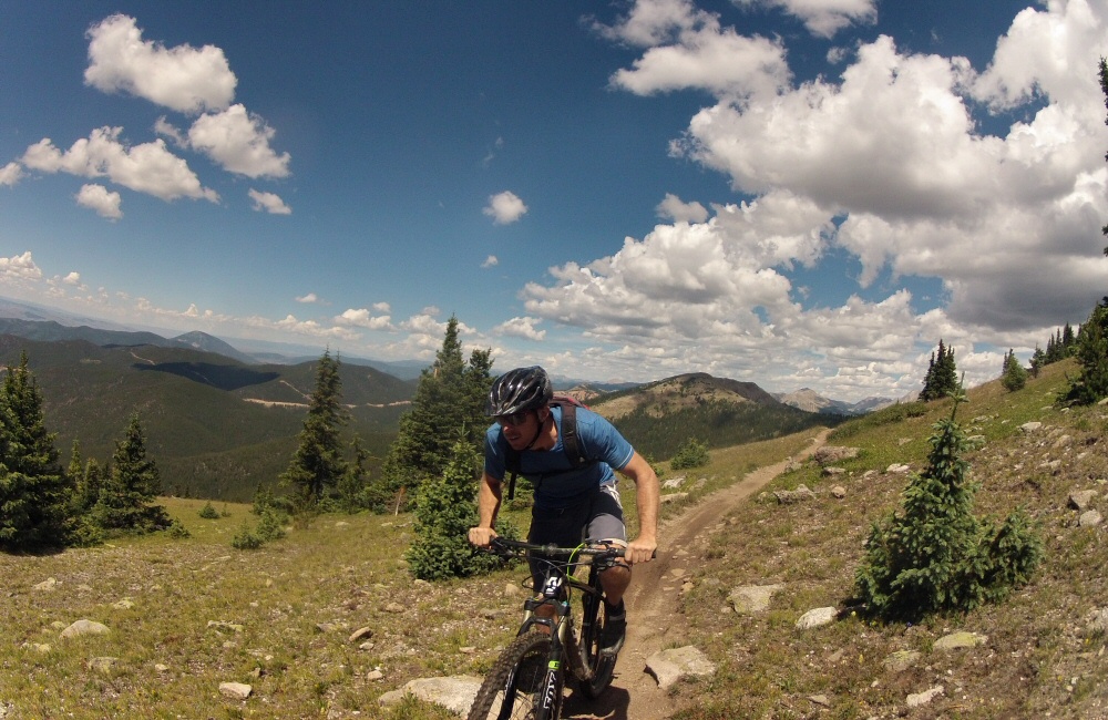
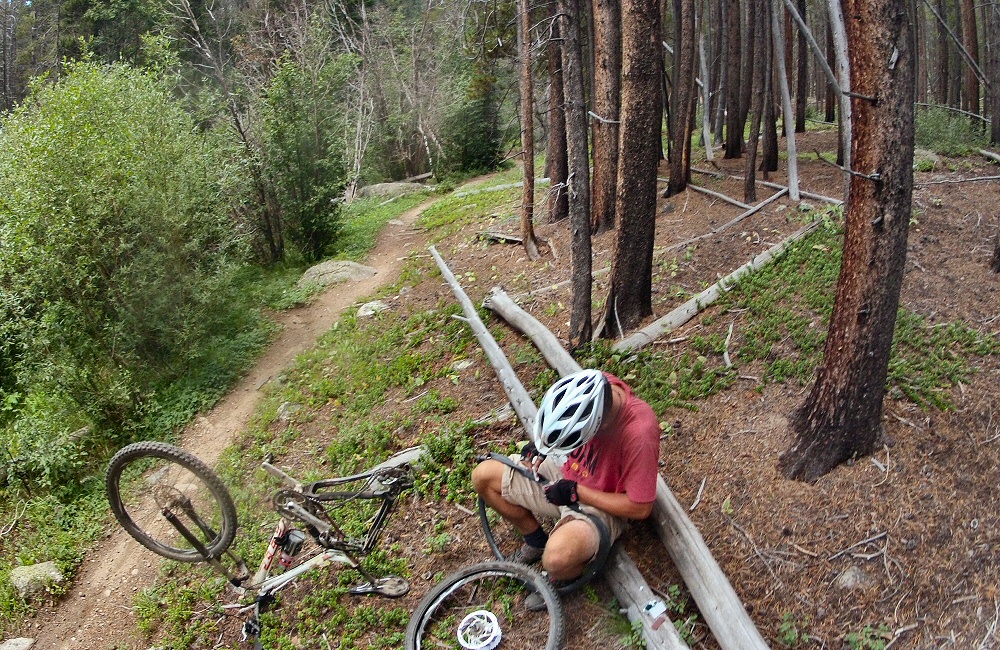
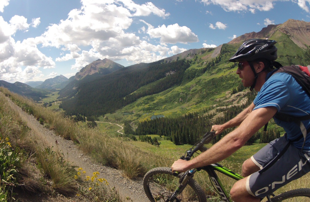
Rode another of Colorado’s top ten trails this morning – the start of the Monarch Crest trail, and then breaking off left down Fosse Creek. Rose wasn’t riding, so she took the van round to pick us up at the bottom, which meant a short bit of climbing for us – with stunning views – and then 9 miles of downhill. Probably the best ride I have ever had in my life. Real mountains, dry, dusty trail, incredible scenery, fast technical downhill that just went on and on and on. Two more pinch punctures – I’m getting good at quick tube changes!
Colorado definitely deserves its title as the mountain bike centre of the world. There are so many amazing trails – we’re only managing to scratch the surface. It feels awesome to have been able to get a taster – I wonder if I’ll ever be back?
Time for a shower, which meant heading east into a small town called Salida to find a motel. In the afternoon, we wandered round the place, did a round of laundry, and then had a meal out. Salida is yet another Colorado mountain bike town – filled with a mix of hippies, cyclists and old timers. Met a couple in a cafe who are cycling down from Montana to Mexico and had a quick chat.
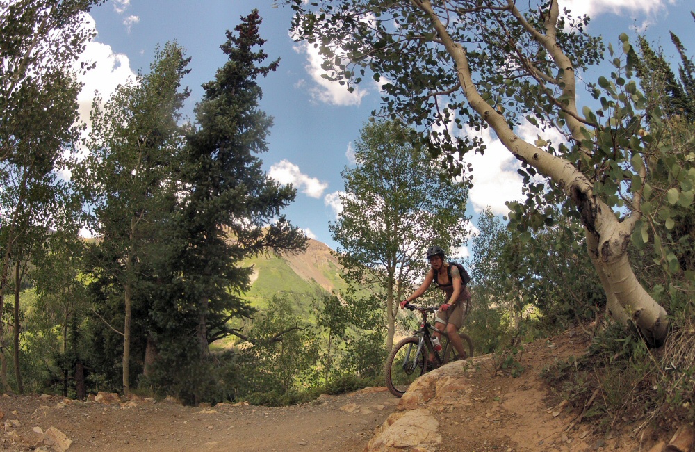
Drove up over Cottonwood Pass – the highest the van has been so far on this trip, an altitude of over 12000 feet. And then all the way down the other side to Crested Butte, one of Colorado’s many mountain bike towns.
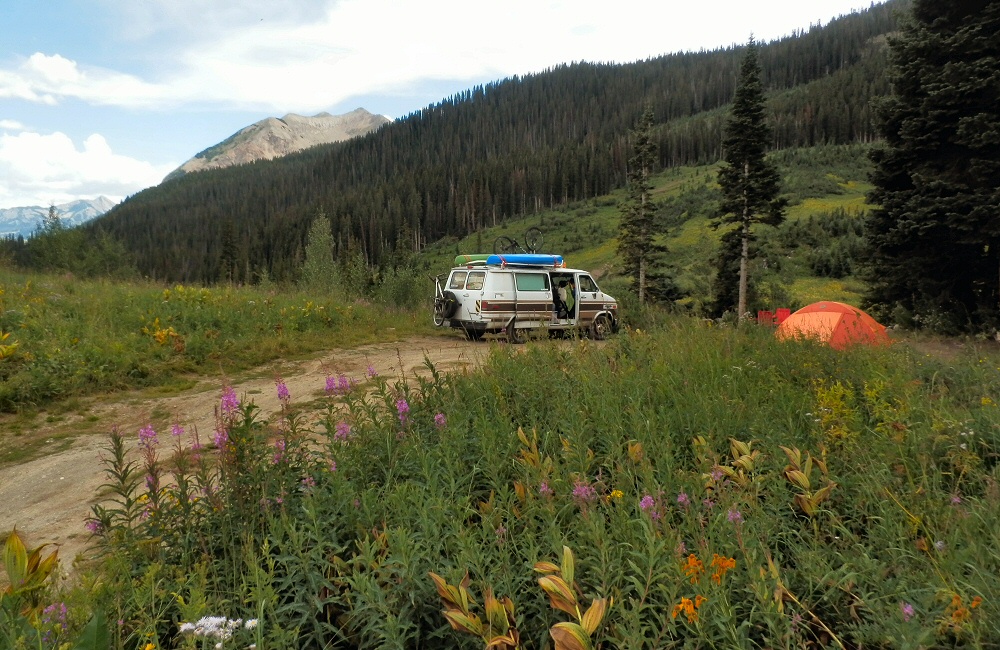
Introduced J&H to The Great American Breakfast at Paradise Café, then headed on up into the hills through Mount Crested Butte, to find somewhere to spend the night. Found a wild National Forest site, perched on the side of Gothic Mountain, along a bumpy dirt track. I’d spotted that the local ski centre was doing free chairlift rides in the evening, so we all had a few hours riding the downhill trails of the bike park. Thunderstorms around the local hills meant that the usual free-Friday night crowds weren’t around, and it wasn’t too hot. My bike is still just about holding together, it’s pretty old and tired now. No idea what I’m going to do with it when we go through the next phase of selling / giving things away in September, to thin possessions down for our trip south. I managed to get two pinch punctures during the evening, broke a tube valve, and a pump. Awesome riding though – typical bike park trails – a range of smooth swoopy berms and rougher technical bumpy stuff through aspen groves.
Saturday 16th
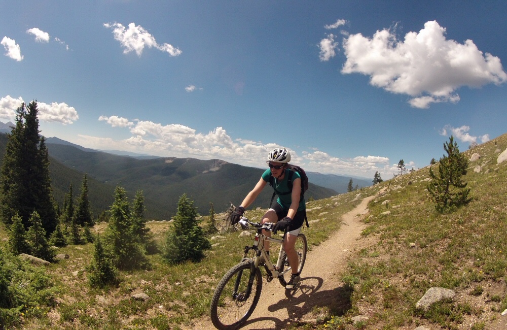
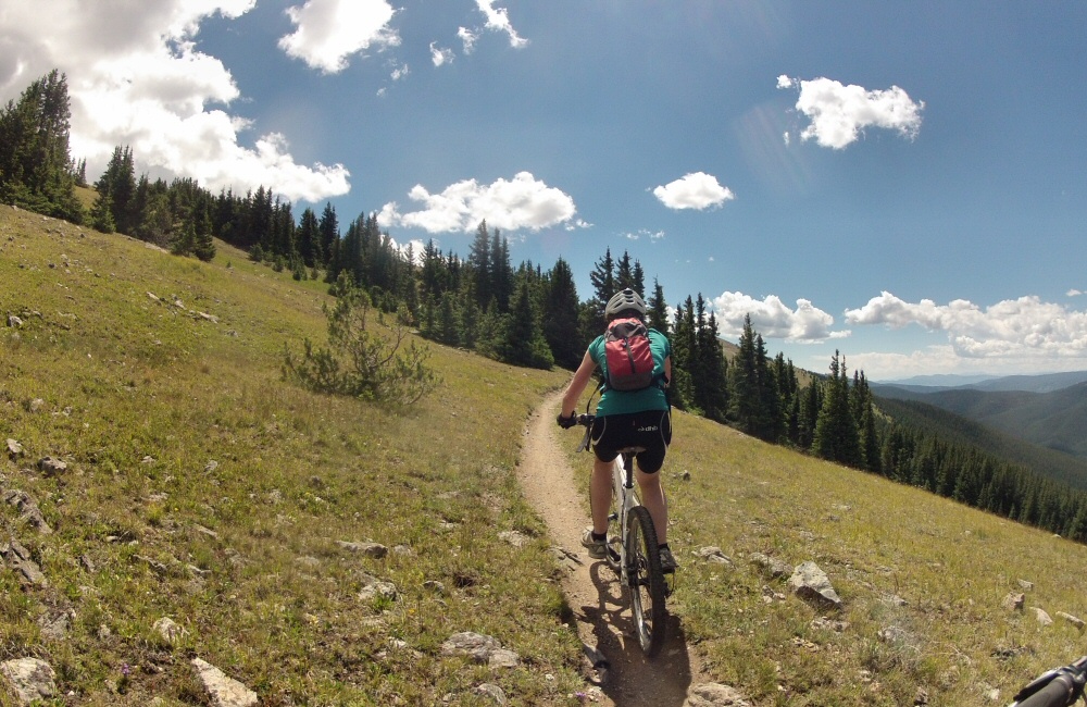
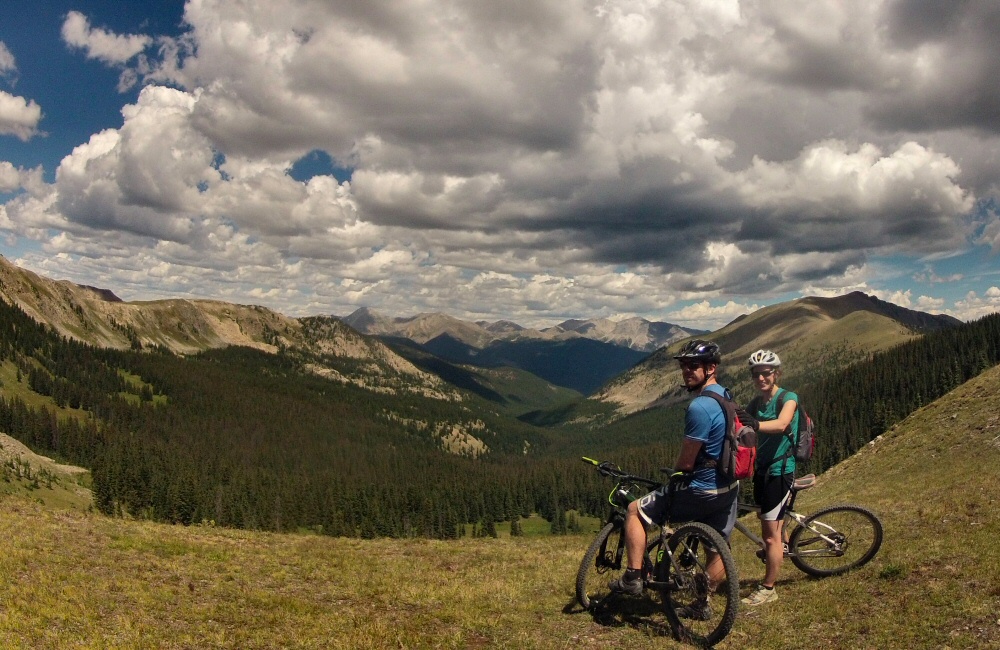
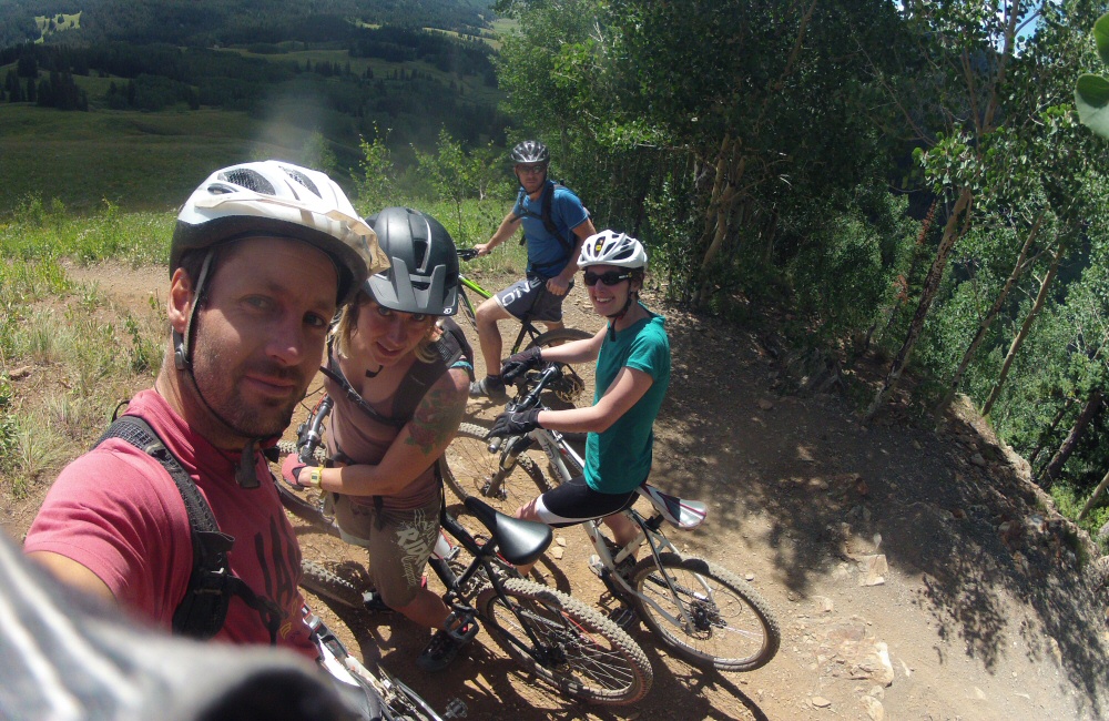
We’d come up this valley to be near a trail called the “401” – one of Colorado’s ten best mountain bike rides. We took the van a short way further up the road and parked up. The ride starts with a couple of miles of tough climbing – a bit of dirt road and then singletrack to the high point at about 11000 feet. Pretty hard work riding at this altitude, but incredible scenery. Then perhaps 6 miles of downhill, skimming along the side of the valley, looking out over amazing views, swooping and twisting through chest-high wild flowers. They say that the height of the wild flowers is a prediction for the depth of snow that’s going to settle in the coming winter. Left Rose and Helen at the bottom of the trail while we rode back up the road to get the van.
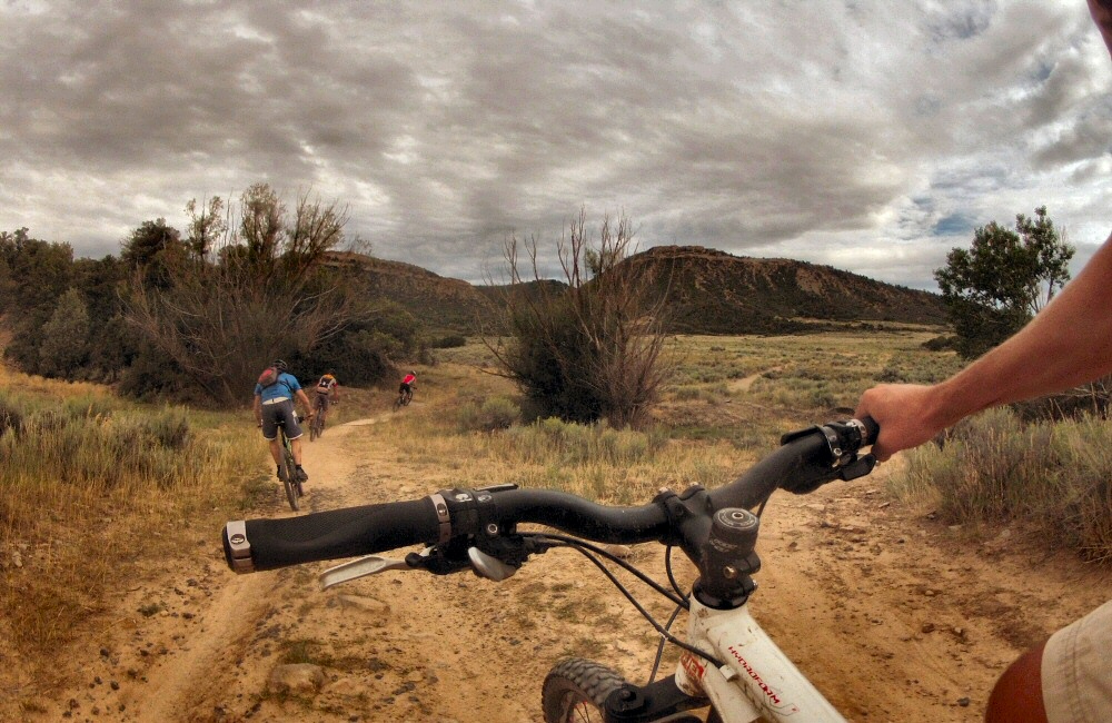
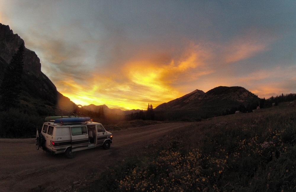
There’s a load more riding here, but we need to keep moving. It’s the same story with everywhere we’ve been – it would be easy to spend days, even weeks, getting to know a place and meeting people, but with limited time, we’re choosing to just get a taster of each spot. So we headed on south through Gunnison towards Salida – over the top of Monarch pass then found a campsite nearby. I was just starting my shower out of the back of van when the rain clouds opened – Jon and Rose put the awning up. The rain didn’t last long, and by the end of the evening we were sat around the camp fire, burning the cardboard bike boxes that we’d been lugging around ever since J&H arrived.
The alarm I’d set to wake me up to see the sun rise over the Tetons did its job, but the mountains were still asleep under a thick blanket of cloud, so I tucked back in for a few more minutes shut-eye. That was almost a week ago! Since leaving the Tetons we’ve crossed half of America, and still have a couple of days to go before Thunder Bay. The Grand Teton Range is on the far western side of Wyoming – the last we see of the Rockies as we head east. The rest of Wyoming, at least the centre section that we drove across, is just empty grassland and ranches.
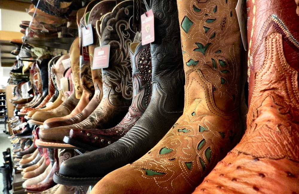
[Friday 18th] We spent the night in Casper, one of the larger towns in the state, so that Rose could go to “the west’s leading ranch outfitters” to buy some cowboy boots. Even though they had the biggest selection we’ve ever seen, nothing had that special feel so we left empty handed.
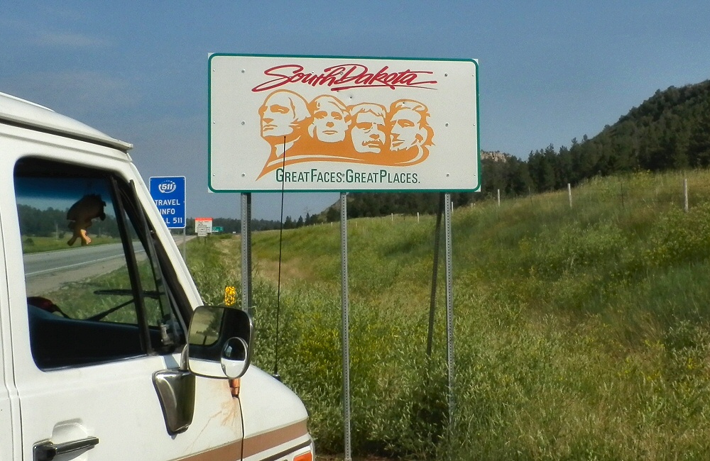
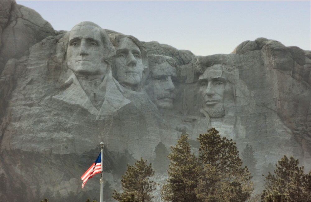
The next day took us to the edge of Wyoming – open, empty land covered in sweet yellow clover grass, as though the hills had been dusted with yellow powder. It’s a lot hotter out here than in the mountains. As soon as we crossed over the state border into South Dakota, we climbed into the Black Hills, where it cooled down quickly. The Black Hills are full of history – Indian sacred grounds and hunting lands, and of course the subsequent clashes with the settlers once gold was found here in the 19th century. We drove through the town of Custer (of Custer’s Last Stand) and past Mt. Rushmore, into Custer State Park where we planned to stay the night. Driving through the park we ended up on a tight, winding mountain road with tunnels and “pig tail” bridges – it turns out that this road was built in the early 20th century purely as an engineering challenge.
Not planning ahead, being naïve travellers, means that when we come across interesting things it’s much more of a surprise. So far we’ve not really been planning anything, other than a general trend towards the north and east. Yeah, we may have missed things along the way, but we don’t want to be just jumping from one tourist spot to the next.
As the sun disappeared we found the last available camp site in the park, and cooked up some chilli and rice. At about midnight we were woken by an amazing storm – huge lighting flashes and booming thunder. And then hail hammering down on the roof of the van, so hard I was expecting to find dents all over it in the morning.
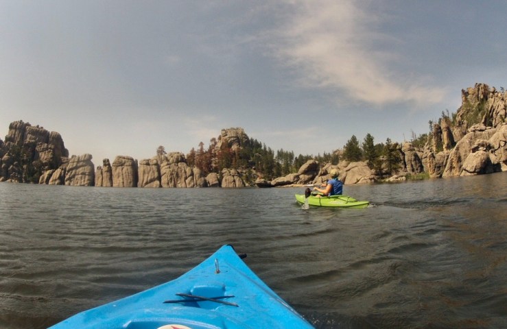
[Saturday 19th] On Saturday we bimbled around the wildlife loop in the state park, seeing more buffalo, plenty of deer and a prairie dog town. I’d seen that there were some mountain bike trails in the Black Hills, and I was desperate to get out on the bike again. But without any internet connection and pretty poor information from the visitor centre, I had to take my chances and head off on a hiking trail – up to Cathedral Spires. Turned out to be a fun hour. Hot! Heading back towards the Crazy Horse memorial we passed Sylvan Lake which looked too tempting to pass by without a quick paddle, so we popped the kayaks in, powered across the lake, and had a swim.
Cathedral Spires, Black Hills, SDSylvan Lake, Black Hills, SD
Late afternoon we wandered around the Crazy Horse visitor centre. The memorial is of one of the Lakota Indian chiefs – as a response to the building of the Mt. Rushmore memorial which commemorates the first four American presidents, “so that the white man knows that the Red man had great leaders too”. It’s a huge undertaking, started in the forties, to sculpt a whole mountain into a statue of the chief riding a horse – the biggest sculpture in the world.
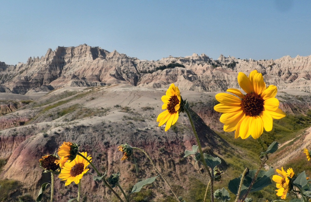
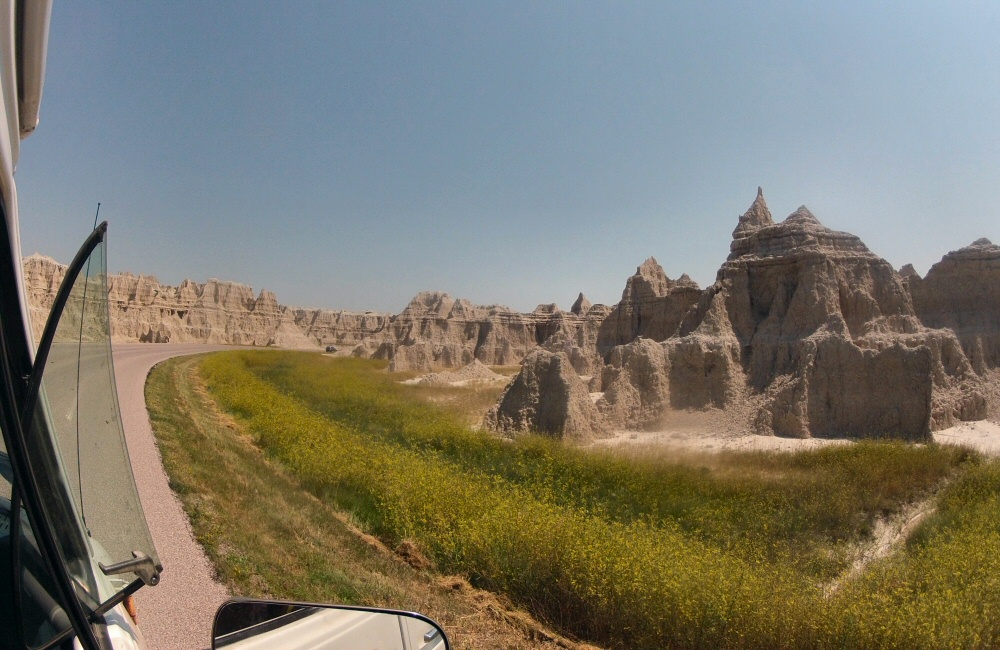
As the evening set in, we grabbed a bite to eat in Custer and then carried on east out to the Badlands National Park. The park campground as described in our National Parks book is “primitive” – it’s just a ring of grass in the middle of the grassland, with a couple of long drop toilets and a bunch of picnic tables under sun shades. Not a single tree, which makes it completely different from every other campground we’ve been to. Still mosquitoes though … how do they survive out here?!
Sunset as we approach Badlands NP
Chatted late into the night with a bunch of other young travellers – one guy from San Francisco heading to Harvard in Boston to spend a few years studying architecture, a young couple driving around the US for a couple of months, almost the same route as us but in reverse – again from the bay area in California, two brothers from Florida headed for college in Missoula, Montana, and a girl from Iowa who was taking a weekend break from her job as a National Park environmental worker in Minnesota. Normally the US and Canadian campgrounds are quite anti-social; everyone has their own pitch with table and fire ring, a good distance apart to give some privacy. It means you don’t really get to meet people, which is a shame. Here you could pitch up anywhere you wanted, no fire rings, and shared tables. Everyone had been travelling for days and was keen for conversation with a new bunch of people.
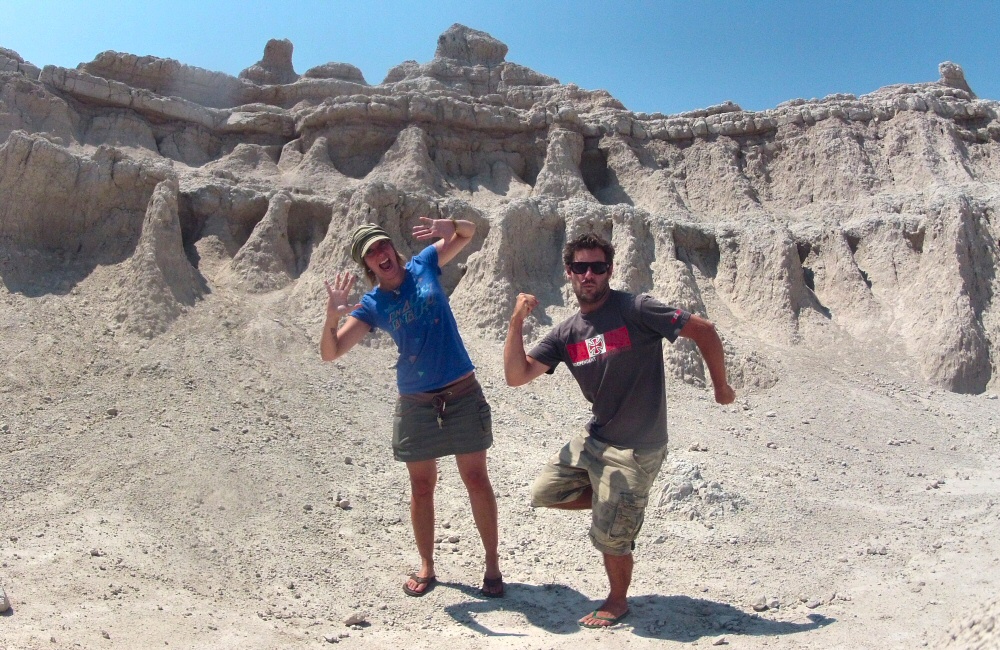
[Sunday 20th] Explored the Badlands in the morning, in the searing heat. Not a breath of wind, and 100-plus degrees made it sweaty, sticky work. The only way to get a breeze, or any shade, was to get moving in the van with the windows all open, so we didn’t dawdle. Sheltering from the sun, sweltering and sweating in our plastic van seats, we slithered across the rest of South Dakota – miles and miles of empty grasslands, turning into wheat fields, and then corn fields further east.
Everything here is geared towards farming. The fields are huge, but there seem to be separate farmhouses every few miles, so the farms themselves can’t be that big. It’s all very well kept, with perfectly mown road verges (I suppose they have the equipment and the time!), neat barns and grain silos, and huge immaculate lawns in front of every house. And of course each property proudly flies the stars and stripes outside. On and on and on. It’s given me a chance to catch up with learning Spanish – I bought some bigger speakers and wired one up to the radio so that it’s a bit easier to hear while we’re blasting along with the windows down.
My other goal for the summer, to learn the Ukelele, hasn’t been progressing so well. I’ve got three basic chords dialled, but that was a month ago and not much has happened since. The same three notes strummed over and over again isn’t the best soundtrack to a summer evening in a remote campsite, especially when we have neighbours.
Just before leaving South Dakota we found a motel for the night, in Watertown, where we had a wonderfully refreshing shower, and caught up with emails. We’d thought that we’d get internet on our phones in the USA, but we’ve not actually had data reception since we left Washington weeks ago (which is one reason why I’ve only been able to update the blog every few days, at coffee shops). The states we’ve been through appear not to have any T-Mobile coverage – we can get other networks, but it turns out that using data on other networks is deemed “domestic roaming” and there’s a 50Mb data limit which we burnt through pretty quickly. Rubbish. But not really a problem. The National Geographic Adventure Atlas of USA and Canada (thanks mum!) has been our only guide – a really good one, with campgrounds and points of interest.
[Monday 21st] We stayed at the motel for most of the morning, spending time online, researching future trips and getting various online jobs done – things like recording a change of address with the California DMV so that I can then renew the boat’s biannual registration. And ordering some electric fans to get some air moving in the van at night! We’ll get them delivered to a town ahead of us, and pick them up on the way back from Canada.
Road tripping is actually really time consuming. I’d thought that we’d get much more time to do things other than drive, but that’s not been the case at all. To cover 10,000 miles in 3 months we need to average over 100 miles a day, and with a few rest days that quickly goes up for the days we’re driving. We’d originally planned 6,000 miles in total, but after 6 weeks we’ve already covered 5,400 miles. The van’s running well. Needed to top up with oil today, but otherwise all A-OK. So glad to have a fridge on board; means we can keep food fresh, have cool drinks during the day, and cold(ish) beers in the evening.
Right now we’re driving through St. Cloud in Minnesota – still stinkin’ hot – gotta go, my turn at the wheel is coming up.
Another early start this morning. I wandered down to the lake to see the sun rise over the hills. An army of small clouds was marching across the sky, the lake was calm, creating amazing reflections. Every degree the sun rose higher, the clouds got smaller, until they were all burnt away. As I sat watching the show, an eagle of some sort flapped its way casually across the lake and settled in a tree behind me. I think it was a bald eagle – with a white head.
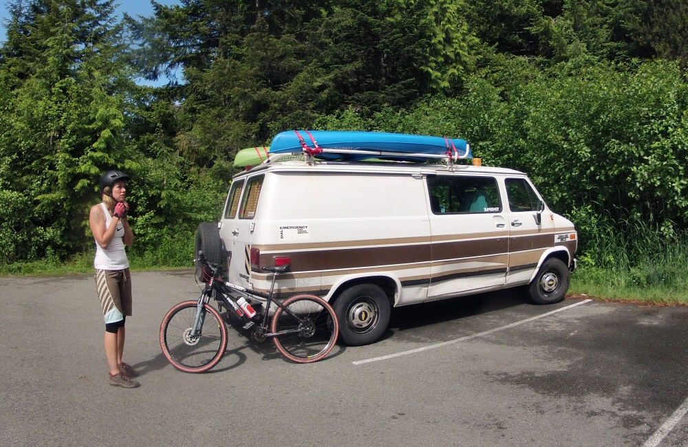
We put our new camp toaster through its paces; egg muffins with marmite for breakfast. Mmm. Then carried on south to Whitefish to hunt down a coffee shop and a laundry. The laundry was a couple of miles out of town, so while our clothes tumbled around we read the local papers, and discovered that the nearby mountain (innovatively called “Big Mountain”) had chairlifts and mountain bike trails open. That settled the plan for the afternoon! We gobbled down a crepe, popped into a huge mountain sports store to pick up some padded shorts for Rose, and then hit the hill mid-afternoon for a couple of hours riding.
Two hours wasn’t nearly enough. With lots of steep, dusty, technical trails I could easily have spent a couple of days here, but riding them solo wasn’t appealing, and we wanted to get through Glacier National Park before hitting a folk festival in Butte at the weekend … so we found a shower at a local state park campground and then drove on to find a place by the side of the road near Hungry Horse Dam.
The mountain sports stores here are huge – in fact all stores are huge. While there are a lot of people just buying kit for the sake of it, I also get the feeling that there are lots of people really attacking their outdoor pursuits seriously. I seems that every other vehicle driving around has either kayaks or bikes on top. It would be great to spend some time in a place like this (or any of the other outdoor centres we’ve stopped at) and meet a crew of adventurers. Passing through in a self-sufficient van, with fairly tight timings, doesn’t lend itself to getting really into a scene. Of course California is pretty hot for outdoor stuff, and there’s the sea too. We’re constantly wondering where we’re going to end up in the future. No firm plans yet!
Wolves are howling on the hill, across the other side of the lake, making noises I never knew a pack of wolves could make; yodeling, yelping and ululating all at the same time. I think they are getting closer. The birds are having a good sing song, sharing their morning gossip. The clouds rushing past the top of the canyon are seared salmon pink with the first light of dawn. The valley floor is still in shade, but it’s warm enough for just shorts and a tee. A breeze is starting to ruffle the surface of the water, and shooing away the mosquitoes in camp. When the wind dies off, I can hear the sound of the waterfall we scrambled across to as the sun went down last night. It’s 5am and I’m sat with a hot cup of fresh, dark coffee and a couple of Aunt Jemima’s pancakes, enjoying the start of what is going to be another scorcher of a day.
I’m up early having been woken by something crawling over my leg in the van – most likely a massive spider. The day beginning outside was too tempting to ignore, so I’m up and about. It’s been too long since I last got up with the sun. It’s also the first time in nearly a week that I’ve had to sit down and catch up.
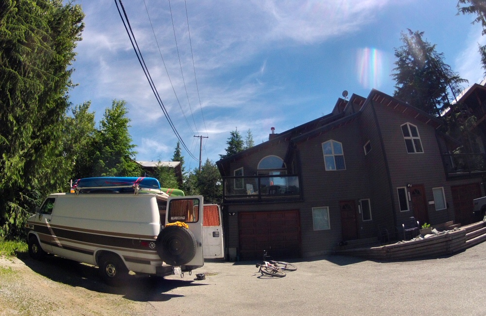
We’ve traveled down from the Sunshine Coast, through Vancouver and Whistler, and we’re now on our way up to Jasper. Arriving in Vancouver was strange. We’d been planning to visit for a long time, throwing around ideas of maybe moving here in the future. But as soon as we found ourselves surrounded by the buildings, streets and hundreds of people, we both felt unsettled. Mainly the fact that we’d been out in the country for a couple of weeks, just the two of us, and being suddenly thrust into a heaving mass of humanity was a shock to the system. We parked up and had a wander around Granville Island, stopping in at a few galleries and studios, had a bite to eat and soaked up the buzz. In the evening we met up with Jim – the guy with the broken down motorbike we met back down in Oregon. He runs a Community Laboratory in Vancouver, where people can join and use the tools and workshop space. He was still working on his bike. A few people were building some micro-houses. Sawdust, grime and shaggy beards. A good “making things” vibe. Over the road was a micro-brewery – Parallel 49 – where we grabbed a couple of beers and a box of poutine from the food truck outside; one of Canada’s national foods I’m told. It’s essentially just chips and gravy with a fancy name, but tasty!
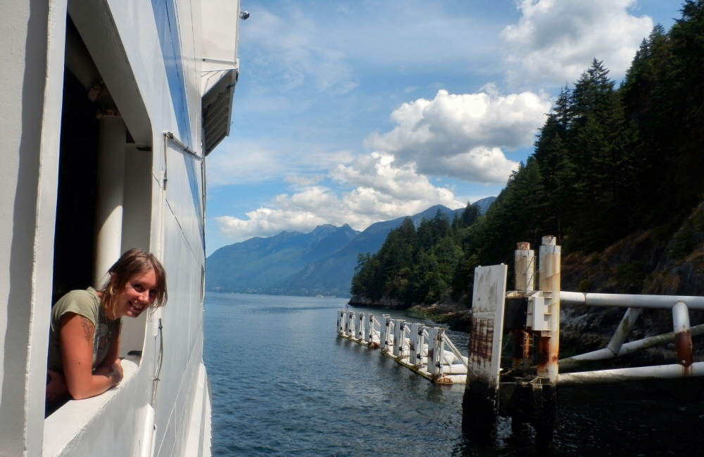
One of the ferries on the Sunshine Coast
We camped by the side of the road half an hour out of town as the campsite was shut by the time we got there at nearly midnight. Friday morning brought rain, we spent the day in town. A couple of hours in the library in the afternoon gave me some time to catch up with a bit of work, and then in the evening we smartened up (a little) and headed off to the circus! Driving out of town the night before we’d seen that Cirque du Soleil was in town – something we’d always wanted to see – so we booked tickets. It was impressive. The usual acrobatics, trapeze work and strong-man feats, with amazing costumes and live music. One act involved a huge, upside down, transparent cone – like a big funnel – with a man stood inside throwing glowing balls around the inner walls. It was dark, so all you could see was the man surrounded by smoke and whirling globes. Too late to find a campsite and in need of a freshen up, we hunted down a motel for the night.
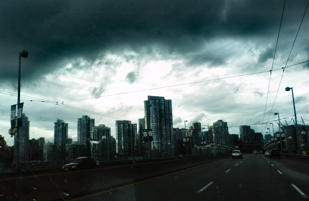
Vancouver
On Saturday we met Will – a buddy of mine from Uni I hadn’t seen in perhaps ten years. We had breakfast and then spent the day hanging out and catching up. Knowing someone in a town, rather than being a complete stranger, makes a huge difference. Maybe also because we’d been in town for a couple of days by then, I felt a bit more comfortable with the place. But we both decided that we don’t want to live in a city again for a while.
In the evening sun we drove up the 99 – the “sea to sky highway” – through Squamish and into Whistler. The original plan was to stop for the night in Squamish. I’d heard about it being “the adventure centre of British Columbia”, there was a kite surf beach, climbing and biking all within the same place. But even on a Saturday night, it felt dead as we arrived around 7pm. We had a quick drive around, and decided that heading on up to Whistler was the best plan. After drinks and dinner in town we found a pull-out on a mountain road a few Kms south for the night.
Sea to Sky Highway
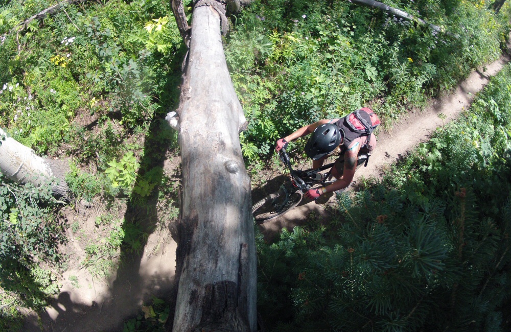
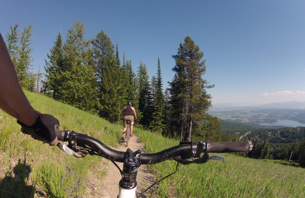
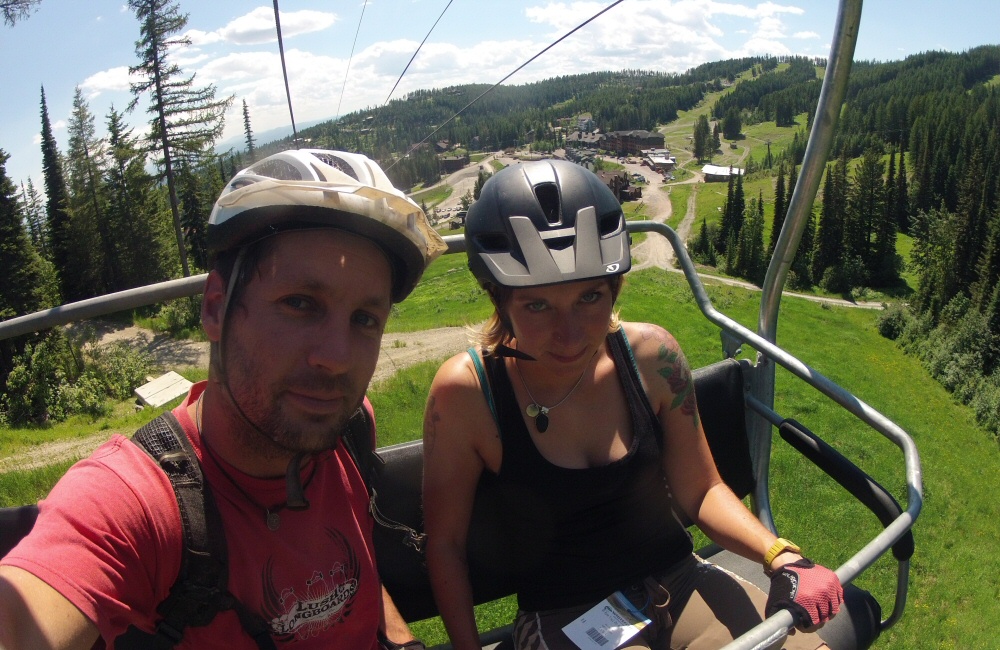
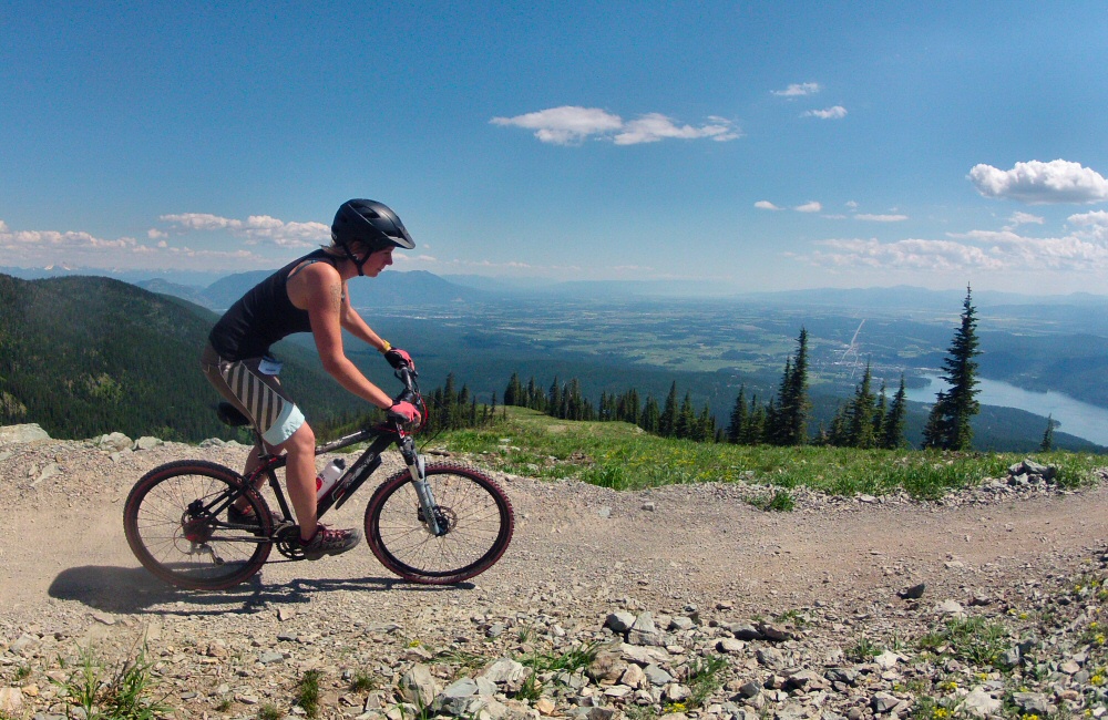
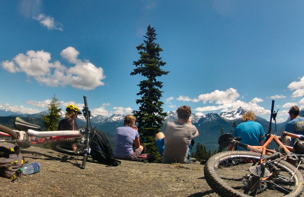
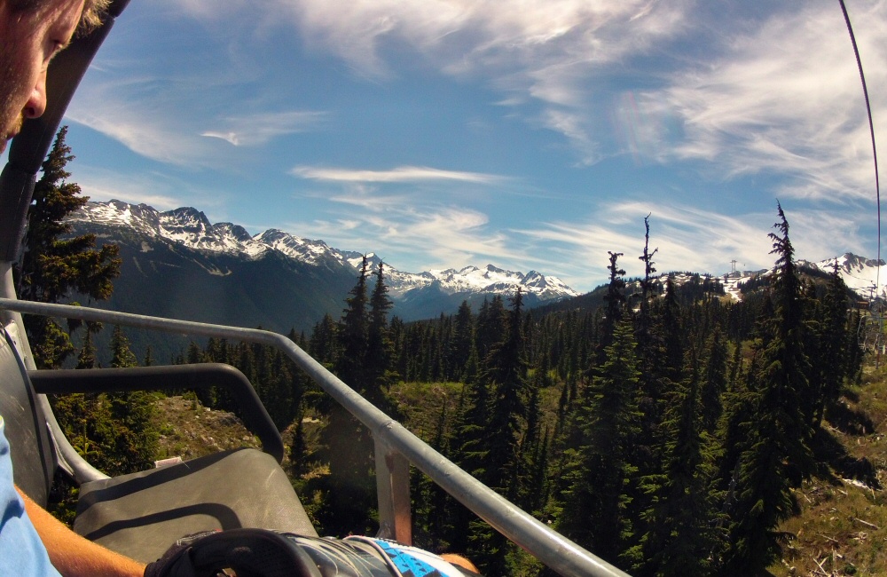
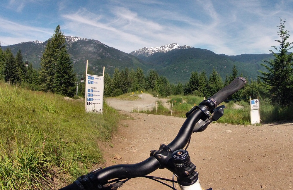
Sunday morning; breakfast in Whistler and then on to Ali’s place. Whistler is one of the world great mountain biking destinations – a purpose-built ski resort in winter, and a mountain bike mecca in summer. The surrounding mountains are covered with hundreds of awesome trails, and the slopes north of the town form the Whistler Bike Park. The chair lifts are converted to take bikes, and the town is packed with downhill warriors in full face helmets and body armour. Rose, Ali and I started the day’s riding with a loop around the Lost Lake trails, then leaving Rose at the house we joined up with a few other guys to ride a couple of trails called “Business Time” and “AM PM”. Steep climbing and steep, fast, technical descents through twisty woods, over rock drops and slatted wooden bridges. So good to be out on these trails with strong riders to follow. A gang came around to Ali’s for the evening where I cooked up a massive carbonara to fuel us up for the next day’s ride.
Back on the hill on Monday. We started with a long, tough climb all the way up the side of the valley, perhaps a couple of hours. Hot and humid. Amazing view from the top. But squadrons of mosquitoes were out and in fighting mode so we gobbled down our snacks, hopped on the bikes and dropped into the trees, onto a trail called “Howler”. In 20 minutes we were back amongst the houses on the valley floor. Spent the afternoon hanging out at Lost Lake, and then another evening relaxing at the house. The Kiwi gang were busy making plans for the next stage of their endless summer; chasing the seasons around the world, riding bikes and working where possible. Most people are here purely to ride bikes; mostly in their early twenties, single, living in shared houses, “doing a season”. All talk is about bikes and travel. One of the guys, Nick, was planning to head to Europe in August to get back into work and career for a while, and was having to make some tricky decisions about whether to follow his mates to New Zealand and ride the southern summer or step back from the party and drop into a 9-to-5 job. Was interesting to have a chat with him, about how it can be possible to work full time in a city whilst also fitting in enough play, and whether just playing out at the weekends could compare to immersing yourself fully into a scene for a whole season.
The Lookout at top of Howler
On Tuesday folks were either back at work in bike shops or workshops, or having a rest, so I headed up to the bike park on my own with a 3-lift sampler pass. Couldn’t go through Whistler without riding the park. As I was by myself I didn’t really push it, but had a blast down some famous lines; Freight Train, No Joke, A-Line. My riding has improved in just three days here; I can easily see how spending a season in this place can take you to another level completely.
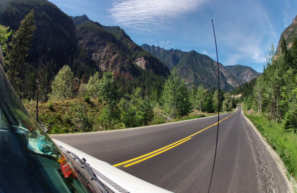
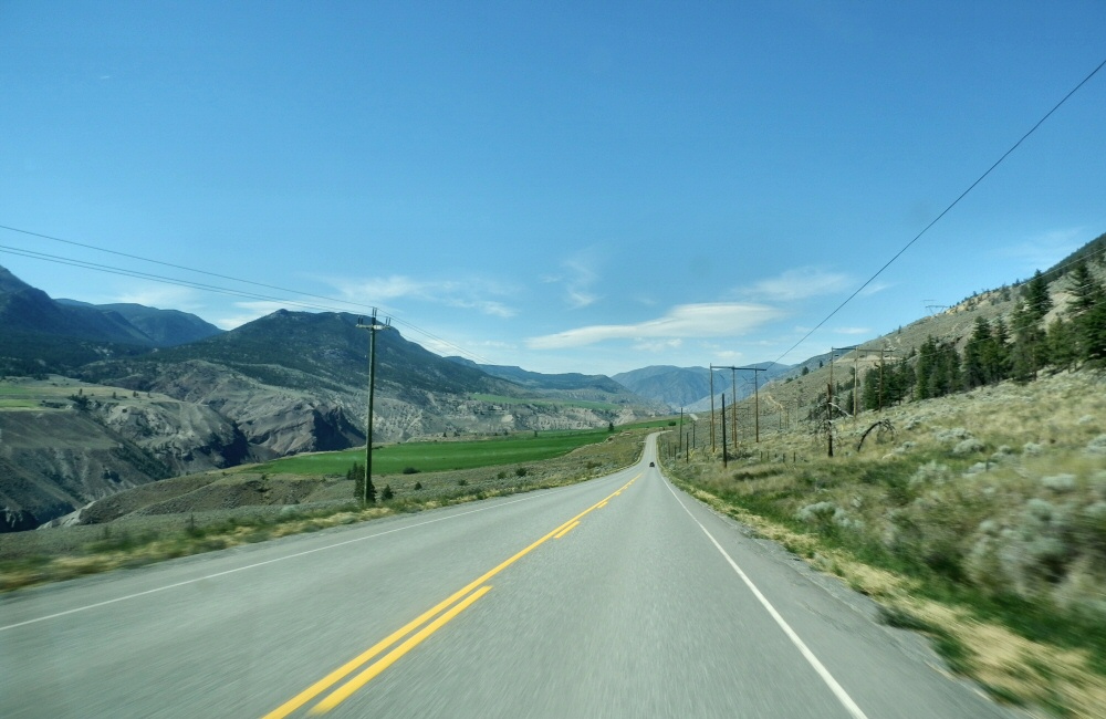
We left Whistler at lunch and drove north into the hot, hot, hot valleys around Lilooet. I wasn’t expecting it to be so dry. I was thinking it was just going to be more of the same pine trees and forests that we’ve seen all the way up the coast so far, but it’s dry and arid. A huge river has cut a deep gorge into the limestone cliffs, exposing huge slabs of rock and creating some incredible scenery.
Here at Marble Canyon, the morning sun is chasing the shade down the slope on the other side of the valley, and it’s going to charge into camp any minute now. I hear Rose stirring in the van, best get the kettle on.
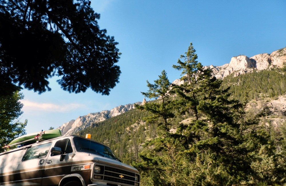
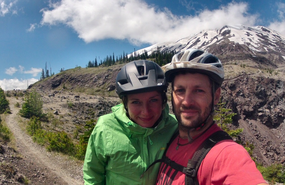
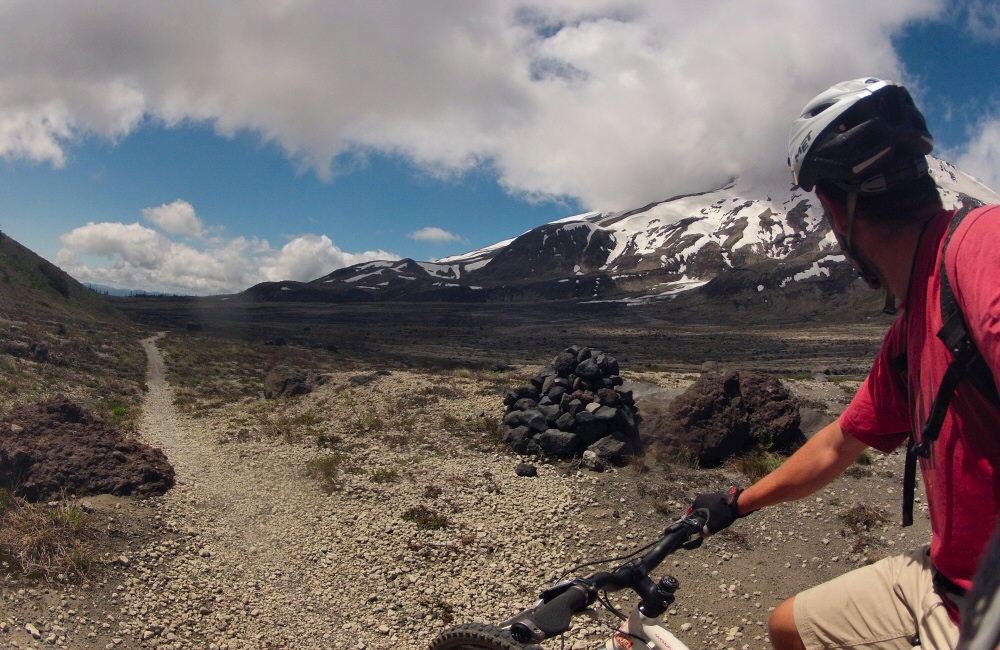
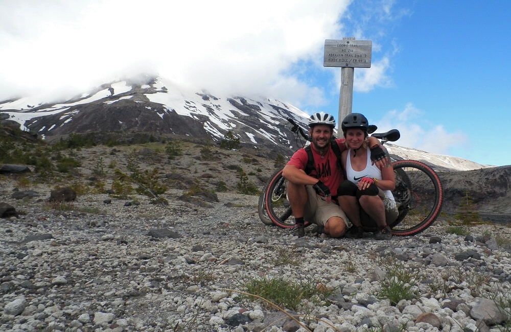
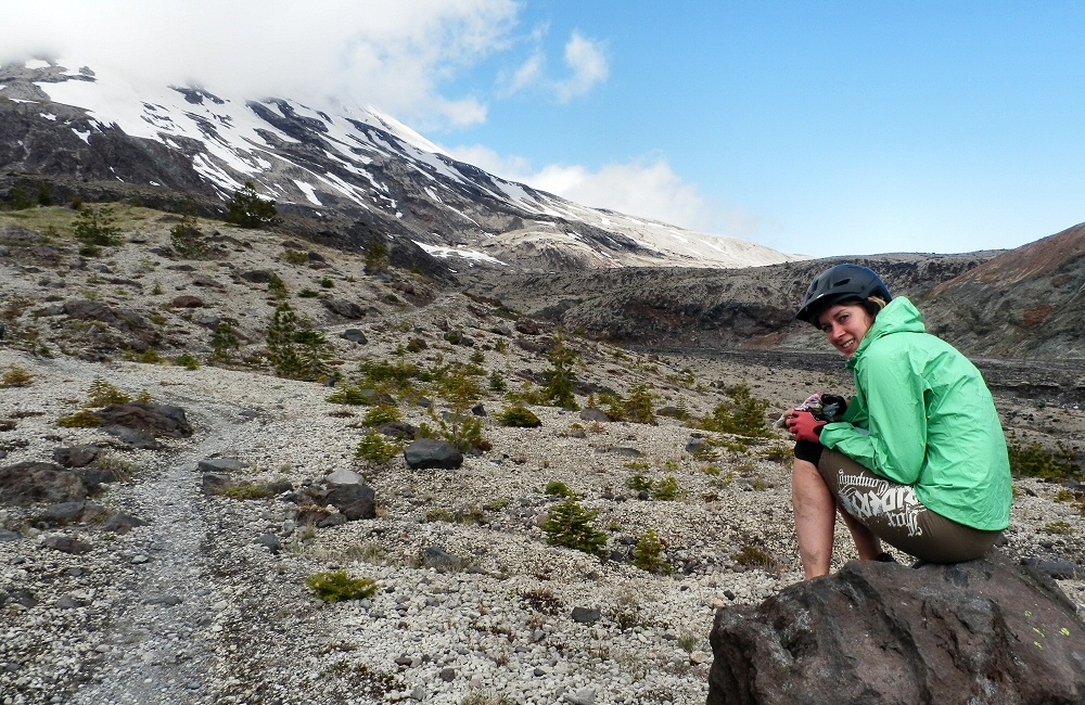
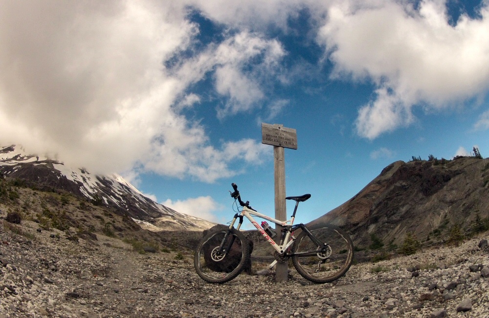
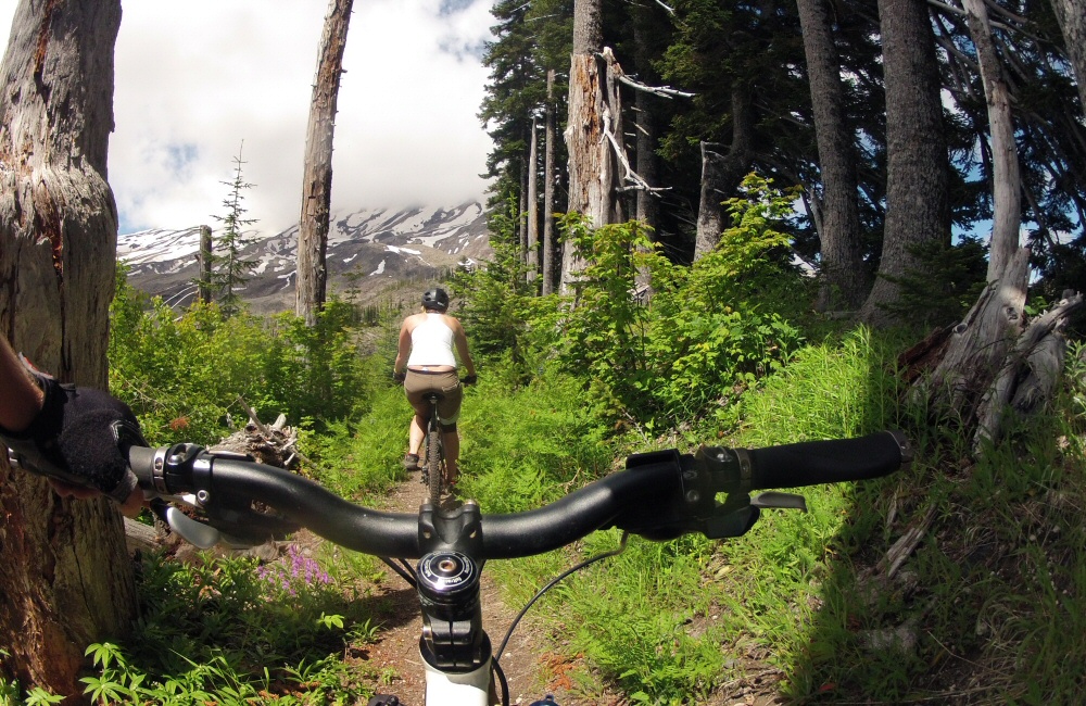
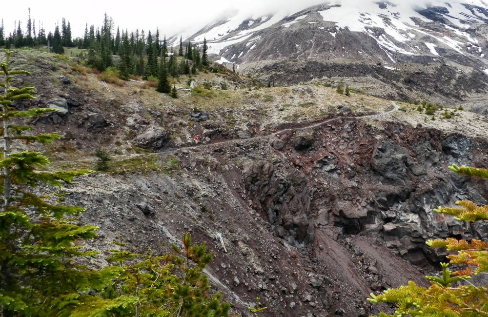
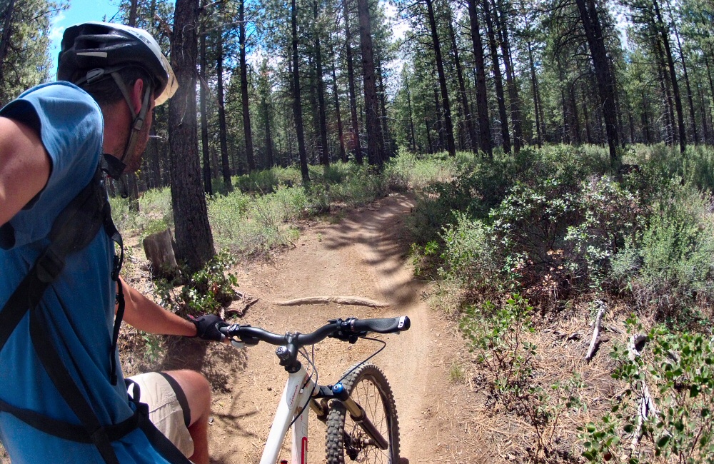
Had an awesome ride up Mount St Helens today. Rode up through fir trees by the side of a huge boulder and gravel-strewn valley for a while, then cut up onto a ridge on quiet singletrack. After an hour or so, we came out above the tree line at the top of the trail. Rose hung out here while I carried on up onto the Plains of Abraham; desolate volcanic flat lands covered in rocks of all types and sizes. Black lava, grey pumice and everything in between. Then back down through the woods to the van for a late morning coffee. Great to be mountain biking on a mountain, on remote trails. We saw one other couple with bikes, and another couple walking. Otherwise, it was an empty mountain.
We wanted to carry on around Mt St Helens up onto Windy Ridge where there’s a viewpoint over the 1980 eruption zone, but the road was closed. On the twisty, mountainous Washington roads we’ve seen a lot of rock falls – I guess they are still clearing up the road after a harsh winter. Even the roads that are open can be a bit dicey at points; lots of subsidence and sharp dips. Gotta drive carefully.
So, quick change of plans; now with an extra couple of hours on our hands we decided to keep heading north. Mount Rainier National Park was tempting, but to be honest we’ve kinda had enough of mountains and fir trees for the time being. Time to head back to the sea. We skipped past the Olympic National Park as well; the Pacific coast here is supposed to be incredible – I read in a local tourist brochure that “nowhere else can you experience majestic old growth forest running right down into the Pacific Ocean” … but that’s exactly what we’ve seen quite a lot of so far in California. And we want to spend some good time in BC, on Vancouver Island and in the Rockies, so it’s now time to head to Canada.
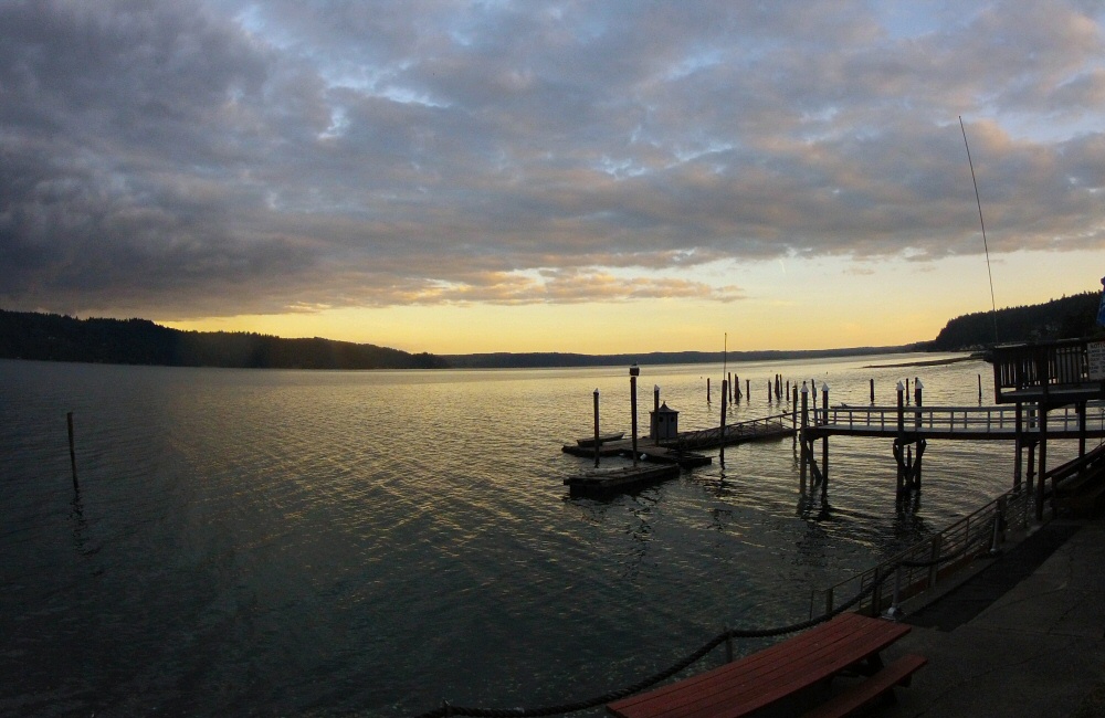
After a mediocre (but typically American-sized; huge) noodle meal at a roadside restaurant and a quick and dirty Wal-Mart stop to buy mosquito net for the van we found a motel in the small town of Hoodsport. Time to wash off the dirt from the ride this morning. Right on the edge of the small gravel beach, the Sunrise Motel has a wonderful view over the water, with its own dock that squeaks with every wave that comes through. We’re a long way from the open ocean here at the southern end of the Puget Sound. Seattle is to our east, across a number of estuaries, islands and waterways. We had no reason to stop in there, and generally want to avoid the big cities.
Yes, it’s definitely Hills Creek Lake. We followed it all the way to the end through more typically Oregonian scenery; hills and trees. I don’t think I’ve ever seen so many trees covering such vast areas of wilderness. The original plan was to do a mountain bike loop in Oakridge, just at the end of the lake, with a promised 7 mile downhill section; but the weather was wet and raining so I wasn’t up for a ride. Rose wasn’t up for wet, smelly bike gear in the van either, so we headed on to Bend.
The Oregon Cascades Scenic Highway took us through the Deschutes National Forest, past lava flows and along more empty, tree lined roads. It’s not a place I’d fancy hitching. There’s nobody around! All the talk of an overpopulated planet is a little harder to understand out here. Makes you realise quite how much humanity has flocked to urban centres.
In Bend we stopped off at a bike shop to get an idea of where the best riding spots are (Bend has a reputation for being a biking mecca), to get a real coffee and to check in on some emails. We’ve had zero phone reception for days. No phone reception and no traffic would mean a long bike ride to get help if we had any trouble with the van… but a lot better than the same distance on foot!
Spent a couple of hours riding in the forest just above Bend; from Phil’s trailhead. There are a load of marked trails here; some of them one-way so you can really crank it. Not especially technical, but very flowy, so it was lots of hard pedalling. I felt the altitude, but otherwise not in bad shape. Out on the trails I met a couple who’d come down from Seattle for a few days biking holiday, and a guy who’d moved to Bend from Idaho 6 years ago and says “it’s the best thing he’s ever done”. Otherwise it was pretty empty. Great to be back on the bike in the dust.
From Bend we headed north through Madras and over the Warm Springs Indian Reserve. I’m not quite sure what an Indian Reserve is; all we saw was lots of open land and yet again, new and impressive scenery. Beyond the Indian Reserve we headed up into the hills, into the cloud and rain again, before going over the summit at Barlow pass and down the Hood River gorge in the late afternoon light.
A shower was on the to-do list for today so we found a State Park campsite just along the freeway from Hood River (the town), at Memaloose. This place is windy! I was expecting wind since it’s one of the world’s top kite surfing spots, so shouldn’t really have been surprised. A train track ran along the bottom of the campground, so every hour or so during the night there was a thunder of engines followed by the rumble of hundreds of rolling stock going past. I (as usual) slept through everything but Rose found it a bit harder.